Property Record
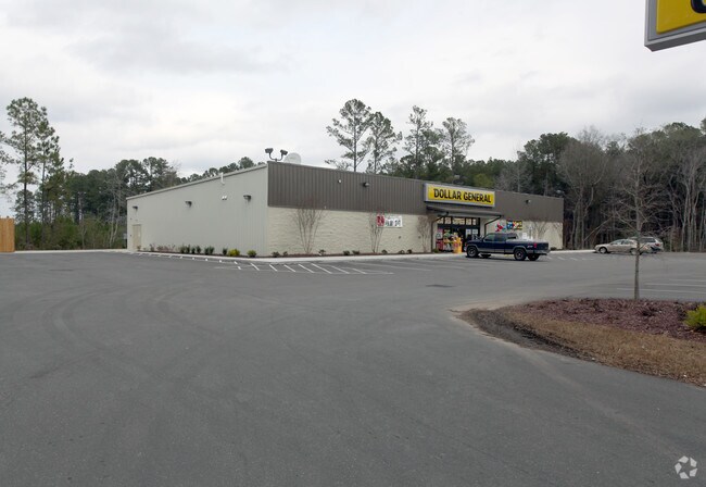
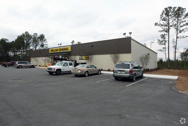
Highway 378, Conway, SC 29527

Property Detail
Highway 378
33613040005
HWY 378; PARCEL A & B
Storebuilding
HORRY
B and X Area of moderate flood hazard, usually the area between the limits of the 100-year and 500-year floods.
South Carolina
2025
2.17 AC
2025
Outlying Horry County
070601
Myrtle Beach/Conway
9,100 SF
Myrtle Beach-Conway-North Myrtle Beach, SC
NEARBY LISTINGS FOR SALE OR LEASE
DEMOGRAPHICS near Highway 378
1 mile
3 mile
5 mile
2025 Total Population
933
13,314
31,024
2030 Population
1,049
14,964
34,833
Pop Growth 2025-2030
+ 12.43%
+ 12.39%
+ 12.28%
Average Age
42
41
41
2025 Total Households
355
5,175
12,034
HH Growth 2025-2030
+ 12.11%
+ 12.17%
+ 12.10%
Median Household Inc
$45,208
$45,153
$54,937
Avg Household Size
2.50
2.50
2.50
2025 Avg HH Vehicles
2.00
2.00
2.00
Median Home Value
$204,861
$237,106
$238,007
Median Year Built
2002
1995
1991
Nearby Places
Map Layers
Map Styles
 Street
 Aerial
Layers
 Traffic
 Biking
Places
Listings with unknown addresses are not visible on the map
- Restaurants
- Banks
- Shops
- Fitness
- Groceries
PUBLIC TRANSPORTATION
AIRPORT
Myrtle Beach International
Drive
Walk
Distance
Myrtle Beach International
29 min
19.3 mi
Freight Ports
Port of Wilmington
Drive
Walk
Distance
Port of Wilmington
112 min
89.9 mi
Nearby Properties
Address
Land Use
TOTAL SIZE
Lot Size
Zoning
Address
Land Use
TOTAL SIZE
Lot Size
Zoning
200,089 SF
23.76 AC
Address
Land Use
TOTAL SIZE
Lot Size
Zoning
78.16 AC
Address
Land Use
TOTAL SIZE
Lot Size
Zoning
6,396 SF
41.50 AC
Address
Land Use
TOTAL SIZE
Lot Size
Zoning
33,843 SF
173.03 AC
Address
Land Use
TOTAL SIZE
Lot Size
Zoning
75,020 SF
13.13 AC
Address
Land Use
TOTAL SIZE
Lot Size
Zoning
33,016 SF
12.09 AC
Address
Land Use
TOTAL SIZE
Lot Size
Zoning
20,008 SF
37.42 AC
Address
Land Use
TOTAL SIZE
Lot Size
Zoning
41,447 SF
8.30 AC
Address
Land Use
TOTAL SIZE
Lot Size
Zoning
26,718 SF
6.04 AC
Address
Land Use
TOTAL SIZE
Lot Size
Zoning
883.65 AC
Address
Land Use
TOTAL SIZE
Lot Size
Zoning
10,860 SF
5 AC
Address
Land Use
TOTAL SIZE
Lot Size
Zoning
10,596 SF
8.66 AC
Address
Land Use
TOTAL SIZE
Lot Size
Zoning
7,112 SF
20.99 AC
Address
Land Use
TOTAL SIZE
Lot Size
Zoning
40,392 SF
8.91 AC
Address
Land Use
TOTAL SIZE
Lot Size
Zoning
24,360 SF
5.20 AC
Address
Land Use
TOTAL SIZE
Lot Size
Zoning
118.71 AC
Address
Land Use
TOTAL SIZE
Lot Size
Zoning
35,786 SF
5.03 AC
Address
Land Use
TOTAL SIZE
Lot Size
Zoning
34,395 SF
1.24 AC
Address
Land Use
TOTAL SIZE
Lot Size
Zoning
27.50 AC
Address
Land Use
TOTAL SIZE
Lot Size
Zoning
35,516 SF
8.43 AC
Address
Land Use
TOTAL SIZE
Lot Size
Zoning
12,250 SF
41 AC
Address
Land Use
TOTAL SIZE
Lot Size
Zoning
13,268 SF
2.52 AC
Address
Land Use
TOTAL SIZE
Lot Size
Zoning
25.07 AC
Address
Land Use
TOTAL SIZE
Lot Size
Zoning
100,000 SF
9.02 AC
Address
Land Use
TOTAL SIZE
Lot Size
Zoning
5,144 SF
1.74 AC
Address
Land Use
TOTAL SIZE
Lot Size
Zoning
3,450 SF
5.06 AC
Address
Land Use
TOTAL SIZE
Lot Size
Zoning
17,378 SF
2.09 AC
The World's #1 Commercial Real Estate Marketplace
Connect with us
© 2026 CoStar Group
The information above has been obtained from sources believed reliable. While we do not doubt its accuracy we have not verified it and make no guarantee, warranty or representation about it. It is your responsibility to independently confirm its accuracy and completeness. Any projections, opinions, assumptions, or estimates used are for example only and do not represent the current or future performance of the property. The value of this transaction to you depends on tax and other factors which should be evaluated by your tax, financial, and legal advisors. You and your advisors should conduct a careful, independent investigation of the property to determine to your satisfaction the suitability of the property for your needs.