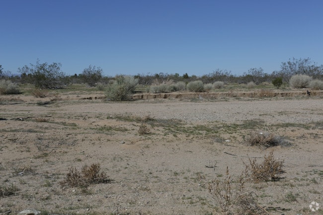
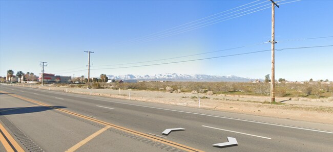
Property Record
Highway 395, Adelanto, CA 92301


NEARBY LISTINGS FOR SALE OR LEASE
-
-
-
-
-
-
-
-
-
-
-
-
-
-
-
-
-
-
-
-
-
-
US HIGHWAY 395 ( X St. Bear Valley Rd.) Hwy @ Bear Valley Rd.
Victorville, CA 92392
$1,800,000
9.36 AC Lots
Land
-
-
-
-
-
-
-
-
-
View all Adelanto listings for sale on LoopNet.com
Property Detail
Highway 395
3103-511-06
S 1/2 NE 1/4 NE 1/4 SEC 21 TP 5N R 5W EX HWY
Vacantlandnec
San Bernardino
D
California
06071C5795H
18.76 AC
2025
Mojave River Valley
2025
Inland Empire (California)
009133
Riverside-San Bernardino-Ontario, CA
DEMOGRAPHICS near Highway 395
1 mile
3 mile
5 mile
2024 Total Population
9,105
76,373
137,329
2029 Population
9,319
78,095
140,473
Pop Growth 2024-2029
+ 2.35%
+ 2.25%
+ 2.29%
Average Age
32
33
34
2024 Total Households
2,183
19,098
36,811
HH Growth 2024-2029
+ 2.34%
+ 2.29%
+ 2.31%
Median Household Inc
$69,582
$73,197
$69,883
Avg Household Size
4.00
3.80
3.60
2024 Avg HH Vehicles
3.00
2.00
2.00
Median Home Value
$285,535
$322,850
$312,042
Median Year Built
2001
2002
1998
Nearby Places
Map Layers
Map Styles
 Street
 Aerial
Transit
 Traffic
 Biking
Places
Listings with unknown addresses are not visible on the map
- Restaurants
- Banks
- Shops
- Fitness
- Groceries
PUBLIC TRANSPORTATION
COMMUTER RAIL
Victorville Amtrak (Southwest Chief - Amtrak)
Drive
Walk
Distance
Victorville Amtrak (Southwest Chief - Amtrak)
12 min
8.4 mi
Freight Ports
Port of Long Beach
Drive
Walk
Distance
Port of Long Beach
113 min
94.1 mi
SALE & LEASE HISTORY
LISTING DATE
SALE/LEASE

Dec 17, 2024
For Sale
Nearby Properties
Address
Land Use
TOTAL SIZE
Lot Size
Zoning
Address
Land Use
TOTAL SIZE
Lot Size
Zoning
194,280 SF
22.61 AC
Address
Land Use
TOTAL SIZE
Lot Size
Zoning
142,928 SF
9.13 AC
Address
Land Use
TOTAL SIZE
Lot Size
Zoning
151,906 SF
8.73 AC
RL
Address
Land Use
TOTAL SIZE
Lot Size
Zoning
42,278 SF
5.11 AC
Address
Land Use
TOTAL SIZE
Lot Size
Zoning
12,238 SF
1.91 AC
Address
Land Use
TOTAL SIZE
Lot Size
Zoning
55,660 SF
3.70 AC
Address
Land Use
TOTAL SIZE
Lot Size
Zoning
14,736 SF
1.96 AC
Address
Land Use
TOTAL SIZE
Lot Size
Zoning
86,560 SF
4.56 AC
Address
Land Use
TOTAL SIZE
Lot Size
Zoning
9,000 SF
0.85 AC
Address
Land Use
TOTAL SIZE
Lot Size
Zoning
11,640 SF
0.65 AC
Address
Land Use
TOTAL SIZE
Lot Size
Zoning
5,176 SF
0.92 AC
Address
Land Use
TOTAL SIZE
Lot Size
Zoning
42,250 SF
4.56 AC
Address
Land Use
TOTAL SIZE
Lot Size
Zoning
Address
Land Use
TOTAL SIZE
Lot Size
Zoning
103,660 SF
4.64 AC
Address
Land Use
TOTAL SIZE
Lot Size
Zoning
6,971 SF
0.79 AC
Address
Land Use
TOTAL SIZE
Lot Size
Zoning
1.58 AC
Address
Land Use
TOTAL SIZE
Lot Size
Zoning
59,989 SF
2.97 AC
Address
Land Use
TOTAL SIZE
Lot Size
Zoning
13,190 SF
1.03 AC
Address
Land Use
TOTAL SIZE
Lot Size
Zoning
1.49 AC
Address
Land Use
TOTAL SIZE
Lot Size
Zoning
26,865 SF
2.50 AC
Address
Land Use
TOTAL SIZE
Lot Size
Zoning
16.67 AC
Address
Land Use
TOTAL SIZE
Lot Size
Zoning
19,764 SF
1.64 AC
Address
Land Use
TOTAL SIZE
Lot Size
Zoning
4,179 SF
1.03 AC
Address
Land Use
TOTAL SIZE
Lot Size
Zoning
1,470 SF
5 AC
Address
Land Use
TOTAL SIZE
Lot Size
Zoning
4,953 SF
1.18 AC
Address
Land Use
TOTAL SIZE
Lot Size
Zoning
9,508 SF
0.78 AC
Address
Land Use
TOTAL SIZE
Lot Size
Zoning
4,080 SF
0.65 AC
Address
Land Use
TOTAL SIZE
Lot Size
Zoning
3,962 SF
1.11 AC
Address
Land Use
TOTAL SIZE
Lot Size
Zoning
4,142 SF
1.13 AC
The World's #1 Commercial Real Estate Marketplace
Connect with us
© 2026 CoStar Group
The information above has been obtained from sources believed reliable. While we do not doubt its accuracy we have not verified it and make no guarantee, warranty or representation about it. It is your responsibility to independently confirm its accuracy and completeness. Any projections, opinions, assumptions, or estimates used are for example only and do not represent the current or future performance of the property. The value of this transaction to you depends on tax and other factors which should be evaluated by your tax, financial, and legal advisors. You and your advisors should conduct a careful, independent investigation of the property to determine to your satisfaction the suitability of the property for your needs.