Property Record
Highway 441 S, Lakemont, GA 30552


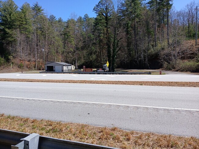

This Property Is For Sale
NEARBY LISTINGS FOR SALE OR LEASE
Property Detail
Highway 441 S
100C-001
Land Surveyor 2042
Commercialacreage
LL 8 LD 5 04TY R/W ACQ
X
Rabun
13241C0270D
Georgia
2025
2 AC
2025
Georgia Northeast
970303
Other Market Areas
DEMOGRAPHICS near Highway 441 S
1 Mile
3 Mile
5 Mile
2024 Total Population
340
1,574
2,966
2029 Population
359
1,635
3,091
Pop Growth 2024-2029
+ 5.59%
+ 3.88%
+ 4.21%
Average Age
46
46
45
2024 Total Households
149
673
1,249
HH Growth 2024-2029
+ 5.37%
+ 3.71%
+ 3.84%
Median Household Inc
$48,026
$48,566
$50,102
Avg Household Size
2.20
2.30
2.30
2024 Avg HH Vehicles
2.00
2.00
2.00
Median Home Value
$270,370
$254,999
$258,564
Median Year Built
1987
1988
1988
Nearby Places
Map Layers
Map Styles
 Street
 Aerial
- Restaurants
- Banks
- Shops
- Fitness
- Groceries
Nearby Properties
Address
Land Use
TOTAL SIZE
Lot Size
Zoning
Address
Land Use
TOTAL SIZE
Lot Size
Zoning
19,800 SF
5.53 AC
HB
Address
Land Use
TOTAL SIZE
Lot Size
Zoning
40.35 AC
HB
Address
Land Use
TOTAL SIZE
Lot Size
Zoning
1,444 SF
0.86 AC
HB
Address
Land Use
TOTAL SIZE
Lot Size
Zoning
10,132 SF
9 AC
Address
Land Use
TOTAL SIZE
Lot Size
Zoning
5,504 SF
8.40 AC
A
Address
Land Use
TOTAL SIZE
Lot Size
Zoning
98.13 AC
A
Address
Land Use
TOTAL SIZE
Lot Size
Zoning
91.52 AC
A
Address
Land Use
TOTAL SIZE
Lot Size
Zoning
4,536 SF
5 AC
A
Address
Land Use
TOTAL SIZE
Lot Size
Zoning
0.81 AC
VC
Address
Land Use
TOTAL SIZE
Lot Size
Zoning
6,600 SF
0.37 AC
VC
Address
Land Use
TOTAL SIZE
Lot Size
Zoning
86.25 AC
LI
Address
Land Use
TOTAL SIZE
Lot Size
Zoning
0.44 AC
VC
Address
Land Use
TOTAL SIZE
Lot Size
Zoning
1,344 SF
5.15 AC
CB
Address
Land Use
TOTAL SIZE
Lot Size
Zoning
15,744 SF
2.28 AC
CB
Address
Land Use
TOTAL SIZE
Lot Size
Zoning
1,788 SF
14.74 AC
A
Address
Land Use
TOTAL SIZE
Lot Size
Zoning
145.46 AC
R1
Address
Land Use
TOTAL SIZE
Lot Size
Zoning
10,950 SF
1.60 AC
M1
Address
Land Use
TOTAL SIZE
Lot Size
Zoning
1,400 SF
VC
Address
Land Use
TOTAL SIZE
Lot Size
Zoning
2,304 SF
1 AC
HB
Address
Land Use
TOTAL SIZE
Lot Size
Zoning
1,440 SF
3.75 AC
CBD
Address
Land Use
TOTAL SIZE
Lot Size
Zoning
42.67 AC
A
Address
Land Use
TOTAL SIZE
Lot Size
Zoning
11.81 AC
CB
Address
Land Use
TOTAL SIZE
Lot Size
Zoning
8.95 AC
A
Address
Land Use
TOTAL SIZE
Lot Size
Zoning
1,058 SF
55.97 AC
A
Address
Land Use
TOTAL SIZE
Lot Size
Zoning
4,500 SF
0.17 AC
CBD
Address
Land Use
TOTAL SIZE
Lot Size
Zoning
28.75 AC
A
Address
Land Use
TOTAL SIZE
Lot Size
Zoning
1,128 SF
5.25 AC
A
Address
Land Use
TOTAL SIZE
Lot Size
Zoning
36.53 AC
HB
Address
Land Use
TOTAL SIZE
Lot Size
Zoning
1,920 SF
0.55 AC
CB
The World's #1 Commercial Real Estate Marketplace
Connect with us
© 2025 CoStar Group
The information above has been obtained from sources believed reliable. While we do not doubt its accuracy we have not verified it and make no guarantee, warranty or representation about it. It is your responsibility to independently confirm its accuracy and completeness. Any projections, opinions, assumptions, or estimates used are for example only and do not represent the current or future performance of the property. The value of this transaction to you depends on tax and other factors which should be evaluated by your tax, financial, and legal advisors. You and your advisors should conduct a careful, independent investigation of the property to determine to your satisfaction the suitability of the property for your needs.