Property Record
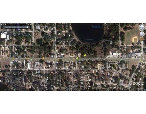
Highway 50, Clermont, FL 34711
NEARBY LISTINGS FOR SALE OR LEASE
Property Detail
Highway 50
Orlando-Kissimmee-Sanford, FL
BEG AT SW COR OF SEC 24-22-26 RUN N 0-39-53 E 525.12 FT TO A POINT 30 FT NELY AS MEASURED AT RIGHT ANGLES TO THE CENTERLINE OF ABANDONED ACL RR R/W THENCE PARALLEL WITH SAID CENTERLINE S 67-0-57 E 26.34 FT S 12-33-53 E 250.75 FT S 35-51-51 E 174.17 F
24-22-26-0003-000-02100
Lake
Transportationcommunicationsgeneral
Florida
A
21
12095C0200H
4.68 AC
0
Lake County
2026
Orlando
031315
DEMOGRAPHICS near Highway 50
1 Mile
3 Mile
5 Mile
2024 Total Population
6,767
56,084
103,853
2029 Population
7,748
65,396
121,696
Pop Growth 2024-2029
+ 14.50%
+ 16.60%
+ 17.18%
Average Age
40
41
42
2024 Total Households
2,694
20,933
38,332
HH Growth 2024-2029
+ 14.37%
+ 16.36%
+ 16.94%
Median Household Inc
$79,466
$79,881
$83,421
Avg Household Size
2.40
2.60
2.70
2024 Avg HH Vehicles
2.00
2.00
2.00
Median Home Value
$234,403
$320,231
$322,401
Median Year Built
1994
2003
2004
Nearby Places
Map Layers
Map Styles
 Street
 Aerial
- Restaurants
- Banks
- Shops
- Fitness
- Groceries
PUBLIC TRANSPORTATION
AIRPORT
Orlando International
DRIVE
WALK
Distance
Orlando International
38 min
28.7 mi
Freight Ports
Port of Tampa Bay
DRIVE
WALK
Distance
Port of Tampa Bay
107 min
83.6 mi
SALE & LEASE HISTORY
LISTING DATE
SALE/LEASE

Sep 24, 2016
For Sale
Nearby Properties
Address
Land Use
TOTAL SIZE
Lot Size
Zoning
Address
Land Use
TOTAL SIZE
Lot Size
Zoning
505,404 SF
16.10 AC
PUD
Address
Land Use
TOTAL SIZE
Lot Size
Zoning
425,675 SF
25.23 AC
Address
Land Use
TOTAL SIZE
Lot Size
Zoning
387,535 SF
22.94 AC
PUD
Address
Land Use
TOTAL SIZE
Lot Size
Zoning
306,892 SF
21.96 AC
A
Address
Land Use
TOTAL SIZE
Lot Size
Zoning
2,000 SF
35.96 AC
PUD
Address
Land Use
TOTAL SIZE
Lot Size
Zoning
2,000 SF
26.79 AC
PUD
Address
Land Use
TOTAL SIZE
Lot Size
Zoning
118.31 AC
P-D
Address
Land Use
TOTAL SIZE
Lot Size
Zoning
273,592 SF
91.55 AC
R6
Address
Land Use
TOTAL SIZE
Lot Size
Zoning
133,767 SF
19.42 AC
I-1
Address
Land Use
TOTAL SIZE
Lot Size
Zoning
53,054 SF
11.65 AC
Address
Land Use
TOTAL SIZE
Lot Size
Zoning
53,982 SF
24.90 AC
Address
Land Use
TOTAL SIZE
Lot Size
Zoning
78,509 SF
18.68 AC
PUD
Address
Land Use
TOTAL SIZE
Lot Size
Zoning
52,986 SF
18.27 AC
Address
Land Use
TOTAL SIZE
Lot Size
Zoning
2,000 SF
30.62 AC
CFD
Address
Land Use
TOTAL SIZE
Lot Size
Zoning
57,124 SF
7.58 AC
Address
Land Use
TOTAL SIZE
Lot Size
Zoning
106,799 SF
9.06 AC
MP
Address
Land Use
TOTAL SIZE
Lot Size
Zoning
62,897 SF
9.81 AC
MP
Address
Land Use
TOTAL SIZE
Lot Size
Zoning
62,794 SF
2.31 AC
Address
Land Use
TOTAL SIZE
Lot Size
Zoning
44,019 SF
9.39 AC
PUD
Address
Land Use
TOTAL SIZE
Lot Size
Zoning
156,135 SF
19.72 AC
Address
Land Use
TOTAL SIZE
Lot Size
Zoning
148,143 SF
0.45 AC
A
Address
Land Use
TOTAL SIZE
Lot Size
Zoning
49,437 SF
9.35 AC
CP
Address
Land Use
TOTAL SIZE
Lot Size
Zoning
178,735 SF
20.68 AC
PUD
Address
Land Use
TOTAL SIZE
Lot Size
Zoning
87,951 SF
5.88 AC
Address
Land Use
TOTAL SIZE
Lot Size
Zoning
135,311 SF
18.18 AC
MP
Address
Land Use
TOTAL SIZE
Lot Size
Zoning
71,135 SF
11.28 AC
Address
Land Use
TOTAL SIZE
Lot Size
Zoning
18.82 AC
P-D
Address
Land Use
TOTAL SIZE
Lot Size
Zoning
48,629 SF
5.81 AC
CP
Address
Land Use
TOTAL SIZE
Lot Size
Zoning
72,600 SF
5.73 AC
Address
Land Use
TOTAL SIZE
Lot Size
Zoning
71,725 SF
9.14 AC
C-1
The World's #1 Commercial Real Estate Marketplace
Connect with us
© 2025 CoStar Group
The information above has been obtained from sources believed reliable. While we do not doubt its accuracy we have not verified it and make no guarantee, warranty or representation about it. It is your responsibility to independently confirm its accuracy and completeness. Any projections, opinions, assumptions, or estimates used are for example only and do not represent the current or future performance of the property. The value of this transaction to you depends on tax and other factors which should be evaluated by your tax, financial, and legal advisors. You and your advisors should conduct a careful, independent investigation of the property to determine to your satisfaction the suitability of the property for your needs.