Property Record
Highway 50, Mark Twain, NV 89403
Property Detail
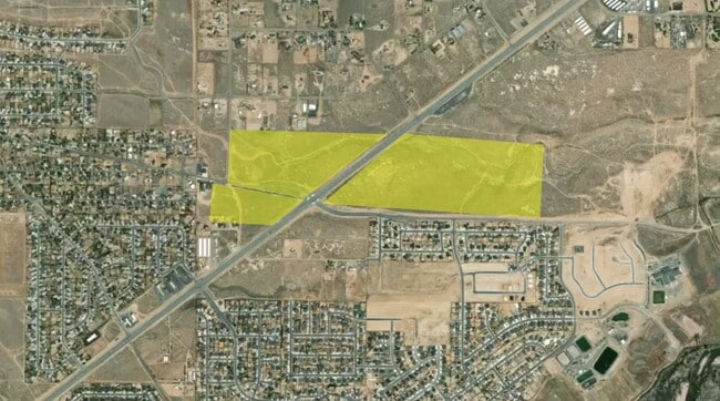
Highway 50
016-025-10
33-17-22 FR N2N2/PARCEL 4 CREATED FROM SPLIT OF PARCEL # 016-025-08 PRIMARY NEW PARCEL IS PARCEL # 016-025-10 N2 N2 PARCEL 4 OF PM 271484
Residentialacreage
LYON
SR-2
Nevada
C and X Area of minimal flood hazard, usually depicted on FIRMs as above the 500-year flood level.
53.02 AC
2026
Lyon County
2025
Reno/Sparks
960302
Reno, NV
NEARBY LISTINGS FOR SALE OR LEASE
DEMOGRAPHICS near Highway 50
1 mile
3 mile
5 mile
2025 Total Population
4,393
8,832
17,017
2030 Population
4,674
9,355
17,981
Pop Growth 2025-2030
+ 6.40%
+ 5.92%
+ 5.66%
Average Age
44
44
44
2025 Total Households
1,622
3,360
6,629
HH Growth 2025-2030
+ 6.41%
+ 5.89%
+ 5.61%
Median Household Inc
$97,844
$93,290
$90,756
Avg Household Size
2.70
2.60
2.50
2025 Avg HH Vehicles
3.00
3.00
2.00
Median Home Value
$438,333
$430,517
$424,027
Median Year Built
2005
2003
2001
Nearby Places
Map Layers
Map Styles
 Street
 Aerial
Transit
 Traffic
 Biking
Places
Listings with unknown addresses are not visible on the map
- Restaurants
- Banks
- Shops
- Fitness
- Groceries
PUBLIC TRANSPORTATION
AIRPORT
Reno/Tahoe International
Drive
Walk
Distance
Reno/Tahoe International
71 min
33.0 mi
Freight Ports
Port of Stockton
Drive
Walk
Distance
Port of Stockton
244 min
169.1 mi
Nearby Properties
Address
Land Use
TOTAL SIZE
Lot Size
Zoning
Address
Land Use
TOTAL SIZE
Lot Size
Zoning
50,495 SF
10.76 AC
E1
Address
Land Use
TOTAL SIZE
Lot Size
Zoning
24.60 AC
MULT
Address
Land Use
TOTAL SIZE
Lot Size
Zoning
9,600 SF
4.50 AC
C2
Address
Land Use
TOTAL SIZE
Lot Size
Zoning
5,760 SF
3 AC
M1
Address
Land Use
TOTAL SIZE
Lot Size
Zoning
37,200 SF
5.55 AC
M1
Address
Land Use
TOTAL SIZE
Lot Size
Zoning
4,644 SF
1.18 AC
C2
Address
Land Use
TOTAL SIZE
Lot Size
Zoning
4,537 SF
35.19 AC
RR2T
Address
Land Use
TOTAL SIZE
Lot Size
Zoning
1,620 SF
2.81 AC
C2
Address
Land Use
TOTAL SIZE
Lot Size
Zoning
78.88 AC
E1
Address
Land Use
TOTAL SIZE
Lot Size
Zoning
2,400 SF
3.01 AC
C2
Address
Land Use
TOTAL SIZE
Lot Size
Zoning
5,250 SF
2.15 AC
M1
Address
Land Use
TOTAL SIZE
Lot Size
Zoning
7,771 SF
1.21 AC
C2
Address
Land Use
TOTAL SIZE
Lot Size
Zoning
10,125 SF
2.03 AC
C2
Address
Land Use
TOTAL SIZE
Lot Size
Zoning
5,952 SF
3.50 AC
M1
Address
Land Use
TOTAL SIZE
Lot Size
Zoning
7,488 SF
5.07 AC
C2
Address
Land Use
TOTAL SIZE
Lot Size
Zoning
67.47 AC
E1
Address
Land Use
TOTAL SIZE
Lot Size
Zoning
2,301 SF
4.98 AC
C2
Address
Land Use
TOTAL SIZE
Lot Size
Zoning
10,800 SF
2.73 AC
C2
Address
Land Use
TOTAL SIZE
Lot Size
Zoning
5,880 SF
2.70 AC
C2
Address
Land Use
TOTAL SIZE
Lot Size
Zoning
4,000 SF
3.59 AC
C1
Address
Land Use
TOTAL SIZE
Lot Size
Zoning
0.51 AC
RR2T
Address
Land Use
TOTAL SIZE
Lot Size
Zoning
4,500 SF
5.71 AC
P
Address
Land Use
TOTAL SIZE
Lot Size
Zoning
5,715 SF
1.02 AC
C1
Address
Land Use
TOTAL SIZE
Lot Size
Zoning
5.75 AC
C2
Address
Land Use
TOTAL SIZE
Lot Size
Zoning
729 SF
28.50 AC
RR2T
Address
Land Use
TOTAL SIZE
Lot Size
Zoning
3,264 SF
300 AC
I-2;INDUST
Address
Land Use
TOTAL SIZE
Lot Size
Zoning
1,953 SF
0.27 AC
E1
Address
Land Use
TOTAL SIZE
Lot Size
Zoning
34.76 AC
E1
The World's #1 Commercial Real Estate Marketplace
Connect with us
© 2026 CoStar Group
The information above has been obtained from sources believed reliable. While we do not doubt its accuracy we have not verified it and make no guarantee, warranty or representation about it. It is your responsibility to independently confirm its accuracy and completeness. Any projections, opinions, assumptions, or estimates used are for example only and do not represent the current or future performance of the property. The value of this transaction to you depends on tax and other factors which should be evaluated by your tax, financial, and legal advisors. You and your advisors should conduct a careful, independent investigation of the property to determine to your satisfaction the suitability of the property for your needs.