Property Record
Highway 56, Pauline, SC 29374


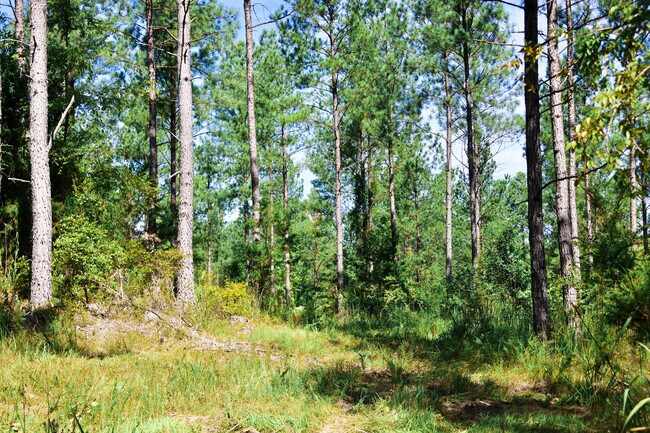
This Property Is For Sale
Property Detail
Highway 56
Spartanburg, SC
N SIDE FIELDS RD & E OF HWY 56 PB 185-395
6-67-00-020.03
SPARTANBURG
Agriculturalland
South Carolina
B and X Area of moderate flood hazard, usually the area between the limits of the 100-year and 500-year floods.
16.48 AC
2025
Lower Spartanburg County
2025
Greenville/Spartanburg
023806
NEARBY LISTINGS FOR SALE OR LEASE
-
-
View all Pauline listings for sale on LoopNet.com
DEMOGRAPHICS near Highway 56
1 mile
3 mile
5 mile
2025 Total Population
203
1,907
5,215
2030 Population
226
2,078
5,685
Pop Growth 2025-2030
+ 11.33%
+ 8.97%
+ 9.01%
Average Age
44
44
44
2025 Total Households
55
588
1,698
HH Growth 2025-2030
+ 12.73%
+ 8.84%
+ 8.95%
Median Household Inc
$62,143
$61,786
$63,991
Avg Household Size
2.60
2.50
2.50
2025 Avg HH Vehicles
2.00
2.00
2.00
Median Home Value
$232,353
$222,147
$236,418
Median Year Built
1990
1989
1990
Nearby Places
Map Layers
Map Styles
 Street
 Aerial
Layers
 Traffic
 Biking
Places
Listings with unknown addresses are not visible on the map
- Restaurants
- Banks
- Shops
- Fitness
- Groceries
PUBLIC TRANSPORTATION
AIRPORT
Greenville Spartanburg International
Drive
Walk
Distance
Greenville Spartanburg International
59 min
34.5 mi
Freight Ports
North Charleston Terminal
Drive
Walk
Distance
North Charleston Terminal
213 min
180.4 mi
Nearby Properties
Address
Land Use
TOTAL SIZE
Lot Size
Zoning
Address
Land Use
TOTAL SIZE
Lot Size
Zoning
6,269 SF
3.36 AC
Address
Land Use
TOTAL SIZE
Lot Size
Zoning
4,819 SF
14.30 AC
Address
Land Use
TOTAL SIZE
Lot Size
Zoning
1,386 SF
41.60 AC
Address
Land Use
TOTAL SIZE
Lot Size
Zoning
2,649 SF
Address
Land Use
TOTAL SIZE
Lot Size
Zoning
2,284 SF
5 AC
Address
Land Use
TOTAL SIZE
Lot Size
Zoning
1,748 SF
Address
Land Use
TOTAL SIZE
Lot Size
Zoning
2,635 SF
89.57 AC
Address
Land Use
TOTAL SIZE
Lot Size
Zoning
5,044 SF
22.23 AC
Address
Land Use
TOTAL SIZE
Lot Size
Zoning
4,718 SF
3.10 AC
Address
Land Use
TOTAL SIZE
Lot Size
Zoning
5,182 SF
37.18 AC
Address
Land Use
TOTAL SIZE
Lot Size
Zoning
3,208 SF
19.39 AC
Address
Land Use
TOTAL SIZE
Lot Size
Zoning
2,051 SF
17 AC
Address
Land Use
TOTAL SIZE
Lot Size
Zoning
1,456 SF
5.85 AC
Address
Land Use
TOTAL SIZE
Lot Size
Zoning
4,800 SF
38.32 AC
Address
Land Use
TOTAL SIZE
Lot Size
Zoning
3,168 SF
14.21 AC
Address
Land Use
TOTAL SIZE
Lot Size
Zoning
3,906 SF
10.12 AC
Address
Land Use
TOTAL SIZE
Lot Size
Zoning
1,872 SF
6.46 AC
Address
Land Use
TOTAL SIZE
Lot Size
Zoning
5.98 AC
Address
Land Use
TOTAL SIZE
Lot Size
Zoning
998 SF
5.14 AC
Address
Land Use
TOTAL SIZE
Lot Size
Zoning
1,548 SF
132.04 AC
Address
Land Use
TOTAL SIZE
Lot Size
Zoning
3,418 SF
20.09 AC
Address
Land Use
TOTAL SIZE
Lot Size
Zoning
3,642 SF
8.87 AC
Address
Land Use
TOTAL SIZE
Lot Size
Zoning
2,752 SF
8.67 AC
Address
Land Use
TOTAL SIZE
Lot Size
Zoning
3,407 SF
Address
Land Use
TOTAL SIZE
Lot Size
Zoning
15 AC
Address
Land Use
TOTAL SIZE
Lot Size
Zoning
3,234 SF
54.39 AC
Address
Land Use
TOTAL SIZE
Lot Size
Zoning
5,190 SF
32.42 AC
Address
Land Use
TOTAL SIZE
Lot Size
Zoning
1,778 SF
928.19 AC
Address
Land Use
TOTAL SIZE
Lot Size
Zoning
2,653 SF
8.49 AC
Address
Land Use
TOTAL SIZE
Lot Size
Zoning
2,584 SF
32.29 AC
The World's #1 Commercial Real Estate Marketplace
Connect with us
© 2026 CoStar Group
The information above has been obtained from sources believed reliable. While we do not doubt its accuracy we have not verified it and make no guarantee, warranty or representation about it. It is your responsibility to independently confirm its accuracy and completeness. Any projections, opinions, assumptions, or estimates used are for example only and do not represent the current or future performance of the property. The value of this transaction to you depends on tax and other factors which should be evaluated by your tax, financial, and legal advisors. You and your advisors should conduct a careful, independent investigation of the property to determine to your satisfaction the suitability of the property for your needs.