Property Record
Highway 60 E, Mulberry, FL 33860

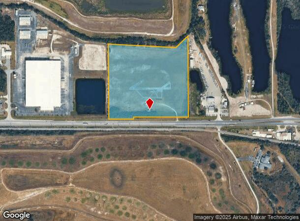

This Property Is For Sale
NEARBY LISTINGS FOR SALE OR LEASE
Property Detail
Highway 60 E
Lakeland-Winter Haven, FL
Alameda Heights
24-30-06-000000-022020
BEG 84.39 FT N & 910.19 FT W SE COR SEC 6 ON N R/W LINE HWY#60 N-89 5428-W 773.88 FT S-00 0522-W 30.0 FT N-89 5438-W 344.41 FT N-00 3147-W 1054.02 FT S-87 0757-E 953.18 FT N-46 0851-E 236.25 FT S-00 1715-E 1141.73 FT TO BEG
Industrialgeneral
Polk
X
Florida
12105C0490G
26.18 AC
2024
Polk County
2025
Tampa/St Petersburg
014905
DEMOGRAPHICS near Highway 60 E
1 mile
3 mile
5 mile
2024 Total Population
66
6,882
45,048
2029 Population
82
8,284
53,583
Pop Growth 2024-2029
+ 24.24%
+ 20.37%
+ 18.95%
Average Age
37
42
40
2024 Total Households
23
2,774
16,457
HH Growth 2024-2029
+ 21.74%
+ 20.30%
+ 18.88%
Median Household Inc
$72,499
$55,246
$78,579
Avg Household Size
2.80
2.50
2.70
2024 Avg HH Vehicles
3.00
2.00
2.00
Median Home Value
$193,749
$151,820
$267,898
Median Year Built
2003
1994
1994
Nearby Places
Map Layers
Map Styles
 Street
 Aerial
Transit
 Traffic
 Biking
Places
Listings with unknown addresses are not visible on the map
- Restaurants
- Banks
- Shops
- Fitness
- Groceries
Nearby Properties
Address
Land Use
TOTAL SIZE
Lot Size
Zoning
Address
Land Use
TOTAL SIZE
Lot Size
Zoning
9,069 SF
89.81 AC
R3
Address
Land Use
TOTAL SIZE
Lot Size
Zoning
5,534 SF
45.83 AC
GI
Address
Land Use
TOTAL SIZE
Lot Size
Zoning
322,938 SF
25.94 AC
Address
Land Use
TOTAL SIZE
Lot Size
Zoning
166,313 SF
63.97 AC
Address
Land Use
TOTAL SIZE
Lot Size
Zoning
174,251 SF
26.66 AC
Address
Land Use
TOTAL SIZE
Lot Size
Zoning
9,036 SF
62.80 AC
RC
Address
Land Use
TOTAL SIZE
Lot Size
Zoning
401,870 SF
545.26 AC
Address
Land Use
TOTAL SIZE
Lot Size
Zoning
116,961 SF
5.01 AC
I1
Address
Land Use
TOTAL SIZE
Lot Size
Zoning
81,706 SF
20.35 AC
Address
Land Use
TOTAL SIZE
Lot Size
Zoning
172,931 SF
20.09 AC
C4
Address
Land Use
TOTAL SIZE
Lot Size
Zoning
95,863 SF
8.10 AC
Address
Land Use
TOTAL SIZE
Lot Size
Zoning
103,698 SF
10.86 AC
GI
Address
Land Use
TOTAL SIZE
Lot Size
Zoning
56,689 SF
9.30 AC
Address
Land Use
TOTAL SIZE
Lot Size
Zoning
42,368 SF
13.63 AC
C4
Address
Land Use
TOTAL SIZE
Lot Size
Zoning
88,138 SF
7.48 AC
Address
Land Use
TOTAL SIZE
Lot Size
Zoning
41,093 SF
1.58 AC
C1
Address
Land Use
TOTAL SIZE
Lot Size
Zoning
26,449 SF
7.54 AC
Address
Land Use
TOTAL SIZE
Lot Size
Zoning
59,860 SF
10.48 AC
GI
Address
Land Use
TOTAL SIZE
Lot Size
Zoning
68,151 SF
18.63 AC
Address
Land Use
TOTAL SIZE
Lot Size
Zoning
93,186 SF
2.67 AC
I1
Address
Land Use
TOTAL SIZE
Lot Size
Zoning
12,452 SF
2.49 AC
C1
Address
Land Use
TOTAL SIZE
Lot Size
Zoning
28,852 SF
5.19 AC
C2
Address
Land Use
TOTAL SIZE
Lot Size
Zoning
24,520 SF
9.99 AC
Address
Land Use
TOTAL SIZE
Lot Size
Zoning
23.86 AC
Address
Land Use
TOTAL SIZE
Lot Size
Zoning
29,902 SF
2.93 AC
Address
Land Use
TOTAL SIZE
Lot Size
Zoning
23,946 SF
11.18 AC
C4
Address
Land Use
TOTAL SIZE
Lot Size
Zoning
103,151 SF
20.86 AC
Address
Land Use
TOTAL SIZE
Lot Size
Zoning
581.94 AC
Address
Land Use
TOTAL SIZE
Lot Size
Zoning
37,474 SF
13.22 AC
Address
Land Use
TOTAL SIZE
Lot Size
Zoning
86,860 SF
3.02 AC
GI
The World's #1 Commercial Real Estate Marketplace
Connect with us
© 2026 CoStar Group
The information above has been obtained from sources believed reliable. While we do not doubt its accuracy we have not verified it and make no guarantee, warranty or representation about it. It is your responsibility to independently confirm its accuracy and completeness. Any projections, opinions, assumptions, or estimates used are for example only and do not represent the current or future performance of the property. The value of this transaction to you depends on tax and other factors which should be evaluated by your tax, financial, and legal advisors. You and your advisors should conduct a careful, independent investigation of the property to determine to your satisfaction the suitability of the property for your needs.