Property Record
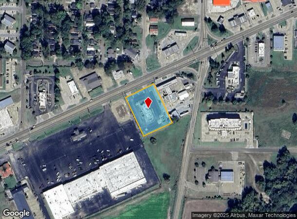
Highway 61 S Taco Bell, Clarksdale, MS 38614

NEARBY LISTINGS FOR SALE OR LEASE
Property Detail
Highway 61 S Taco Bell
421-261720000-0000400
1.3 ACS IN SEC LOT 2 DB 382 PG 235 26-27-4
Commercialnec
Coahoma
X
Mississippi
28027C0279E
2
2024
1.30 AC
2025
Tupelo/North Area
950500
Other Market Areas
4,062 SF
Clarksdale, MS
DEMOGRAPHICS near Highway 61 S Taco Bell
1 Mile
3 Mile
5 Mile
2024 Total Population
4,168
14,779
15,640
2029 Population
3,972
13,888
14,691
Pop Growth 2024-2029
(4.70%)
(6.03%)
(6.07%)
Average Age
37
38
38
2024 Total Households
1,619
5,754
6,086
HH Growth 2024-2029
(4.51%)
(5.91%)
(5.93%)
Median Household Inc
$24,113
$30,494
$31,389
Avg Household Size
2.50
2.40
2.40
2024 Avg HH Vehicles
2.00
2.00
2.00
Median Home Value
$70,876
$80,597
$83,768
Median Year Built
1963
1968
1969
Nearby Places
Map Layers
Map Styles
 Street
 Aerial
- Restaurants
- Banks
- Shops
- Fitness
- Groceries
SALE & LEASE HISTORY
LISTING DATE
SALE/LEASE

Nov 11, 2021
For Sale
Nearby Properties
Address
Land Use
TOTAL SIZE
Lot Size
Zoning
Address
Land Use
TOTAL SIZE
Lot Size
Zoning
16.28 AC
Address
Land Use
TOTAL SIZE
Lot Size
Zoning
156,778 SF
18.99 AC
Address
Land Use
TOTAL SIZE
Lot Size
Zoning
5,778 SF
10 AC
Address
Land Use
TOTAL SIZE
Lot Size
Zoning
6,647 SF
8 AC
Address
Land Use
TOTAL SIZE
Lot Size
Zoning
20,037 SF
4.58 AC
Address
Land Use
TOTAL SIZE
Lot Size
Zoning
109,925 SF
0.38 AC
Address
Land Use
TOTAL SIZE
Lot Size
Zoning
60,285 SF
22.50 AC
Address
Land Use
TOTAL SIZE
Lot Size
Zoning
5,047 SF
5.40 AC
Address
Land Use
TOTAL SIZE
Lot Size
Zoning
10,093 SF
10 AC
Address
Land Use
TOTAL SIZE
Lot Size
Zoning
2,161 SF
141.20 AC
Address
Land Use
TOTAL SIZE
Lot Size
Zoning
35,625 SF
10 AC
Address
Land Use
TOTAL SIZE
Lot Size
Zoning
36,847 SF
2.12 AC
Address
Land Use
TOTAL SIZE
Lot Size
Zoning
504 SF
13.80 AC
Address
Land Use
TOTAL SIZE
Lot Size
Zoning
10,776 SF
6.46 AC
Address
Land Use
TOTAL SIZE
Lot Size
Zoning
4,430 SF
22.70 AC
Address
Land Use
TOTAL SIZE
Lot Size
Zoning
59,782 SF
12.80 AC
Address
Land Use
TOTAL SIZE
Lot Size
Zoning
2,700 SF
10.40 AC
Address
Land Use
TOTAL SIZE
Lot Size
Zoning
6,102 SF
3.15 AC
Address
Land Use
TOTAL SIZE
Lot Size
Zoning
3.20 AC
Address
Land Use
TOTAL SIZE
Lot Size
Zoning
5,861 SF
5.70 AC
Address
Land Use
TOTAL SIZE
Lot Size
Zoning
10,795 SF
15.80 AC
Address
Land Use
TOTAL SIZE
Lot Size
Zoning
Address
Land Use
TOTAL SIZE
Lot Size
Zoning
2,130 SF
5 AC
Address
Land Use
TOTAL SIZE
Lot Size
Zoning
13,256 SF
2.20 AC
Address
Land Use
TOTAL SIZE
Lot Size
Zoning
9,384 SF
3.98 AC
Address
Land Use
TOTAL SIZE
Lot Size
Zoning
3,798 SF
0.76 AC
Address
Land Use
TOTAL SIZE
Lot Size
Zoning
22,910 SF
0.30 AC
Address
Land Use
TOTAL SIZE
Lot Size
Zoning
17,408 SF
2.44 AC
The World's #1 Commercial Real Estate Marketplace
Connect with us
© 2025 CoStar Group
The information above has been obtained from sources believed reliable. While we do not doubt its accuracy we have not verified it and make no guarantee, warranty or representation about it. It is your responsibility to independently confirm its accuracy and completeness. Any projections, opinions, assumptions, or estimates used are for example only and do not represent the current or future performance of the property. The value of this transaction to you depends on tax and other factors which should be evaluated by your tax, financial, and legal advisors. You and your advisors should conduct a careful, independent investigation of the property to determine to your satisfaction the suitability of the property for your needs.