Property Record
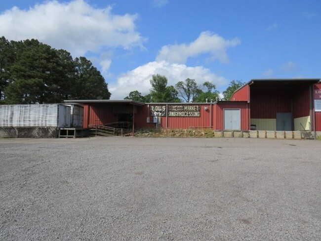
Highway 64 E, Pottsville, AR 72858

NEARBY LISTINGS FOR SALE OR LEASE
Property Detail
Highway 64 E
908-00235-000C
Pottsville By Sections
Lightindustrial
PT NE SE & PT NW SW CITY OF POTTSVILLE
X
Pope
05115C0400E
Arkansas
2024
2.20 AC
2025
Fort Smith/Russellville I-40
951202
Other Market Areas
8,963 SF
Russellville, AR
DEMOGRAPHICS near Highway 64 E
1 Mile
3 Mile
5 Mile
2024 Total Population
447
6,318
20,798
2029 Population
459
6,504
21,262
Pop Growth 2024-2029
+ 2.68%
+ 2.94%
+ 2.23%
Average Age
37
38
37
2024 Total Households
161
2,276
8,029
HH Growth 2024-2029
+ 2.48%
+ 2.90%
+ 2.23%
Median Household Inc
$49,166
$58,240
$43,794
Avg Household Size
2.80
2.70
2.50
2024 Avg HH Vehicles
2.00
2.00
2.00
Median Home Value
$148,648
$151,560
$142,408
Median Year Built
2003
1996
1987
Nearby Places
Map Layers
Map Styles
 Street
 Aerial
- Restaurants
- Banks
- Shops
- Fitness
- Groceries
SALE & LEASE HISTORY
LISTING DATE
SALE/LEASE

Sep 24, 2016
For Sale
Nearby Properties
Address
Land Use
TOTAL SIZE
Lot Size
Zoning
Address
Land Use
TOTAL SIZE
Lot Size
Zoning
189,756 SF
18.30 AC
Address
Land Use
TOTAL SIZE
Lot Size
Zoning
61,652 SF
20 AC
Address
Land Use
TOTAL SIZE
Lot Size
Zoning
293,355 SF
94.01 AC
Address
Land Use
TOTAL SIZE
Lot Size
Zoning
250,834 SF
25.20 AC
Address
Land Use
TOTAL SIZE
Lot Size
Zoning
194,164 SF
55.75 AC
Address
Land Use
TOTAL SIZE
Lot Size
Zoning
12,078 SF
22.32 AC
Address
Land Use
TOTAL SIZE
Lot Size
Zoning
133,229 SF
40 AC
Address
Land Use
TOTAL SIZE
Lot Size
Zoning
245,532 SF
25.93 AC
Address
Land Use
TOTAL SIZE
Lot Size
Zoning
97,230 SF
35.10 AC
Address
Land Use
TOTAL SIZE
Lot Size
Zoning
149,932 SF
16.38 AC
Address
Land Use
TOTAL SIZE
Lot Size
Zoning
35,102 SF
4.07 AC
Address
Land Use
TOTAL SIZE
Lot Size
Zoning
76,277 SF
8.10 AC
Address
Land Use
TOTAL SIZE
Lot Size
Zoning
24,097 SF
2.51 AC
Address
Land Use
TOTAL SIZE
Lot Size
Zoning
103,787 SF
13.25 AC
Address
Land Use
TOTAL SIZE
Lot Size
Zoning
8,672 SF
1.39 AC
Address
Land Use
TOTAL SIZE
Lot Size
Zoning
30,518 SF
4.60 AC
Address
Land Use
TOTAL SIZE
Lot Size
Zoning
5,530 SF
6.95 AC
Address
Land Use
TOTAL SIZE
Lot Size
Zoning
20,020 SF
2.20 AC
Address
Land Use
TOTAL SIZE
Lot Size
Zoning
34,250 SF
11.08 AC
Address
Land Use
TOTAL SIZE
Lot Size
Zoning
40,500 SF
17.43 AC
Address
Land Use
TOTAL SIZE
Lot Size
Zoning
3,456 SF
80 AC
Address
Land Use
TOTAL SIZE
Lot Size
Zoning
40,500 SF
10 AC
Address
Land Use
TOTAL SIZE
Lot Size
Zoning
9,332 SF
8 AC
Address
Land Use
TOTAL SIZE
Lot Size
Zoning
86,500 SF
8.23 AC
Address
Land Use
TOTAL SIZE
Lot Size
Zoning
60,000 SF
3.35 AC
Address
Land Use
TOTAL SIZE
Lot Size
Zoning
14,400 SF
10.23 AC
Address
Land Use
TOTAL SIZE
Lot Size
Zoning
29,159 SF
6.91 AC
Address
Land Use
TOTAL SIZE
Lot Size
Zoning
13,955 SF
4.51 AC
Address
Land Use
TOTAL SIZE
Lot Size
Zoning
46,750 SF
10.23 AC
The World's #1 Commercial Real Estate Marketplace
Connect with us
© 2025 CoStar Group
The information above has been obtained from sources believed reliable. While we do not doubt its accuracy we have not verified it and make no guarantee, warranty or representation about it. It is your responsibility to independently confirm its accuracy and completeness. Any projections, opinions, assumptions, or estimates used are for example only and do not represent the current or future performance of the property. The value of this transaction to you depends on tax and other factors which should be evaluated by your tax, financial, and legal advisors. You and your advisors should conduct a careful, independent investigation of the property to determine to your satisfaction the suitability of the property for your needs.