Property Record
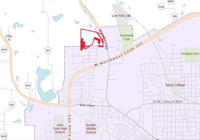
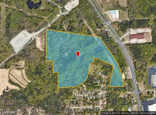
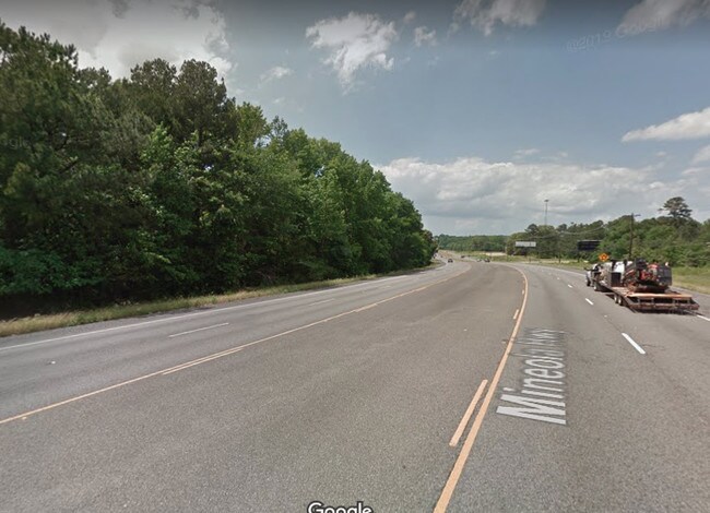
Highway 69, , TX
NEARBY LISTINGS FOR SALE OR LEASE
Property Detail
Highway 69
Tyler, TX
A0367 H George
1-00000-0367-02-021010
ABST A0367 H GEORGETRACT 21A
Agriculturalland
Smith
X
Texas
48423C0240D
44.07 AC
2024
Tyler & Longview
2025
Other Market Areas
000202
DEMOGRAPHICS near Highway 69
1 Mile
3 Mile
5 Mile
2024 Total Population
3,154
31,271
70,966
2029 Population
3,383
34,092
77,332
Pop Growth 2024-2029
+ 7.26%
+ 9.02%
+ 8.97%
Average Age
36
35
36
2024 Total Households
1,086
10,204
24,899
HH Growth 2024-2029
+ 6.81%
+ 8.57%
+ 8.42%
Median Household Inc
$48,422
$45,669
$49,153
Avg Household Size
2.80
2.80
2.60
2024 Avg HH Vehicles
2.00
2.00
2.00
Median Home Value
$75,784
$87,161
$132,223
Median Year Built
1967
1965
1968
Nearby Places
Map Layers
Map Styles
 Street
 Aerial
- Restaurants
- Banks
- Shops
- Fitness
- Groceries
PUBLIC TRANSPORTATION
AIRPORT
Tyler Pounds Regional
DRIVE
WALK
Distance
Tyler Pounds Regional
15 min
7.6 mi
Freight Ports
Port of Shreveport
DRIVE
WALK
Distance
Port of Shreveport
122 min
107.2 mi
SALE & LEASE HISTORY
LISTING DATE
SALE/LEASE

Oct 02, 2019
For Sale
Nearby Properties
Address
Land Use
TOTAL SIZE
Lot Size
Zoning
Address
Land Use
TOTAL SIZE
Lot Size
Zoning
31.74 AC
Address
Land Use
TOTAL SIZE
Lot Size
Zoning
Address
Land Use
TOTAL SIZE
Lot Size
Zoning
187.64 AC
R1A
Address
Land Use
TOTAL SIZE
Lot Size
Zoning
63 AC
R1A
Address
Land Use
TOTAL SIZE
Lot Size
Zoning
22.85 AC
Address
Land Use
TOTAL SIZE
Lot Size
Zoning
2,802 SF
14 AC
RMF
Address
Land Use
TOTAL SIZE
Lot Size
Zoning
25.54 AC
INT
Address
Land Use
TOTAL SIZE
Lot Size
Zoning
14.16 AC
Address
Land Use
TOTAL SIZE
Lot Size
Zoning
205,196 SF
25.19 AC
C2
Address
Land Use
TOTAL SIZE
Lot Size
Zoning
Address
Land Use
TOTAL SIZE
Lot Size
Zoning
3,222 SF
7.43 AC
RMF
Address
Land Use
TOTAL SIZE
Lot Size
Zoning
111,048 SF
10 AC
RMF
Address
Land Use
TOTAL SIZE
Lot Size
Zoning
1,375 SF
8.50 AC
RMF
Address
Land Use
TOTAL SIZE
Lot Size
Zoning
171,588 SF
16.21 AC
Address
Land Use
TOTAL SIZE
Lot Size
Zoning
49,110 SF
2.19 AC
C2
Address
Land Use
TOTAL SIZE
Lot Size
Zoning
34,637 SF
149.75 AC
R1A
Address
Land Use
TOTAL SIZE
Lot Size
Zoning
135,792 SF
12.05 AC
C1
Address
Land Use
TOTAL SIZE
Lot Size
Zoning
3,312 SF
10.58 AC
Address
Land Use
TOTAL SIZE
Lot Size
Zoning
3,319 SF
18 AC
Address
Land Use
TOTAL SIZE
Lot Size
Zoning
92,268 SF
8.48 AC
C2
Address
Land Use
TOTAL SIZE
Lot Size
Zoning
64,882 SF
6.07 AC
C1
Address
Land Use
TOTAL SIZE
Lot Size
Zoning
20,597 SF
3.28 AC
Address
Land Use
TOTAL SIZE
Lot Size
Zoning
18,577 SF
8.60 AC
M1
Address
Land Use
TOTAL SIZE
Lot Size
Zoning
2,162 SF
19.54 AC
Address
Land Use
TOTAL SIZE
Lot Size
Zoning
18,073 SF
2.73 AC
R2
Address
Land Use
TOTAL SIZE
Lot Size
Zoning
32,175 SF
3.48 AC
C2
Address
Land Use
TOTAL SIZE
Lot Size
Zoning
15,364 SF
43.24 AC
Address
Land Use
TOTAL SIZE
Lot Size
Zoning
57,576 SF
5.96 AC
M1
Address
Land Use
TOTAL SIZE
Lot Size
Zoning
4,747 SF
42.83 AC
Address
Land Use
TOTAL SIZE
Lot Size
Zoning
78,957 SF
13.58 AC
M1
The World's #1 Commercial Real Estate Marketplace
Connect with us
© 2026 CoStar Group
The information above has been obtained from sources believed reliable. While we do not doubt its accuracy we have not verified it and make no guarantee, warranty or representation about it. It is your responsibility to independently confirm its accuracy and completeness. Any projections, opinions, assumptions, or estimates used are for example only and do not represent the current or future performance of the property. The value of this transaction to you depends on tax and other factors which should be evaluated by your tax, financial, and legal advisors. You and your advisors should conduct a careful, independent investigation of the property to determine to your satisfaction the suitability of the property for your needs.