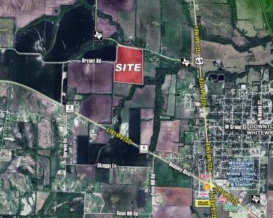
Property Record
Highway 697, Whitewright, TX 75491


Property Detail
Highway 697
Sherman-Denison, TX
G-0494 HILBURN AMBROSE A-G0494, ACRES 31.332
129660
GRAYSON
Agriculturalland
Texas
B and X Area of moderate flood hazard, usually the area between the limits of the 100-year and 500-year floods.
31.33 AC
2024
Texas North Area
2025
Other Market Areas
001802
NEARBY LISTINGS FOR SALE OR LEASE
-
-
View all Whitewright listings for sale on LoopNet.com
DEMOGRAPHICS near Highway 697
1 mile
3 mile
5 mile
2025 Total Population
219
2,718
5,412
2030 Population
239
2,942
5,779
Pop Growth 2025-2030
+ 9.13%
+ 8.24%
+ 6.78%
Average Age
40
40
41
2025 Total Households
82
1,056
2,057
HH Growth 2025-2030
+ 9.76%
+ 8.33%
+ 6.85%
Median Household Inc
$59,666
$73,155
$84,015
Avg Household Size
2.50
2.50
2.60
2025 Avg HH Vehicles
2.00
2.00
2.00
Median Home Value
$311,111
$312,963
$305,580
Median Year Built
1986
1978
1983
Nearby Places
Map Layers
Map Styles
 Street
 Aerial
Transit
 Traffic
 Biking
Places
Listings with unknown addresses are not visible on the map
- Restaurants
- Banks
- Shops
- Fitness
- Groceries
Nearby Properties
Address
Land Use
TOTAL SIZE
Lot Size
Zoning
Address
Land Use
TOTAL SIZE
Lot Size
Zoning
119,604 SF
16.59 AC
Address
Land Use
TOTAL SIZE
Lot Size
Zoning
Address
Land Use
TOTAL SIZE
Lot Size
Zoning
53,440 SF
4.22 AC
Address
Land Use
TOTAL SIZE
Lot Size
Zoning
49,356 SF
3.81 AC
Address
Land Use
TOTAL SIZE
Lot Size
Zoning
11,800 SF
1.79 AC
Address
Land Use
TOTAL SIZE
Lot Size
Zoning
6,564 SF
3.11 AC
Address
Land Use
TOTAL SIZE
Lot Size
Zoning
47,740 SF
6.73 AC
Address
Land Use
TOTAL SIZE
Lot Size
Zoning
10,788 SF
1.26 AC
Address
Land Use
TOTAL SIZE
Lot Size
Zoning
11,153 SF
1.61 AC
Address
Land Use
TOTAL SIZE
Lot Size
Zoning
1,920 SF
6.94 AC
Address
Land Use
TOTAL SIZE
Lot Size
Zoning
28,880 SF
0.82 AC
Address
Land Use
TOTAL SIZE
Lot Size
Zoning
Address
Land Use
TOTAL SIZE
Lot Size
Zoning
29,640 SF
2.87 AC
Address
Land Use
TOTAL SIZE
Lot Size
Zoning
5,623 SF
2.30 AC
Address
Land Use
TOTAL SIZE
Lot Size
Zoning
150 AC
Address
Land Use
TOTAL SIZE
Lot Size
Zoning
11,113 SF
12.15 AC
Address
Land Use
TOTAL SIZE
Lot Size
Zoning
185.03 AC
Address
Land Use
TOTAL SIZE
Lot Size
Zoning
3,600 SF
39.83 AC
Address
Land Use
TOTAL SIZE
Lot Size
Zoning
22,345 SF
1.97 AC
Address
Land Use
TOTAL SIZE
Lot Size
Zoning
9,270 SF
0.86 AC
Address
Land Use
TOTAL SIZE
Lot Size
Zoning
5,727 SF
1.77 AC
Address
Land Use
TOTAL SIZE
Lot Size
Zoning
20,240 SF
17.18 AC
Address
Land Use
TOTAL SIZE
Lot Size
Zoning
8,000 SF
0.92 AC
Address
Land Use
TOTAL SIZE
Lot Size
Zoning
12,480 SF
0.57 AC
Address
Land Use
TOTAL SIZE
Lot Size
Zoning
1,200 SF
10.39 AC
Address
Land Use
TOTAL SIZE
Lot Size
Zoning
4,100 SF
0.71 AC
Address
Land Use
TOTAL SIZE
Lot Size
Zoning
2,880 SF
0.47 AC
Address
Land Use
TOTAL SIZE
Lot Size
Zoning
8,117 SF
22 AC
Address
Land Use
TOTAL SIZE
Lot Size
Zoning
Address
Land Use
TOTAL SIZE
Lot Size
Zoning
1,302 SF
52 AC
The World's #1 Commercial Real Estate Marketplace
Connect with us
© 2026 CoStar Group
The information above has been obtained from sources believed reliable. While we do not doubt its accuracy we have not verified it and make no guarantee, warranty or representation about it. It is your responsibility to independently confirm its accuracy and completeness. Any projections, opinions, assumptions, or estimates used are for example only and do not represent the current or future performance of the property. The value of this transaction to you depends on tax and other factors which should be evaluated by your tax, financial, and legal advisors. You and your advisors should conduct a careful, independent investigation of the property to determine to your satisfaction the suitability of the property for your needs.