Property Record
Highway 72 E, Athens, AL 35613

Current Lease Availabilities
Property Detail
Highway 72 E
Huntsville, AL
COMM SW COR OF NW\4 OF SE\4 THE 330 TO POB CONT E 302.63 N92.24 NW 353.59 S 279.83 TOPOB SEC 14 3 4 ADDED ATHENS CITY TAX BY
10-06-14-0-000-077.006
LIMESTONE
Commercialacreage
Alabama
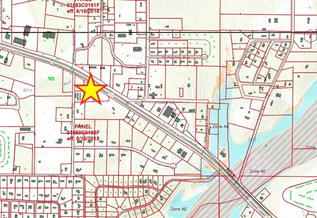
B and X Area of moderate flood hazard, usually the area between the limits of the 100-year and 500-year floods.
1.29 AC
2025
Athens
2025
Huntsville
020806
NEARBY LISTINGS FOR SALE OR LEASE
DEMOGRAPHICS near Highway 72 E
1 mile
3 mile
5 mile
2025 Total Population
2,631
16,469
43,136
2030 Population
2,966
18,505
48,413
Pop Growth 2025-2030
+ 12.73%
+ 12.36%
+ 12.23%
Average Age
43
42
41
2025 Total Households
1,054
6,718
17,262
HH Growth 2025-2030
+ 13.00%
+ 12.62%
+ 12.48%
Median Household Inc
$118,971
$99,394
$85,033
Avg Household Size
2.50
2.40
2.40
2025 Avg HH Vehicles
3.00
2.00
2.00
Median Home Value
$393,708
$359,446
$301,998
Median Year Built
2001
1996
1992
Nearby Places
Map Layers
Map Styles
 Street
 Aerial
Transit
 Traffic
 Biking
Places
Listings with unknown addresses are not visible on the map
- Restaurants
- Banks
- Shops
- Fitness
- Groceries
PUBLIC TRANSPORTATION
AIRPORT
Huntsville International-Carl T Jones Field
Drive
Walk
Distance
Huntsville International-Carl T Jones Field
29 min
17.8 mi
Freight Ports
Port of Mobile
Drive
Walk
Distance
Port of Mobile
379 min
348.0 mi
Nearby Properties
Address
Land Use
TOTAL SIZE
Lot Size
Zoning
Address
Land Use
TOTAL SIZE
Lot Size
Zoning
111,960 SF
13.96 AC
Address
Land Use
TOTAL SIZE
Lot Size
Zoning
31,812 SF
54.94 AC
Address
Land Use
TOTAL SIZE
Lot Size
Zoning
Address
Land Use
TOTAL SIZE
Lot Size
Zoning
194,291 SF
21.52 AC
Address
Land Use
TOTAL SIZE
Lot Size
Zoning
3,040 SF
15.33 AC
Address
Land Use
TOTAL SIZE
Lot Size
Zoning
79,713 SF
9.37 AC
Address
Land Use
TOTAL SIZE
Lot Size
Zoning
11,620 SF
7.40 AC
Address
Land Use
TOTAL SIZE
Lot Size
Zoning
134,312 SF
17.38 AC
Address
Land Use
TOTAL SIZE
Lot Size
Zoning
36,460 SF
6.65 AC
Address
Land Use
TOTAL SIZE
Lot Size
Zoning
67,241 SF
2.80 AC
Address
Land Use
TOTAL SIZE
Lot Size
Zoning
11 AC
Address
Land Use
TOTAL SIZE
Lot Size
Zoning
2,119 SF
17.54 AC
Address
Land Use
TOTAL SIZE
Lot Size
Zoning
56,242 SF
5.43 AC
Address
Land Use
TOTAL SIZE
Lot Size
Zoning
60,612 SF
3.74 AC
Address
Land Use
TOTAL SIZE
Lot Size
Zoning
42,868 SF
11.54 AC
Address
Land Use
TOTAL SIZE
Lot Size
Zoning
241,870 SF
7.50 AC
Address
Land Use
TOTAL SIZE
Lot Size
Zoning
45,156 SF
2.28 AC
Address
Land Use
TOTAL SIZE
Lot Size
Zoning
8,943 SF
50.58 AC
Address
Land Use
TOTAL SIZE
Lot Size
Zoning
36,990 SF
7.72 AC
Address
Land Use
TOTAL SIZE
Lot Size
Zoning
17 AC
Address
Land Use
TOTAL SIZE
Lot Size
Zoning
11,928 SF
1.88 AC
Address
Land Use
TOTAL SIZE
Lot Size
Zoning
42,975 SF
2.18 AC
Address
Land Use
TOTAL SIZE
Lot Size
Zoning
Address
Land Use
TOTAL SIZE
Lot Size
Zoning
4.33 AC
Address
Land Use
TOTAL SIZE
Lot Size
Zoning
23.30 AC
Address
Land Use
TOTAL SIZE
Lot Size
Zoning
1,506 SF
6.50 AC
Address
Land Use
TOTAL SIZE
Lot Size
Zoning
30,000 SF
4.87 AC
Address
Land Use
TOTAL SIZE
Lot Size
Zoning
27,632 SF
20.73 AC
Address
Land Use
TOTAL SIZE
Lot Size
Zoning
12,881 SF
1.63 AC
Address
Land Use
TOTAL SIZE
Lot Size
Zoning
23,249 SF
3.78 AC
The World's #1 Commercial Real Estate Marketplace
Connect with us
© 2026 CoStar Group
The information above has been obtained from sources believed reliable. While we do not doubt its accuracy we have not verified it and make no guarantee, warranty or representation about it. It is your responsibility to independently confirm its accuracy and completeness. Any projections, opinions, assumptions, or estimates used are for example only and do not represent the current or future performance of the property. The value of this transaction to you depends on tax and other factors which should be evaluated by your tax, financial, and legal advisors. You and your advisors should conduct a careful, independent investigation of the property to determine to your satisfaction the suitability of the property for your needs.