Property Record
Highway 73, Port Arthur, TX 77642
NEARBY LISTINGS FOR SALE OR LEASE
-
-
View all Port Arthur listings for sale on LoopNet.com
Property Detail
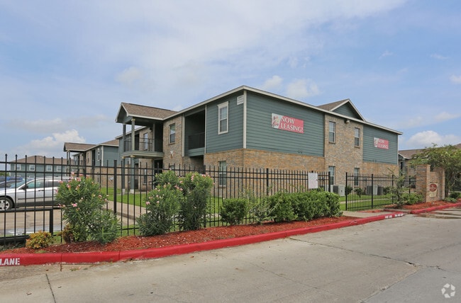
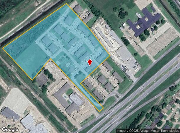
Highway 73
Beaumont/Port Arthur
Palco - P.A.
Beaumont-Port Arthur, TX
LT 6 TR 1 & LT 7 TR 2 BLK 7 RG H PT LOTS 2 & 3 BLK 8 RG H PALCO 14.42 AC
049400-000-037100-00210
Jefferson
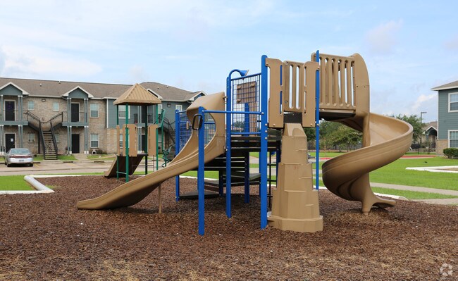
Multifamilydwelling
Texas
0
6
2025
14.36 AC
007002
Port Arthur/Groves
206,139 SF
DEMOGRAPHICS near Highway 73
1 Mile
3 Mile
5 Mile
2024 Total Population
5,600
56,588
95,141
2029 Population
5,364
54,754
92,536
Pop Growth 2024-2029
(4.21%)
(3.24%)
(2.74%)
Average Age
34
37
38
2024 Total Households
1,959
21,010
36,272
HH Growth 2024-2029
(4.29%)
(3.42%)
(2.83%)
Median Household Inc
$49,663
$54,446
$56,904
Avg Household Size
2.80
2.60
2.60
2024 Avg HH Vehicles
2.00
2.00
2.00
Median Home Value
$141,390
$130,397
$141,672
Median Year Built
1970
1971
1971
Nearby Places
Map Layers
Map Styles
 Street
 Aerial
- Restaurants
- Banks
- Shops
- Fitness
- Groceries
Nearby Properties
Address
Land Use
TOTAL SIZE
Lot Size
Zoning
Address
Land Use
TOTAL SIZE
Lot Size
Zoning
284,108 SF
25 AC
Address
Land Use
TOTAL SIZE
Lot Size
Zoning
279,375 SF
18.94 AC
Address
Land Use
TOTAL SIZE
Lot Size
Zoning
235,864 SF
12.21 AC
Address
Land Use
TOTAL SIZE
Lot Size
Zoning
157,411 SF
38.21 AC
Address
Land Use
TOTAL SIZE
Lot Size
Zoning
130,420 SF
6.78 AC
Address
Land Use
TOTAL SIZE
Lot Size
Zoning
24,763 SF
2.74 AC
Address
Land Use
TOTAL SIZE
Lot Size
Zoning
16,200 SF
2.09 AC
Address
Land Use
TOTAL SIZE
Lot Size
Zoning
129,495 SF
7.23 AC
Address
Land Use
TOTAL SIZE
Lot Size
Zoning
127,946 SF
7.72 AC
Address
Land Use
TOTAL SIZE
Lot Size
Zoning
303,400 SF
14.15 AC
Address
Land Use
TOTAL SIZE
Lot Size
Zoning
17,414 SF
2.20 AC
Address
Land Use
TOTAL SIZE
Lot Size
Zoning
628,811 SF
38.48 AC
Address
Land Use
TOTAL SIZE
Lot Size
Zoning
79,096 SF
9.09 AC
Address
Land Use
TOTAL SIZE
Lot Size
Zoning
185,832 SF
10.08 AC
Address
Land Use
TOTAL SIZE
Lot Size
Zoning
157,188 SF
8.70 AC
Address
Land Use
TOTAL SIZE
Lot Size
Zoning
55,953 SF
1.87 AC
Address
Land Use
TOTAL SIZE
Lot Size
Zoning
97,588 SF
2.81 AC
Address
Land Use
TOTAL SIZE
Lot Size
Zoning
183,963 SF
23.46 AC
Address
Land Use
TOTAL SIZE
Lot Size
Zoning
86,567 SF
5 AC
Address
Land Use
TOTAL SIZE
Lot Size
Zoning
132,007 SF
1.27 AC
Address
Land Use
TOTAL SIZE
Lot Size
Zoning
89,093 SF
10.51 AC
Address
Land Use
TOTAL SIZE
Lot Size
Zoning
135,891 SF
9.95 AC
Address
Land Use
TOTAL SIZE
Lot Size
Zoning
243,132 SF
21.67 AC
Address
Land Use
TOTAL SIZE
Lot Size
Zoning
155,734 SF
11.27 AC
Address
Land Use
TOTAL SIZE
Lot Size
Zoning
157,343 SF
9.09 AC
Address
Land Use
TOTAL SIZE
Lot Size
Zoning
134,056 SF
16.68 AC
Address
Land Use
TOTAL SIZE
Lot Size
Zoning
151,121 SF
9.04 AC
Address
Land Use
TOTAL SIZE
Lot Size
Zoning
22,746 SF
2.77 AC
Address
Land Use
TOTAL SIZE
Lot Size
Zoning
49,170 SF
1.63 AC
Address
Land Use
TOTAL SIZE
Lot Size
Zoning
50,937 SF
16.35 AC
The World's #1 Commercial Real Estate Marketplace
Connect with us
© 2025 CoStar Group
The information above has been obtained from sources believed reliable. While we do not doubt its accuracy we have not verified it and make no guarantee, warranty or representation about it. It is your responsibility to independently confirm its accuracy and completeness. Any projections, opinions, assumptions, or estimates used are for example only and do not represent the current or future performance of the property. The value of this transaction to you depends on tax and other factors which should be evaluated by your tax, financial, and legal advisors. You and your advisors should conduct a careful, independent investigation of the property to determine to your satisfaction the suitability of the property for your needs.