Property Record
Highway 73, Townsend, TN 37882


NEARBY LISTINGS FOR SALE OR LEASE
-
-
View all Townsend listings for sale on LoopNet.com
Property Detail
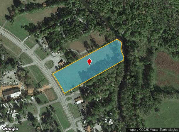
Highway 73
097-054.00
DISTRICT: 15, COUNTY AREA: H01
Residentialacreage
Blount
AE
Tennessee
47009C0312C
3.58 AC
2024
Blount County
2025
Knoxville
011404
Knoxville, TN
DEMOGRAPHICS near Highway 73
1 Mile
3 Mile
5 Mile
2024 Total Population
193
1,568
5,472
2029 Population
217
1,747
6,035
Pop Growth 2024-2029
+ 12.44%
+ 11.42%
+ 10.29%
Average Age
51
51
51
2024 Total Households
94
752
2,516
HH Growth 2024-2029
+ 11.70%
+ 11.57%
+ 10.49%
Median Household Inc
$41,944
$41,224
$48,007
Avg Household Size
2.10
2.10
2.10
2024 Avg HH Vehicles
2.00
2.00
2.00
Median Home Value
$242,857
$259,333
$273,683
Median Year Built
1991
1990
1995
Nearby Places
Map Layers
Map Styles
 Street
 Aerial
- Restaurants
- Banks
- Shops
- Fitness
- Groceries
PUBLIC TRANSPORTATION
AIRPORT
McGhee Tyson
DRIVE
WALK
Distance
McGhee Tyson
40 min
26.1 mi
Freight Ports
Georgia Ports - Savannah
DRIVE
WALK
Distance
Georgia Ports - Savannah
481 min
410.8 mi
Nearby Properties
Address
Land Use
TOTAL SIZE
Lot Size
Zoning
Address
Land Use
TOTAL SIZE
Lot Size
Zoning
13,545 SF
1.61 AC
B1
Address
Land Use
TOTAL SIZE
Lot Size
Zoning
23,218 SF
4.47 AC
R1
Address
Land Use
TOTAL SIZE
Lot Size
Zoning
120 AC
R2
Address
Land Use
TOTAL SIZE
Lot Size
Zoning
42,649 SF
3.22 AC
B1
Address
Land Use
TOTAL SIZE
Lot Size
Zoning
10,725 SF
3.80 AC
B1
Address
Land Use
TOTAL SIZE
Lot Size
Zoning
9,220 SF
4.76 AC
R1
Address
Land Use
TOTAL SIZE
Lot Size
Zoning
20,200 SF
4.14 AC
B1
Address
Land Use
TOTAL SIZE
Lot Size
Zoning
9,996 SF
3.34 AC
B1
Address
Land Use
TOTAL SIZE
Lot Size
Zoning
11,756 SF
4.17 AC
B1
Address
Land Use
TOTAL SIZE
Lot Size
Zoning
2,514 SF
1.86 AC
B1
Address
Land Use
TOTAL SIZE
Lot Size
Zoning
9,228 SF
3.30 AC
B1
Address
Land Use
TOTAL SIZE
Lot Size
Zoning
9,301 SF
1.20 AC
B1
Address
Land Use
TOTAL SIZE
Lot Size
Zoning
3,070 SF
1.60 AC
B1
Address
Land Use
TOTAL SIZE
Lot Size
Zoning
3,456 SF
0.67 AC
R-1
Address
Land Use
TOTAL SIZE
Lot Size
Zoning
0.87 AC
R-1
Address
Land Use
TOTAL SIZE
Lot Size
Zoning
Address
Land Use
TOTAL SIZE
Lot Size
Zoning
4,814 SF
5.05 AC
R1
Address
Land Use
TOTAL SIZE
Lot Size
Zoning
5,544 SF
1.12 AC
B1
Address
Land Use
TOTAL SIZE
Lot Size
Zoning
2.37 AC
B1
Address
Land Use
TOTAL SIZE
Lot Size
Zoning
5,796 SF
3.19 AC
B1
Address
Land Use
TOTAL SIZE
Lot Size
Zoning
2,374 SF
3.44 AC
B1
Address
Land Use
TOTAL SIZE
Lot Size
Zoning
3.60 AC
B1
Address
Land Use
TOTAL SIZE
Lot Size
Zoning
3,065 SF
1.65 AC
B1
Address
Land Use
TOTAL SIZE
Lot Size
Zoning
4,780 SF
0.88 AC
B1
Address
Land Use
TOTAL SIZE
Lot Size
Zoning
8,046 SF
0.39 AC
B1
Address
Land Use
TOTAL SIZE
Lot Size
Zoning
4,304 SF
0.64 AC
B1
Address
Land Use
TOTAL SIZE
Lot Size
Zoning
5,100 SF
1.03 AC
B1
Address
Land Use
TOTAL SIZE
Lot Size
Zoning
7,162 SF
1.34 AC
B1
Address
Land Use
TOTAL SIZE
Lot Size
Zoning
6,840 SF
4.69 AC
B1
Address
Land Use
TOTAL SIZE
Lot Size
Zoning
15,265 SF
0.87 AC
B1
The World's #1 Commercial Real Estate Marketplace
Connect with us
© 2025 CoStar Group
The information above has been obtained from sources believed reliable. While we do not doubt its accuracy we have not verified it and make no guarantee, warranty or representation about it. It is your responsibility to independently confirm its accuracy and completeness. Any projections, opinions, assumptions, or estimates used are for example only and do not represent the current or future performance of the property. The value of this transaction to you depends on tax and other factors which should be evaluated by your tax, financial, and legal advisors. You and your advisors should conduct a careful, independent investigation of the property to determine to your satisfaction the suitability of the property for your needs.