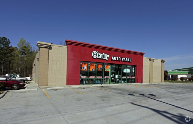
Property Record
Highway 74, Monroe, NC 28110

Property Detail
Highway 74
09-336-006-B
#1-4 & P/5 (LESS 2700SF) HELMS OPCC053 PLUS #2 OPCC424 & OPCL976 LESS 6837-034
Commercialnec
UNION
CD MONROE
North Carolina
B and X Area of moderate flood hazard, usually the area between the limits of the 100-year and 500-year floods.
1.03 AC
2025
Union County
2025
Charlotte
020502
Charlotte-Concord-Gastonia, NC-SC
7,720 SF
NEARBY LISTINGS FOR SALE OR LEASE
DEMOGRAPHICS near Highway 74
1 mile
3 mile
5 mile
2025 Total Population
3,285
27,700
85,689
2030 Population
3,641
30,329
94,129
Pop Growth 2025-2030
+ 10.84%
+ 9.49%
+ 9.85%
Average Age
38
39
38
2025 Total Households
1,200
9,935
29,674
HH Growth 2025-2030
+ 10.92%
+ 9.61%
+ 9.93%
Median Household Inc
$88,834
$82,530
$89,688
Avg Household Size
2.70
2.80
2.80
2025 Avg HH Vehicles
2.00
2.00
2.00
Median Home Value
$347,733
$357,672
$373,608
Median Year Built
2002
1998
2000
Nearby Places
Map Layers
Map Styles
 Street
 Aerial
Transit
 Traffic
 Biking
Places
Listings with unknown addresses are not visible on the map
- Restaurants
- Banks
- Shops
- Fitness
- Groceries
PUBLIC TRANSPORTATION
AIRPORT
Charlotte/Douglas International
Drive
Walk
Distance
Charlotte/Douglas International
43 min
27.3 mi
Concord-Padgett Regional
Drive
Walk
Distance
Concord-Padgett Regional
41 min
31.5 mi
Freight Ports
North Charleston Terminal
Drive
Walk
Distance
North Charleston Terminal
228 min
189.7 mi
Nearby Properties
Address
Land Use
TOTAL SIZE
Lot Size
Zoning
Address
Land Use
TOTAL SIZE
Lot Size
Zoning
30,708 SF
29.10 AC
R-MF MONRO
Address
Land Use
TOTAL SIZE
Lot Size
Zoning
124.87 AC
LI UNION C
Address
Land Use
TOTAL SIZE
Lot Size
Zoning
150,880 SF
73.40 AC
G-I MONROE
Address
Land Use
TOTAL SIZE
Lot Size
Zoning
166,254 SF
99.20 AC
G-I MONROE
Address
Land Use
TOTAL SIZE
Lot Size
Zoning
81,504 SF
30.21 AC
CD MONROE
Address
Land Use
TOTAL SIZE
Lot Size
Zoning
83,808 SF
23.45 AC
CD MONROE
Address
Land Use
TOTAL SIZE
Lot Size
Zoning
23.16 AC
CD MONROE
Address
Land Use
TOTAL SIZE
Lot Size
Zoning
11,424 SF
17.71 AC
GB MONROE
Address
Land Use
TOTAL SIZE
Lot Size
Zoning
35.14 AC
G-I MONROE
Address
Land Use
TOTAL SIZE
Lot Size
Zoning
24.89 AC
Address
Land Use
TOTAL SIZE
Lot Size
Zoning
98,929 SF
50.34 AC
SF-1 INDIA
Address
Land Use
TOTAL SIZE
Lot Size
Zoning
263,636 SF
20.36 AC
G-I MONROE
Address
Land Use
TOTAL SIZE
Lot Size
Zoning
49,710 SF
14.20 AC
CZ INDIAN
Address
Land Use
TOTAL SIZE
Lot Size
Zoning
219,625 SF
36.12 AC
GB MONROE
Address
Land Use
TOTAL SIZE
Lot Size
Zoning
159,892 SF
15.84 AC
G-I MONROE
Address
Land Use
TOTAL SIZE
Lot Size
Zoning
103,100 SF
28.55 AC
RBD INDIAN
Address
Land Use
TOTAL SIZE
Lot Size
Zoning
95,700 SF
24.87 AC
G-I MONROE
Address
Land Use
TOTAL SIZE
Lot Size
Zoning
2,968 SF
9.34 AC
R-20 UNION
Address
Land Use
TOTAL SIZE
Lot Size
Zoning
97,083 SF
32.30 AC
R-40 MONRO
Address
Land Use
TOTAL SIZE
Lot Size
Zoning
105,218 SF
40.66 AC
G-I MONROE
Address
Land Use
TOTAL SIZE
Lot Size
Zoning
79,930 SF
261.95 AC
RBD INDIAN
Address
Land Use
TOTAL SIZE
Lot Size
Zoning
54,712 SF
10.01 AC
GB MONROE
Address
Land Use
TOTAL SIZE
Lot Size
Zoning
123,296 SF
9.70 AC
CD MONROE
Address
Land Use
TOTAL SIZE
Lot Size
Zoning
145,600 SF
11.75 AC
G-I MONROE
Address
Land Use
TOTAL SIZE
Lot Size
Zoning
45.21 AC
RBD INDIAN
Address
Land Use
TOTAL SIZE
Lot Size
Zoning
118,802 SF
10.82 AC
G-I MONROE
Address
Land Use
TOTAL SIZE
Lot Size
Zoning
13,141 SF
174.76 AC
G-I MONROE
Address
Land Use
TOTAL SIZE
Lot Size
Zoning
40,291 SF
3.59 AC
CD MONROE
Address
Land Use
TOTAL SIZE
Lot Size
Zoning
7,680 SF
9.99 AC
R-MF MONRO
Address
Land Use
TOTAL SIZE
Lot Size
Zoning
105,820 SF
20 AC
G-I MONROE
The World's #1 Commercial Real Estate Marketplace
Connect with us
© 2026 CoStar Group
The information above has been obtained from sources believed reliable. While we do not doubt its accuracy we have not verified it and make no guarantee, warranty or representation about it. It is your responsibility to independently confirm its accuracy and completeness. Any projections, opinions, assumptions, or estimates used are for example only and do not represent the current or future performance of the property. The value of this transaction to you depends on tax and other factors which should be evaluated by your tax, financial, and legal advisors. You and your advisors should conduct a careful, independent investigation of the property to determine to your satisfaction the suitability of the property for your needs.