Property Record
Highway 79, Hutto, TX 78634
Property Detail
Highway 79
Austin-Round Rock-San Marcos, TX
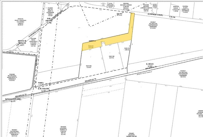
S7361 - COVERT-79 SUB, LOT 2, ACRES 9.9782
R401199
WILLIAMSON
Commercialnec
Texas
B and X Area of moderate flood hazard, usually the area between the limits of the 100-year and 500-year floods.
2
2024
9.98 AC
2025
Georgetown
020813
Austin
7,735 SF
NEARBY LISTINGS FOR SALE OR LEASE
DEMOGRAPHICS near Highway 79
1 mile
3 mile
5 mile
2025 Total Population
533
28,763
56,424
2030 Population
636
33,564
65,548
Pop Growth 2025-2030
+ 19.32%
+ 16.69%
+ 16.17%
Average Age
37
35
35
2025 Total Households
183
9,022
18,456
HH Growth 2025-2030
+ 20.22%
+ 17.09%
+ 16.57%
Median Household Inc
$146,153
$121,937
$123,815
Avg Household Size
2.90
3.10
3.00
2025 Avg HH Vehicles
3.00
2.00
2.00
Median Home Value
$510,714
$397,438
$413,655
Median Year Built
2011
2010
2010
Nearby Places
Map Layers
Map Styles
 Street
 Aerial
Transit
 Traffic
 Biking
Places
Listings with unknown addresses are not visible on the map
- Restaurants
- Banks
- Shops
- Fitness
- Groceries
PUBLIC TRANSPORTATION
COMMUTER RAIL
Taylor Amtrak (Texas Eagle - Amtrak)
Drive
Walk
Distance
Taylor Amtrak (Texas Eagle - Amtrak)
9 min
6.8 mi
AIRPORT
Austin-Bergstrom International
Drive
Walk
Distance
Austin-Bergstrom International
44 min
34.7 mi
Freight Ports
Calhoun Port
Drive
Walk
Distance
Calhoun Port
204 min
177.6 mi
Nearby Properties
Address
Land Use
TOTAL SIZE
Lot Size
Zoning
Address
Land Use
TOTAL SIZE
Lot Size
Zoning
243,097 SF
15.73 AC
Address
Land Use
TOTAL SIZE
Lot Size
Zoning
29,616 SF
158.84 AC
Address
Land Use
TOTAL SIZE
Lot Size
Zoning
301,721 SF
16.54 AC
Address
Land Use
TOTAL SIZE
Lot Size
Zoning
304,814 SF
17.04 AC
Address
Land Use
TOTAL SIZE
Lot Size
Zoning
367,116 SF
21.71 AC
Address
Land Use
TOTAL SIZE
Lot Size
Zoning
76.14 AC
Address
Land Use
TOTAL SIZE
Lot Size
Zoning
183,310 SF
10.78 AC
Address
Land Use
TOTAL SIZE
Lot Size
Zoning
243,097 SF
12.53 AC
Address
Land Use
TOTAL SIZE
Lot Size
Zoning
154,528 SF
7.23 AC
Address
Land Use
TOTAL SIZE
Lot Size
Zoning
220,850 SF
12.06 AC
Address
Land Use
TOTAL SIZE
Lot Size
Zoning
205,355 SF
13.24 AC
Address
Land Use
TOTAL SIZE
Lot Size
Zoning
297,577 SF
28.22 AC
Address
Land Use
TOTAL SIZE
Lot Size
Zoning
535,408 SF
30.16 AC
Address
Land Use
TOTAL SIZE
Lot Size
Zoning
192 SF
102.19 AC
Address
Land Use
TOTAL SIZE
Lot Size
Zoning
147,230 SF
8.05 AC
Address
Land Use
TOTAL SIZE
Lot Size
Zoning
109,908 SF
7.94 AC
Address
Land Use
TOTAL SIZE
Lot Size
Zoning
14.30 AC
Address
Land Use
TOTAL SIZE
Lot Size
Zoning
183,955 SF
30.94 AC
Address
Land Use
TOTAL SIZE
Lot Size
Zoning
108,422 SF
15.72 AC
Address
Land Use
TOTAL SIZE
Lot Size
Zoning
35,187 SF
5.57 AC
Address
Land Use
TOTAL SIZE
Lot Size
Zoning
83,300 SF
10.35 AC
Address
Land Use
TOTAL SIZE
Lot Size
Zoning
154,752 SF
0.90 AC
Address
Land Use
TOTAL SIZE
Lot Size
Zoning
140,233 SF
12.63 AC
Address
Land Use
TOTAL SIZE
Lot Size
Zoning
21,183 SF
3.70 AC
Address
Land Use
TOTAL SIZE
Lot Size
Zoning
108,594 SF
3.18 AC
Address
Land Use
TOTAL SIZE
Lot Size
Zoning
59.01 AC
Address
Land Use
TOTAL SIZE
Lot Size
Zoning
49.63 AC
Address
Land Use
TOTAL SIZE
Lot Size
Zoning
42.43 AC
Address
Land Use
TOTAL SIZE
Lot Size
Zoning
15,787 SF
2.73 AC
Address
Land Use
TOTAL SIZE
Lot Size
Zoning
101,253 SF
13 AC
The World's #1 Commercial Real Estate Marketplace
Connect with us
© 2026 CoStar Group
The information above has been obtained from sources believed reliable. While we do not doubt its accuracy we have not verified it and make no guarantee, warranty or representation about it. It is your responsibility to independently confirm its accuracy and completeness. Any projections, opinions, assumptions, or estimates used are for example only and do not represent the current or future performance of the property. The value of this transaction to you depends on tax and other factors which should be evaluated by your tax, financial, and legal advisors. You and your advisors should conduct a careful, independent investigation of the property to determine to your satisfaction the suitability of the property for your needs.