Property Record
Highway 80, Danville, GA 31017

Property Detail
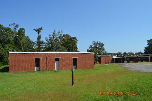
Highway 80
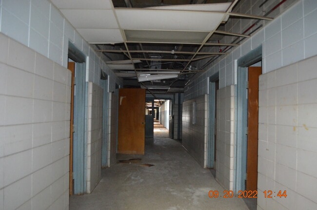
Distributionwarehouseregional
TWIGGS
004
Georgia
B and X Area of moderate flood hazard, usually the area between the limits of the 100-year and 500-year floods.
4.38 AC
2025
Twiggs County
2025
Atlanta
060200
Macon-Bibb County, GA
26,629 SF
DV04-038
NEARBY LISTINGS FOR SALE OR LEASE
-
-
View all Danville listings for sale on LoopNet.com
DEMOGRAPHICS near Highway 80
1 mile
3 mile
5 mile
2025 Total Population
327
848
1,606
2030 Population
322
842
1,601
Pop Growth 2025-2030
(1.53%)
(0.71%)
(0.31%)
Average Age
47
46
45
2025 Total Households
148
373
699
HH Growth 2025-2030
(1.35%)
(0.54%)
(0.29%)
Median Household Inc
$82,954
$75,735
$70,684
Avg Household Size
2.20
2.30
2.30
2025 Avg HH Vehicles
2.00
2.00
2.00
Median Home Value
$90,908
$105,682
$112,717
Median Year Built
1979
1980
1979
Nearby Places
Map Layers
Map Styles
 Street
 Aerial
Layers
 Traffic
 Biking
Places
Listings with unknown addresses are not visible on the map
- Restaurants
- Banks
- Shops
- Fitness
- Groceries
SALE & LEASE HISTORY
LISTING DATE
SALE/LEASE

Sep 28, 2022
For Sale
Nearby Properties
Address
Land Use
TOTAL SIZE
Lot Size
Zoning
Address
Land Use
TOTAL SIZE
Lot Size
Zoning
430.61 AC
007
Address
Land Use
TOTAL SIZE
Lot Size
Zoning
428.59 AC
007
Address
Land Use
TOTAL SIZE
Lot Size
Zoning
397 AC
R-AG
Address
Land Use
TOTAL SIZE
Lot Size
Zoning
375.80 AC
007
Address
Land Use
TOTAL SIZE
Lot Size
Zoning
Address
Land Use
TOTAL SIZE
Lot Size
Zoning
269.94 AC
R-AG
Address
Land Use
TOTAL SIZE
Lot Size
Zoning
9,100 SF
2 AC
Address
Land Use
TOTAL SIZE
Lot Size
Zoning
223 AC
007
Address
Land Use
TOTAL SIZE
Lot Size
Zoning
850 SF
256.53 AC
R-AG
Address
Land Use
TOTAL SIZE
Lot Size
Zoning
3,400 SF
22.82 AC
UNZONED RU
Address
Land Use
TOTAL SIZE
Lot Size
Zoning
134.67 AC
005
Address
Land Use
TOTAL SIZE
Lot Size
Zoning
191.15 AC
007
Address
Land Use
TOTAL SIZE
Lot Size
Zoning
744 SF
150.44 AC
R-AG
Address
Land Use
TOTAL SIZE
Lot Size
Zoning
3,312 SF
12.96 AC
RESIDENTIA
Address
Land Use
TOTAL SIZE
Lot Size
Zoning
111.83 AC
005
Address
Land Use
TOTAL SIZE
Lot Size
Zoning
130.83 AC
005
Address
Land Use
TOTAL SIZE
Lot Size
Zoning
1,608 SF
163 AC
UNZONED RU
Address
Land Use
TOTAL SIZE
Lot Size
Zoning
1,624 SF
202.80 AC
UNZONED RU
Address
Land Use
TOTAL SIZE
Lot Size
Zoning
6,782 SF
0.72 AC
001
Address
Land Use
TOTAL SIZE
Lot Size
Zoning
Address
Land Use
TOTAL SIZE
Lot Size
Zoning
107 AC
007
Address
Land Use
TOTAL SIZE
Lot Size
Zoning
139.43 AC
R-AG
Address
Land Use
TOTAL SIZE
Lot Size
Zoning
94.15 AC
RURAL
Address
Land Use
TOTAL SIZE
Lot Size
Zoning
159.30 AC
RESIDENTIA
Address
Land Use
TOTAL SIZE
Lot Size
Zoning
14,000 SF
2 AC
001
Address
Land Use
TOTAL SIZE
Lot Size
Zoning
125.03 AC
UNZONED RU
Address
Land Use
TOTAL SIZE
Lot Size
Zoning
153.23 AC
UNZONED RU
Address
Land Use
TOTAL SIZE
Lot Size
Zoning
80.50 AC
R-AG
Address
Land Use
TOTAL SIZE
Lot Size
Zoning
166 AC
007
The World's #1 Commercial Real Estate Marketplace
Connect with us
© 2026 CoStar Group
The information above has been obtained from sources believed reliable. While we do not doubt its accuracy we have not verified it and make no guarantee, warranty or representation about it. It is your responsibility to independently confirm its accuracy and completeness. Any projections, opinions, assumptions, or estimates used are for example only and do not represent the current or future performance of the property. The value of this transaction to you depends on tax and other factors which should be evaluated by your tax, financial, and legal advisors. You and your advisors should conduct a careful, independent investigation of the property to determine to your satisfaction the suitability of the property for your needs.