Property Record
Highway 80 W, Statesboro, GA 30458

NEARBY LISTINGS FOR SALE OR LEASE
-
-
View all Statesboro listings for sale on LoopNet.com
Property Detail
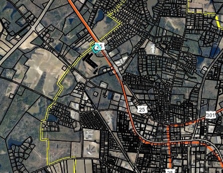
Highway 80 W
MS37000023-001
2.633 AC / HWY 80
Residentialacreage
Bulloch
X
Georgia
13031C0206D
2.63 AC
2024
Georgia South Area
2025
Other Market Areas
110401
Statesboro, GA
17,600 SF
DEMOGRAPHICS near Highway 80 W
1 Mile
3 Mile
5 Mile
2024 Total Population
2,829
20,347
46,290
2029 Population
3,131
22,426
50,386
Pop Growth 2024-2029
+ 10.68%
+ 10.22%
+ 8.85%
Average Age
39
37
33
2024 Total Households
1,152
8,176
17,385
HH Growth 2024-2029
+ 11.28%
+ 10.89%
+ 9.63%
Median Household Inc
$57,987
$53,718
$51,161
Avg Household Size
2.40
2.40
2.30
2024 Avg HH Vehicles
2.00
2.00
2.00
Median Home Value
$192,785
$178,076
$199,815
Median Year Built
1988
1985
1990
Nearby Places
Map Layers
Map Styles
 Street
 Aerial
- Restaurants
- Banks
- Shops
- Fitness
- Groceries
SALE & LEASE HISTORY
LISTING DATE
SALE/LEASE

Mar 19, 2018
For Sale
Nearby Properties
Address
Land Use
TOTAL SIZE
Lot Size
Zoning
Address
Land Use
TOTAL SIZE
Lot Size
Zoning
41.09 AC
R3/R15
Address
Land Use
TOTAL SIZE
Lot Size
Zoning
950 SF
12.73 AC
PUD/R4
Address
Land Use
TOTAL SIZE
Lot Size
Zoning
58,176 SF
2.10 AC
HOC
Address
Land Use
TOTAL SIZE
Lot Size
Zoning
13 AC
R20
Address
Land Use
TOTAL SIZE
Lot Size
Zoning
149.70 AC
AG-5/R-40
Address
Land Use
TOTAL SIZE
Lot Size
Zoning
19.41 AC
R10/R15
Address
Land Use
TOTAL SIZE
Lot Size
Zoning
13,820 SF
5.14 AC
CR
Address
Land Use
TOTAL SIZE
Lot Size
Zoning
52.59 AC
HC/R-80
Address
Land Use
TOTAL SIZE
Lot Size
Zoning
70,000 SF
12 AC
R4/HOC
Address
Land Use
TOTAL SIZE
Lot Size
Zoning
29,004 SF
5.39 AC
LI
Address
Land Use
TOTAL SIZE
Lot Size
Zoning
75,000 SF
19.30 AC
LI
Address
Land Use
TOTAL SIZE
Lot Size
Zoning
88,014 SF
9.64 AC
CR
Address
Land Use
TOTAL SIZE
Lot Size
Zoning
20 AC
R15
Address
Land Use
TOTAL SIZE
Lot Size
Zoning
1,893 SF
10.73 AC
R4
Address
Land Use
TOTAL SIZE
Lot Size
Zoning
49,581 SF
3.61 AC
HOC
Address
Land Use
TOTAL SIZE
Lot Size
Zoning
2.36 AC
HOC
Address
Land Use
TOTAL SIZE
Lot Size
Zoning
40,517 SF
12.42 AC
R4
Address
Land Use
TOTAL SIZE
Lot Size
Zoning
1.42 AC
CBD
Address
Land Use
TOTAL SIZE
Lot Size
Zoning
52,320 SF
7.36 AC
R4
Address
Land Use
TOTAL SIZE
Lot Size
Zoning
1.25 AC
R8
Address
Land Use
TOTAL SIZE
Lot Size
Zoning
4,368 SF
7.20 AC
R4
Address
Land Use
TOTAL SIZE
Lot Size
Zoning
1,036 SF
11.70 AC
R4
Address
Land Use
TOTAL SIZE
Lot Size
Zoning
12,013 SF
1.43 AC
CBD
Address
Land Use
TOTAL SIZE
Lot Size
Zoning
0.76 AC
CBD
Address
Land Use
TOTAL SIZE
Lot Size
Zoning
18.56 AC
CR/PUD
Address
Land Use
TOTAL SIZE
Lot Size
Zoning
16,618 SF
1.71 AC
O
Address
Land Use
TOTAL SIZE
Lot Size
Zoning
175.95 AC
R-25
Address
Land Use
TOTAL SIZE
Lot Size
Zoning
1,568 SF
5.81 AC
HOC/LI
Address
Land Use
TOTAL SIZE
Lot Size
Zoning
953 SF
4.89 AC
PUD/R4
Address
Land Use
TOTAL SIZE
Lot Size
Zoning
43.56 AC
AG-5/R-40
The World's #1 Commercial Real Estate Marketplace
Connect with us
© 2026 CoStar Group
The information above has been obtained from sources believed reliable. While we do not doubt its accuracy we have not verified it and make no guarantee, warranty or representation about it. It is your responsibility to independently confirm its accuracy and completeness. Any projections, opinions, assumptions, or estimates used are for example only and do not represent the current or future performance of the property. The value of this transaction to you depends on tax and other factors which should be evaluated by your tax, financial, and legal advisors. You and your advisors should conduct a careful, independent investigation of the property to determine to your satisfaction the suitability of the property for your needs.