Property Record
Highway 81, Loganville, GA 30052

NEARBY LISTINGS FOR SALE OR LEASE
-
-
View all Loganville listings for sale on LoopNet.com
Property Detail
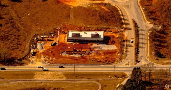
Highway 81
Atlanta-Sandy Springs-Roswell, GA
09097- [Ac] 81 S>Tom Brewer
LG120-005-A
14.94AC
Commercialacreage
Walton
A
Georgia
13297C0085E
14.94 AC
2024
Walton County
2024
Atlanta
110509
DEMOGRAPHICS near Highway 81
1 Mile
3 Mile
5 Mile
2024 Total Population
4,996
26,376
68,644
2029 Population
5,751
29,711
75,964
Pop Growth 2024-2029
+ 15.11%
+ 12.64%
+ 10.66%
Average Age
39
39
38
2024 Total Households
1,563
8,770
22,094
HH Growth 2024-2029
+ 15.36%
+ 13.01%
+ 11.03%
Median Household Inc
$82,596
$85,699
$84,251
Avg Household Size
3.10
3.00
3.10
2024 Avg HH Vehicles
2.00
2.00
2.00
Median Home Value
$258,091
$272,890
$283,592
Median Year Built
2001
1998
2000
Nearby Places
Map Layers
Map Styles
 Street
 Aerial
- Restaurants
- Banks
- Shops
- Fitness
- Groceries
Nearby Properties
Address
Land Use
TOTAL SIZE
Lot Size
Zoning
Address
Land Use
TOTAL SIZE
Lot Size
Zoning
3,480 SF
57.72 AC
RM8
Address
Land Use
TOTAL SIZE
Lot Size
Zoning
197,044 SF
95.31 AC
A1
Address
Land Use
TOTAL SIZE
Lot Size
Zoning
133,375 SF
16.50 AC
CH
Address
Land Use
TOTAL SIZE
Lot Size
Zoning
3,261 SF
30 AC
RM8
Address
Land Use
TOTAL SIZE
Lot Size
Zoning
111,277 SF
17.36 AC
CH
Address
Land Use
TOTAL SIZE
Lot Size
Zoning
154,281 SF
45.25 AC
R44
Address
Land Use
TOTAL SIZE
Lot Size
Zoning
103,892 SF
17.44 AC
CH
Address
Land Use
TOTAL SIZE
Lot Size
Zoning
56,664 SF
5.35 AC
CH
Address
Land Use
TOTAL SIZE
Lot Size
Zoning
102,850 SF
10.03 AC
LI
Address
Land Use
TOTAL SIZE
Lot Size
Zoning
29,724 SF
24.45 AC
R100
Address
Land Use
TOTAL SIZE
Lot Size
Zoning
201,210 SF
27.11 AC
CH
Address
Land Use
TOTAL SIZE
Lot Size
Zoning
74,945 SF
12.99 AC
CH
Address
Land Use
TOTAL SIZE
Lot Size
Zoning
137,401 SF
12.95 AC
CH
Address
Land Use
TOTAL SIZE
Lot Size
Zoning
95,842 SF
25.91 AC
A1
Address
Land Use
TOTAL SIZE
Lot Size
Zoning
118,235 SF
31.54 AC
CH
Address
Land Use
TOTAL SIZE
Lot Size
Zoning
83,131 SF
3.44 AC
LI
Address
Land Use
TOTAL SIZE
Lot Size
Zoning
40,359 SF
5.51 AC
CH
Address
Land Use
TOTAL SIZE
Lot Size
Zoning
51,764 SF
9 AC
R44
Address
Land Use
TOTAL SIZE
Lot Size
Zoning
205,621 SF
14.49 AC
CH
Address
Land Use
TOTAL SIZE
Lot Size
Zoning
34,128 SF
61.26 AC
A1 B2 M1
Address
Land Use
TOTAL SIZE
Lot Size
Zoning
25,781 SF
5.36 AC
CH
Address
Land Use
TOTAL SIZE
Lot Size
Zoning
30,999 SF
2.96 AC
CH
Address
Land Use
TOTAL SIZE
Lot Size
Zoning
62,352 SF
22.67 AC
CH
Address
Land Use
TOTAL SIZE
Lot Size
Zoning
29,084 SF
19.19 AC
CH
Address
Land Use
TOTAL SIZE
Lot Size
Zoning
49,022 SF
23.15 AC
R22
Address
Land Use
TOTAL SIZE
Lot Size
Zoning
24,335 SF
2.75 AC
CH
Address
Land Use
TOTAL SIZE
Lot Size
Zoning
33,685 SF
17.71 AC
CH
Address
Land Use
TOTAL SIZE
Lot Size
Zoning
98,000 SF
4.53 AC
LI
Address
Land Use
TOTAL SIZE
Lot Size
Zoning
28,284 SF
6.45 AC
CN
Address
Land Use
TOTAL SIZE
Lot Size
Zoning
3,218 SF
12.46 AC
RM8
The World's #1 Commercial Real Estate Marketplace
Connect with us
© 2026 CoStar Group
The information above has been obtained from sources believed reliable. While we do not doubt its accuracy we have not verified it and make no guarantee, warranty or representation about it. It is your responsibility to independently confirm its accuracy and completeness. Any projections, opinions, assumptions, or estimates used are for example only and do not represent the current or future performance of the property. The value of this transaction to you depends on tax and other factors which should be evaluated by your tax, financial, and legal advisors. You and your advisors should conduct a careful, independent investigation of the property to determine to your satisfaction the suitability of the property for your needs.