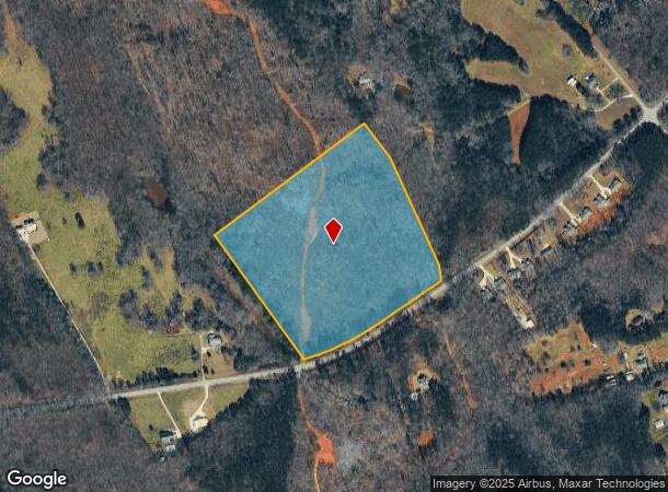
Property Record
Highway 82, Winder, GA 30680
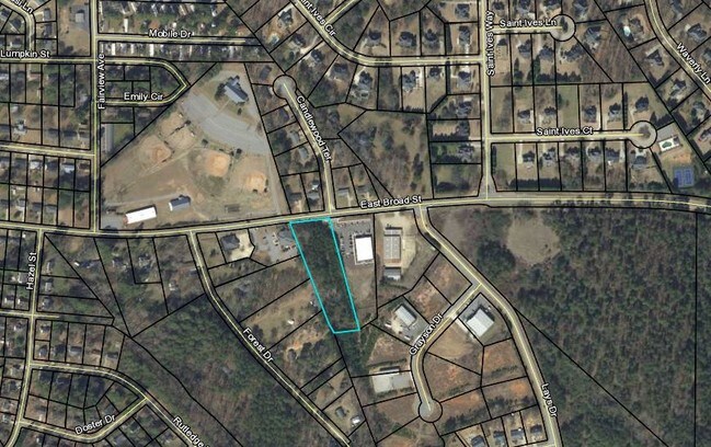
NEARBY LISTINGS FOR SALE OR LEASE
Property Detail
Highway 82
Atlanta-Sandy Springs-Roswell, GA
HWY 82
XX112-032A
Barrow
Privatepreserveopenspacevacantlandforestlandconservation
Georgia
X
res
13013C0155D
24.20 AC
2024
Barrow County
2024
Atlanta
180203
DEMOGRAPHICS near Highway 82
1 Mile
3 Mile
5 Mile
2024 Total Population
830
11,847
30,291
2029 Population
963
13,891
35,710
Pop Growth 2024-2029
+ 16.02%
+ 17.25%
+ 17.89%
Average Age
37
38
38
2024 Total Households
284
4,096
10,669
HH Growth 2024-2029
+ 15.85%
+ 17.43%
+ 17.99%
Median Household Inc
$68,999
$68,672
$67,101
Avg Household Size
2.90
2.90
2.80
2024 Avg HH Vehicles
2.00
2.00
2.00
Median Home Value
$193,043
$210,965
$218,673
Median Year Built
2003
2003
2003
Nearby Places
Map Layers
Map Styles
 Street
 Aerial
- Restaurants
- Banks
- Shops
- Fitness
- Groceries
SALE & LEASE HISTORY
LISTING DATE
SALE/LEASE

Jul 11, 2019
For Sale
Nearby Properties
Address
Land Use
TOTAL SIZE
Lot Size
Zoning
Address
Land Use
TOTAL SIZE
Lot Size
Zoning
398,490 SF
56.70 AC
M-1
Address
Land Use
TOTAL SIZE
Lot Size
Zoning
160,000 SF
29.40 AC
O-I
Address
Land Use
TOTAL SIZE
Lot Size
Zoning
27,337 SF
60 AC
M-2
Address
Land Use
TOTAL SIZE
Lot Size
Zoning
6,960 SF
46.90 AC
M-2
Address
Land Use
TOTAL SIZE
Lot Size
Zoning
33,704 SF
14.20 AC
O-I
Address
Land Use
TOTAL SIZE
Lot Size
Zoning
41,916 SF
16.10 AC
LI
Address
Land Use
TOTAL SIZE
Lot Size
Zoning
2,800 SF
5.30 AC
O-I
Address
Land Use
TOTAL SIZE
Lot Size
Zoning
10,125 SF
63.60 AC
M-2
Address
Land Use
TOTAL SIZE
Lot Size
Zoning
22,142 SF
26.70 AC
AG
Address
Land Use
TOTAL SIZE
Lot Size
Zoning
24,222 SF
3.80 AC
O-I
Address
Land Use
TOTAL SIZE
Lot Size
Zoning
20,891 SF
3.10 AC
HB
Address
Land Use
TOTAL SIZE
Lot Size
Zoning
7,500 SF
3 AC
LI
Address
Land Use
TOTAL SIZE
Lot Size
Zoning
9,125 SF
7.40 AC
C-1
Address
Land Use
TOTAL SIZE
Lot Size
Zoning
984 SF
2.10 AC
HB
Address
Land Use
TOTAL SIZE
Lot Size
Zoning
26,400 SF
13.40 AC
M-1
Address
Land Use
TOTAL SIZE
Lot Size
Zoning
64,733 SF
1.60 AC
CB
Address
Land Use
TOTAL SIZE
Lot Size
Zoning
3,200 SF
3.40 AC
M-1
Address
Land Use
TOTAL SIZE
Lot Size
Zoning
18,865 SF
0.50 AC
HR
Address
Land Use
TOTAL SIZE
Lot Size
Zoning
10,000 SF
2.60 AC
LI
Address
Land Use
TOTAL SIZE
Lot Size
Zoning
18,000 SF
1.90 AC
Address
Land Use
TOTAL SIZE
Lot Size
Zoning
109.60 AC
PUD
Address
Land Use
TOTAL SIZE
Lot Size
Zoning
190.70 AC
AG
Address
Land Use
TOTAL SIZE
Lot Size
Zoning
12,000 SF
5 AC
LI
Address
Land Use
TOTAL SIZE
Lot Size
Zoning
4,738 SF
9.80 AC
AG
Address
Land Use
TOTAL SIZE
Lot Size
Zoning
6,000 SF
24.20 AC
R-1
Address
Land Use
TOTAL SIZE
Lot Size
Zoning
10,800 SF
5 AC
LI
Address
Land Use
TOTAL SIZE
Lot Size
Zoning
9,170 SF
4 AC
C-2
Address
Land Use
TOTAL SIZE
Lot Size
Zoning
35,220 SF
5.40 AC
LI
Address
Land Use
TOTAL SIZE
Lot Size
Zoning
17,090 SF
4.80 AC
AG
Address
Land Use
TOTAL SIZE
Lot Size
Zoning
4,500 SF
18.70 AC
M-1
The World's #1 Commercial Real Estate Marketplace
Connect with us
© 2025 CoStar Group
The information above has been obtained from sources believed reliable. While we do not doubt its accuracy we have not verified it and make no guarantee, warranty or representation about it. It is your responsibility to independently confirm its accuracy and completeness. Any projections, opinions, assumptions, or estimates used are for example only and do not represent the current or future performance of the property. The value of this transaction to you depends on tax and other factors which should be evaluated by your tax, financial, and legal advisors. You and your advisors should conduct a careful, independent investigation of the property to determine to your satisfaction the suitability of the property for your needs.