Property Record
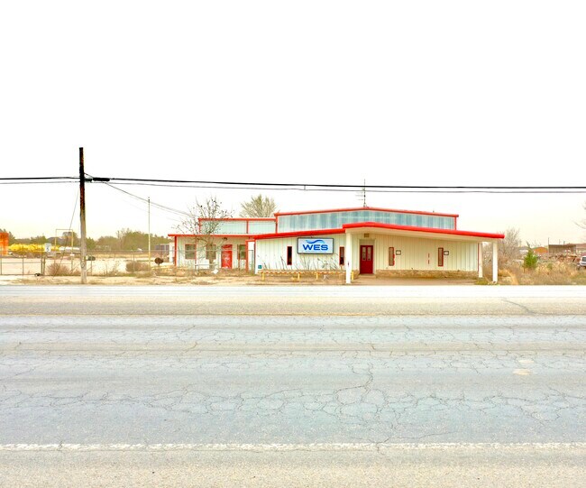
Highway 83, Denver City, TX 79323

Property Detail
Highway 83
Other Market Areas
LT 3-4 BLK 2 1ST CONT HILLCREST AX 37
3929
YOAKUM
Residentialacreage
Texas
2025
3,4
2025
1.35 AC
950200
Panhandle Area
NEARBY LISTINGS FOR SALE OR LEASE
-
-
View all Denver City listings for sale on LoopNet.com
DEMOGRAPHICS near Highway 83
1 mile
3 mile
5 mile
2025 Total Population
1,570
6,095
6,293
2030 Population
1,599
6,213
6,405
Pop Growth 2025-2030
+ 1.85%
+ 1.94%
+ 1.78%
Average Age
37
37
37
2025 Total Households
512
2,087
2,154
HH Growth 2025-2030
+ 1.95%
+ 2.01%
+ 1.86%
Median Household Inc
$89,830
$86,297
$86,212
Avg Household Size
3.10
2.90
2.90
2025 Avg HH Vehicles
2.00
2.00
2.00
Median Home Value
$249,729
$181,578
$182,450
Median Year Built
1984
1980
1980
Nearby Places
Map Layers
Map Styles
 Street
 Aerial
Layers
 Traffic
 Biking
Places
Listings with unknown addresses are not visible on the map
- Restaurants
- Banks
- Shops
- Fitness
- Groceries
SALE & LEASE HISTORY
LISTING DATE
SALE/LEASE

Feb 28, 2024
For Sale
Nearby Properties
Address
Land Use
TOTAL SIZE
Lot Size
Zoning
Address
Land Use
TOTAL SIZE
Lot Size
Zoning
42,600 SF
44.77 AC
Address
Land Use
TOTAL SIZE
Lot Size
Zoning
17.71 AC
Address
Land Use
TOTAL SIZE
Lot Size
Zoning
89,065 SF
1.29 AC
Address
Land Use
TOTAL SIZE
Lot Size
Zoning
2.27 AC
Address
Land Use
TOTAL SIZE
Lot Size
Zoning
96,553 SF
3.73 AC
Address
Land Use
TOTAL SIZE
Lot Size
Zoning
37,973 SF
2.30 AC
Address
Land Use
TOTAL SIZE
Lot Size
Zoning
6,590 SF
1.11 AC
Address
Land Use
TOTAL SIZE
Lot Size
Zoning
161,473 SF
3.77 AC
Address
Land Use
TOTAL SIZE
Lot Size
Zoning
18,161 SF
4.22 AC
Address
Land Use
TOTAL SIZE
Lot Size
Zoning
48,976 SF
1.51 AC
Address
Land Use
TOTAL SIZE
Lot Size
Zoning
43,708 SF
0.96 AC
Address
Land Use
TOTAL SIZE
Lot Size
Zoning
24,302 SF
2.83 AC
Address
Land Use
TOTAL SIZE
Lot Size
Zoning
47,907 SF
12.50 AC
Address
Land Use
TOTAL SIZE
Lot Size
Zoning
138,456 SF
5.94 AC
Address
Land Use
TOTAL SIZE
Lot Size
Zoning
27,934 SF
0.96 AC
Address
Land Use
TOTAL SIZE
Lot Size
Zoning
90,039 SF
0.96 AC
Address
Land Use
TOTAL SIZE
Lot Size
Zoning
127,788 SF
4.10 AC
Address
Land Use
TOTAL SIZE
Lot Size
Zoning
42,296 SF
1.69 AC
Address
Land Use
TOTAL SIZE
Lot Size
Zoning
27,168 SF
0.96 AC
Address
Land Use
TOTAL SIZE
Lot Size
Zoning
130,384 SF
20.36 AC
Address
Land Use
TOTAL SIZE
Lot Size
Zoning
15,622 SF
1.16 AC
Address
Land Use
TOTAL SIZE
Lot Size
Zoning
18,564 SF
0.93 AC
Address
Land Use
TOTAL SIZE
Lot Size
Zoning
34,524 SF
10.30 AC
Address
Land Use
TOTAL SIZE
Lot Size
Zoning
8,385 SF
2.42 AC
Address
Land Use
TOTAL SIZE
Lot Size
Zoning
30,600 SF
1.50 AC
Address
Land Use
TOTAL SIZE
Lot Size
Zoning
12,976 SF
0.64 AC
Address
Land Use
TOTAL SIZE
Lot Size
Zoning
43,935 SF
0.96 AC
Address
Land Use
TOTAL SIZE
Lot Size
Zoning
44,577 SF
2.07 AC
The World's #1 Commercial Real Estate Marketplace
Connect with us
© 2026 CoStar Group
The information above has been obtained from sources believed reliable. While we do not doubt its accuracy we have not verified it and make no guarantee, warranty or representation about it. It is your responsibility to independently confirm its accuracy and completeness. Any projections, opinions, assumptions, or estimates used are for example only and do not represent the current or future performance of the property. The value of this transaction to you depends on tax and other factors which should be evaluated by your tax, financial, and legal advisors. You and your advisors should conduct a careful, independent investigation of the property to determine to your satisfaction the suitability of the property for your needs.