Property Record
Highway 84, Prentiss, MS 39474

Current Lease Availabilities
Property Detail
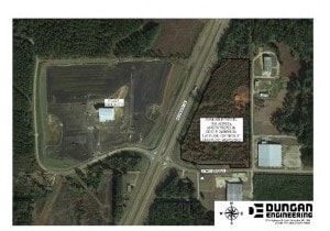
Highway 84
3 048 02 004 00
S1/2 NW1/4 65.31 M/L 31-432 LESS PT TO HWY DB 31/432 DB 82/321 8/15/66 DB 153/01 7/17/95 INT DB 160 PG 630 8/12/97 INT 177-68
Vacantlandnec
JEFF N DAVIS
B and X Area of moderate flood hazard, usually the area between the limits of the 100-year and 500-year floods.
Mississippi
0
20.57 AC
2025
Hattiesburg/South Area
950102
Other Market Areas
NEARBY LISTINGS FOR SALE OR LEASE
-
-
View all Prentiss listings for lease on LoopNet.com
DEMOGRAPHICS near Highway 84
1 mile
3 mile
5 mile
2025 Total Population
579
1,625
3,067
2030 Population
525
1,542
2,983
Pop Growth 2025-2030
(9.33%)
(5.11%)
(2.74%)
Average Age
46
44
44
2025 Total Households
240
675
1,284
HH Growth 2025-2030
(10.00%)
(5.19%)
(2.80%)
Median Household Inc
$26,000
$29,356
$32,010
Avg Household Size
2.10
2.20
2.30
2025 Avg HH Vehicles
1.00
2.00
2.00
Median Home Value
$80,113
$85,739
$88,107
Median Year Built
1970
1974
1977
Nearby Places
Map Layers
Map Styles
 Street
 Aerial
Layers
 Traffic
 Biking
Places
Listings with unknown addresses are not visible on the map
- Restaurants
- Banks
- Shops
- Fitness
- Groceries
Nearby Properties
Address
Land Use
TOTAL SIZE
Lot Size
Zoning
Address
Land Use
TOTAL SIZE
Lot Size
Zoning
77,870 SF
18.34 AC
Address
Land Use
TOTAL SIZE
Lot Size
Zoning
13,376 SF
0.66 AC
Address
Land Use
TOTAL SIZE
Lot Size
Zoning
27,742 SF
2.80 AC
Address
Land Use
TOTAL SIZE
Lot Size
Zoning
1,690 SF
44.74 AC
Address
Land Use
TOTAL SIZE
Lot Size
Zoning
11,645 SF
2.30 AC
Address
Land Use
TOTAL SIZE
Lot Size
Zoning
21,772 SF
2.80 AC
Address
Land Use
TOTAL SIZE
Lot Size
Zoning
44,205 SF
9.76 AC
Address
Land Use
TOTAL SIZE
Lot Size
Zoning
10,589 SF
0.75 AC
Address
Land Use
TOTAL SIZE
Lot Size
Zoning
31,528 SF
1.70 AC
Address
Land Use
TOTAL SIZE
Lot Size
Zoning
10,648 SF
0.99 AC
Address
Land Use
TOTAL SIZE
Lot Size
Zoning
3,519 SF
2.37 AC
Address
Land Use
TOTAL SIZE
Lot Size
Zoning
Address
Land Use
TOTAL SIZE
Lot Size
Zoning
3,829 SF
3.70 AC
Address
Land Use
TOTAL SIZE
Lot Size
Zoning
7,791 SF
1.99 AC
Address
Land Use
TOTAL SIZE
Lot Size
Zoning
4,640 SF
58.43 AC
Address
Land Use
TOTAL SIZE
Lot Size
Zoning
3,090 SF
2.16 AC
Address
Land Use
TOTAL SIZE
Lot Size
Zoning
20,723 SF
2.26 AC
Address
Land Use
TOTAL SIZE
Lot Size
Zoning
38,900 SF
3 AC
Address
Land Use
TOTAL SIZE
Lot Size
Zoning
2,063 SF
0.57 AC
Address
Land Use
TOTAL SIZE
Lot Size
Zoning
2,367 SF
4.61 AC
Address
Land Use
TOTAL SIZE
Lot Size
Zoning
3,789 SF
0.34 AC
Address
Land Use
TOTAL SIZE
Lot Size
Zoning
842 SF
0.18 AC
Address
Land Use
TOTAL SIZE
Lot Size
Zoning
6,840 SF
15.67 AC
Address
Land Use
TOTAL SIZE
Lot Size
Zoning
1 SF
0.83 AC
Address
Land Use
TOTAL SIZE
Lot Size
Zoning
7,047 SF
0.65 AC
Address
Land Use
TOTAL SIZE
Lot Size
Zoning
1 SF
0.58 AC
Address
Land Use
TOTAL SIZE
Lot Size
Zoning
9,976 SF
1.81 AC
Address
Land Use
TOTAL SIZE
Lot Size
Zoning
14,220 SF
2.70 AC
Address
Land Use
TOTAL SIZE
Lot Size
Zoning
8,108 SF
0.13 AC
Address
Land Use
TOTAL SIZE
Lot Size
Zoning
9,956 SF
1.38 AC
The World's #1 Commercial Real Estate Marketplace
Connect with us
© 2026 CoStar Group
The information above has been obtained from sources believed reliable. While we do not doubt its accuracy we have not verified it and make no guarantee, warranty or representation about it. It is your responsibility to independently confirm its accuracy and completeness. Any projections, opinions, assumptions, or estimates used are for example only and do not represent the current or future performance of the property. The value of this transaction to you depends on tax and other factors which should be evaluated by your tax, financial, and legal advisors. You and your advisors should conduct a careful, independent investigation of the property to determine to your satisfaction the suitability of the property for your needs.