Property Record
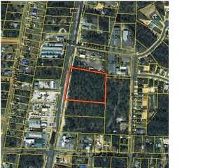
Highway 87 S, Navarre, FL 32566

Property Detail
Highway 87 S
17-2S-26-0000-00161-0000
NORTHERN 2/3 OF THE FOLLOWING PARCEL: COM ON S LN OF SEC AT E R/W OF HWY 87 THN N ON RD 200 FT TO POB & CONT 557.50 FT TO C/L OF 20 ESMNT THN 90* RT 434.90 FT TO C/L OF 20 ESMNT THN RT 81*59 ON C/L 491 .40 FT THN 90* RT 508.40 FT TO POB SBJT TO 20 ES
Wellsiteagricultural
SANTA ROSA
HCD
Florida
B and X Area of moderate flood hazard, usually the area between the limits of the 100-year and 500-year floods.
3.77 AC
0
Navarre
2025
Pensacola
010826
Pensacola-Ferry Pass-Brent, FL
NEARBY LISTINGS FOR SALE OR LEASE
DEMOGRAPHICS near Highway 87 S
1 mile
3 mile
5 mile
2025 Total Population
7,572
29,907
51,858
2030 Population
8,185
32,766
56,599
Pop Growth 2025-2030
+ 8.10%
+ 9.56%
+ 9.14%
Average Age
37
40
40
2025 Total Households
2,739
11,365
19,465
HH Growth 2025-2030
+ 7.89%
+ 9.73%
+ 9.24%
Median Household Inc
$90,153
$93,752
$96,431
Avg Household Size
2.70
2.60
2.60
2025 Avg HH Vehicles
2.00
2.00
2.00
Median Home Value
$364,250
$393,496
$402,557
Median Year Built
2002
2000
2000
Nearby Places
Map Layers
Map Styles
 Street
 Aerial
Layers
 Traffic
 Biking
Places
Listings with unknown addresses are not visible on the map
- Restaurants
- Banks
- Shops
- Fitness
- Groceries
PUBLIC TRANSPORTATION
AIRPORT
Eglin AFB/Destin-Ft Walton Beach
Drive
Walk
Distance
Eglin AFB/Destin-Ft Walton Beach
54 min
27.6 mi
Pensacola International
Drive
Walk
Distance
Pensacola International
52 min
30.0 mi
Nearby Properties
Address
Land Use
TOTAL SIZE
Lot Size
Zoning
Address
Land Use
TOTAL SIZE
Lot Size
Zoning
44,985 SF
317.38 AC
NB-C
Address
Land Use
TOTAL SIZE
Lot Size
Zoning
344,974 SF
16.11 AC
R3
Address
Land Use
TOTAL SIZE
Lot Size
Zoning
375,552 SF
10.62 AC
PBD
Address
Land Use
TOTAL SIZE
Lot Size
Zoning
131,381 SF
8.84 AC
HNB
Address
Land Use
TOTAL SIZE
Lot Size
Zoning
244,004 SF
10.54 AC
HCD
Address
Land Use
TOTAL SIZE
Lot Size
Zoning
110,921 SF
9.65 AC
HCD
Address
Land Use
TOTAL SIZE
Lot Size
Zoning
131,381 SF
11.25 AC
HNB
Address
Land Use
TOTAL SIZE
Lot Size
Zoning
23.12 AC
C
Address
Land Use
TOTAL SIZE
Lot Size
Zoning
248,857 SF
22.80 AC
PBD
Address
Land Use
TOTAL SIZE
Lot Size
Zoning
106,696 SF
15.59 AC
HCD
Address
Land Use
TOTAL SIZE
Lot Size
Zoning
7,800 SF
7.68 AC
R2
Address
Land Use
TOTAL SIZE
Lot Size
Zoning
77,417 SF
8.06 AC
HCD
Address
Land Use
TOTAL SIZE
Lot Size
Zoning
97,214 SF
2.79 AC
HCD
Address
Land Use
TOTAL SIZE
Lot Size
Zoning
65,936 SF
1.86 AC
PBD
Address
Land Use
TOTAL SIZE
Lot Size
Zoning
68,334 SF
4.45 AC
HCD
Address
Land Use
TOTAL SIZE
Lot Size
Zoning
85,562 SF
36.21 AC
PBD
Address
Land Use
TOTAL SIZE
Lot Size
Zoning
48,055 SF
9.12 AC
HCD
Address
Land Use
TOTAL SIZE
Lot Size
Zoning
19,350 SF
9.10 AC
HCD
Address
Land Use
TOTAL SIZE
Lot Size
Zoning
60,854 SF
7.07 AC
HCD
Address
Land Use
TOTAL SIZE
Lot Size
Zoning
14,448 SF
17.20 AC
P
Address
Land Use
TOTAL SIZE
Lot Size
Zoning
48,198 SF
1.76 AC
PBD
Address
Land Use
TOTAL SIZE
Lot Size
Zoning
21,567 SF
5.56 AC
HCD
Address
Land Use
TOTAL SIZE
Lot Size
Zoning
4,975 SF
6.03 AC
HCD
Address
Land Use
TOTAL SIZE
Lot Size
Zoning
8,714 SF
7 AC
P2-HON
Address
Land Use
TOTAL SIZE
Lot Size
Zoning
45,672 SF
2.47 AC
PUD
Address
Land Use
TOTAL SIZE
Lot Size
Zoning
2,046 SF
0.79 AC
HCD
Address
Land Use
TOTAL SIZE
Lot Size
Zoning
3.39 AC
NB-C
Address
Land Use
TOTAL SIZE
Lot Size
Zoning
37,436 SF
4.79 AC
R3
The World's #1 Commercial Real Estate Marketplace
Connect with us
© 2026 CoStar Group
The information above has been obtained from sources believed reliable. While we do not doubt its accuracy we have not verified it and make no guarantee, warranty or representation about it. It is your responsibility to independently confirm its accuracy and completeness. Any projections, opinions, assumptions, or estimates used are for example only and do not represent the current or future performance of the property. The value of this transaction to you depends on tax and other factors which should be evaluated by your tax, financial, and legal advisors. You and your advisors should conduct a careful, independent investigation of the property to determine to your satisfaction the suitability of the property for your needs.