Property Record
Highway 9, Cheraw, SC 29520

Property Detail
Highway 9
259-000-000-064
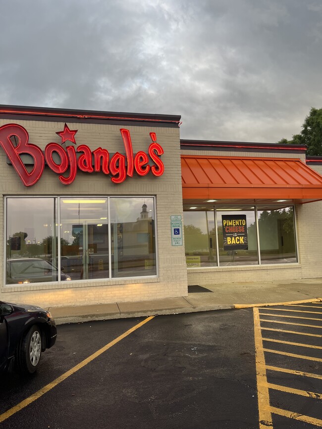
CHERAW BOJANGLES-.76 ACRES
Commercialnec
CHESTERFIELD
B and X Area of moderate flood hazard, usually the area between the limits of the 100-year and 500-year floods.
South Carolina
2025
0.76 AC
2025
South Carolina Rural Areas
950503
Other Market Areas
3,050 SF
NEARBY LISTINGS FOR SALE OR LEASE
-
-
View all Cheraw listings for sale on LoopNet.com
DEMOGRAPHICS near Highway 9
1 mile
3 mile
5 mile
2025 Total Population
1,483
9,544
11,829
2030 Population
1,512
9,850
12,221
Pop Growth 2025-2030
+ 1.96%
+ 3.21%
+ 3.31%
Average Age
44
43
43
2025 Total Households
626
3,946
4,903
HH Growth 2025-2030
+ 1.92%
+ 3.27%
+ 3.32%
Median Household Inc
$28,825
$38,627
$39,834
Avg Household Size
2.20
2.30
2.30
2025 Avg HH Vehicles
2.00
2.00
2.00
Median Home Value
$78,483
$113,402
$115,290
Median Year Built
1977
1974
1977
Nearby Places
Map Layers
Map Styles
 Street
 Aerial
Transit
 Traffic
 Biking
Places
Listings with unknown addresses are not visible on the map
- Restaurants
- Banks
- Shops
- Fitness
- Groceries
SALE & LEASE HISTORY
LISTING DATE
SALE/LEASE

May 16, 2022
For Sale
Nearby Properties
Address
Land Use
TOTAL SIZE
Lot Size
Zoning
Address
Land Use
TOTAL SIZE
Lot Size
Zoning
22.04 AC
Address
Land Use
TOTAL SIZE
Lot Size
Zoning
51.75 AC
Address
Land Use
TOTAL SIZE
Lot Size
Zoning
Address
Land Use
TOTAL SIZE
Lot Size
Zoning
4.19 AC
Address
Land Use
TOTAL SIZE
Lot Size
Zoning
3.34 AC
Address
Land Use
TOTAL SIZE
Lot Size
Zoning
0.39 AC
Address
Land Use
TOTAL SIZE
Lot Size
Zoning
24.70 AC
Address
Land Use
TOTAL SIZE
Lot Size
Zoning
0.83 AC
Address
Land Use
TOTAL SIZE
Lot Size
Zoning
2,834 SF
0.73 AC
Address
Land Use
TOTAL SIZE
Lot Size
Zoning
3,001 SF
0.83 AC
Address
Land Use
TOTAL SIZE
Lot Size
Zoning
3,537 SF
0.80 AC
Address
Land Use
TOTAL SIZE
Lot Size
Zoning
1,612 SF
0.89 AC
Address
Land Use
TOTAL SIZE
Lot Size
Zoning
4.76 AC
Address
Land Use
TOTAL SIZE
Lot Size
Zoning
660 SF
7 AC
Address
Land Use
TOTAL SIZE
Lot Size
Zoning
0.70 AC
Address
Land Use
TOTAL SIZE
Lot Size
Zoning
2.09 AC
Address
Land Use
TOTAL SIZE
Lot Size
Zoning
0.46 AC
Address
Land Use
TOTAL SIZE
Lot Size
Zoning
0.33 AC
Address
Land Use
TOTAL SIZE
Lot Size
Zoning
Address
Land Use
TOTAL SIZE
Lot Size
Zoning
3,082 SF
1.21 AC
Address
Land Use
TOTAL SIZE
Lot Size
Zoning
2,680 SF
0.49 AC
Address
Land Use
TOTAL SIZE
Lot Size
Zoning
3,007 SF
0.50 AC
Address
Land Use
TOTAL SIZE
Lot Size
Zoning
1,813 SF
1.50 AC
Address
Land Use
TOTAL SIZE
Lot Size
Zoning
0.30 AC
Address
Land Use
TOTAL SIZE
Lot Size
Zoning
2,400 SF
0.36 AC
Address
Land Use
TOTAL SIZE
Lot Size
Zoning
1,786 SF
1.20 AC
Address
Land Use
TOTAL SIZE
Lot Size
Zoning
2,365 SF
0.70 AC
Address
Land Use
TOTAL SIZE
Lot Size
Zoning
2,323 SF
0.63 AC
Address
Land Use
TOTAL SIZE
Lot Size
Zoning
2,945 SF
0.69 AC
The World's #1 Commercial Real Estate Marketplace
Connect with us
© 2026 CoStar Group
The information above has been obtained from sources believed reliable. While we do not doubt its accuracy we have not verified it and make no guarantee, warranty or representation about it. It is your responsibility to independently confirm its accuracy and completeness. Any projections, opinions, assumptions, or estimates used are for example only and do not represent the current or future performance of the property. The value of this transaction to you depends on tax and other factors which should be evaluated by your tax, financial, and legal advisors. You and your advisors should conduct a careful, independent investigation of the property to determine to your satisfaction the suitability of the property for your needs.