Property Record
Highway 90, Sneads, FL 32460

Save to a Folder
{{folder.Name}}
{{folder.ListingIds.length}} Properties
{{folder.ListingIds.length}} Property
Create a New Folder
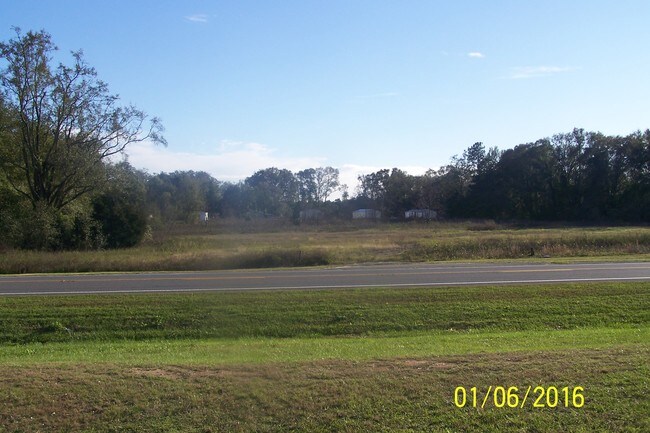
Property Detail
Highway 90
Other Market Areas
OR 229 P 676 BEGIN AT INTERS E LINE E1/2 OF NW1/4 & S RTWY HWY 90, RUN S 2* W 1304.66 FT TO N RTWY L&N RR, N 76* W 417.03 FT, N 2* W 1193.46 FT TO S RTWY HWY 90, S 87* E 402.2 FT TO POB, LESS 1AC PER OR 282 P 279...OR 492 P 410 OR 539 P 668 OR 547 P
35-4N-07-0000-0020-0020
JACKSON
Commercialacreage
Florida
A Areas with a 1% annual chance of flooding and a 26% chance of flooding over the life of a 30-year mortgage.
20
2025
6.01 AC
2025
Florida Panhandle Area
210902
NEARBY LISTINGS FOR SALE OR LEASE
-
-
View all Sneads listings for sale on LoopNet.com
DEMOGRAPHICS near Highway 90
1 mile
3 mile
5 mile
2025 Total Population
1,146
4,368
8,689
2030 Population
1,183
4,502
8,995
Pop Growth 2025-2030
+ 3.23%
+ 3.07%
+ 3.52%
Average Age
45
44
44
2025 Total Households
190
968
2,648
HH Growth 2025-2030
+ 2.11%
+ 2.48%
+ 3.78%
Median Household Inc
$51,500
$48,606
$51,725
Avg Household Size
2.20
2.30
2.30
2025 Avg HH Vehicles
2.00
2.00
2.00
Median Home Value
$133,333
$140,147
$125,237
Median Year Built
1979
1980
1977
Nearby Places
Map Layers
Map Styles
 Street
 Aerial
Layers
 Traffic
 Biking
Places
Listings with unknown addresses are not visible on the map
- Restaurants
- Banks
- Shops
- Fitness
- Groceries
SALE & LEASE HISTORY
LISTING DATE
SALE/LEASE

Sep 24, 2016
For Sale
Jan 26, 2017
For Sale
Nearby Properties
Address
Land Use
TOTAL SIZE
Lot Size
Zoning
Address
Land Use
TOTAL SIZE
Lot Size
Zoning
428,048 SF
292.80 AC
Address
Land Use
TOTAL SIZE
Lot Size
Zoning
275,983 SF
245.50 AC
Address
Land Use
TOTAL SIZE
Lot Size
Zoning
Address
Land Use
TOTAL SIZE
Lot Size
Zoning
133,792 SF
314 AC
Address
Land Use
TOTAL SIZE
Lot Size
Zoning
83,262 SF
13.93 AC
Address
Land Use
TOTAL SIZE
Lot Size
Zoning
79,389 SF
10.07 AC
Address
Land Use
TOTAL SIZE
Lot Size
Zoning
6,935 SF
280.30 AC
Address
Land Use
TOTAL SIZE
Lot Size
Zoning
45,723 SF
5.26 AC
Address
Land Use
TOTAL SIZE
Lot Size
Zoning
23,743 SF
2.64 AC
Address
Land Use
TOTAL SIZE
Lot Size
Zoning
20,367 SF
5.16 AC
Address
Land Use
TOTAL SIZE
Lot Size
Zoning
20,138 SF
4.50 AC
Address
Land Use
TOTAL SIZE
Lot Size
Zoning
33,873 SF
11.88 AC
Address
Land Use
TOTAL SIZE
Lot Size
Zoning
480 AC
Address
Land Use
TOTAL SIZE
Lot Size
Zoning
447.50 AC
Address
Land Use
TOTAL SIZE
Lot Size
Zoning
1,374 SF
440 AC
Address
Land Use
TOTAL SIZE
Lot Size
Zoning
18,584 SF
4.25 AC
Address
Land Use
TOTAL SIZE
Lot Size
Zoning
202.15 AC
Address
Land Use
TOTAL SIZE
Lot Size
Zoning
8,682 SF
0.50 AC
Address
Land Use
TOTAL SIZE
Lot Size
Zoning
15,739 SF
1 AC
Address
Land Use
TOTAL SIZE
Lot Size
Zoning
299 AC
Address
Land Use
TOTAL SIZE
Lot Size
Zoning
266 AC
Address
Land Use
TOTAL SIZE
Lot Size
Zoning
27,264 SF
5 AC
Address
Land Use
TOTAL SIZE
Lot Size
Zoning
8,381 SF
1.99 AC
Address
Land Use
TOTAL SIZE
Lot Size
Zoning
6,304 SF
103 AC
Address
Land Use
TOTAL SIZE
Lot Size
Zoning
11,689 SF
160 AC
Address
Land Use
TOTAL SIZE
Lot Size
Zoning
6,240 SF
10.49 AC
Address
Land Use
TOTAL SIZE
Lot Size
Zoning
10,540 SF
1.07 AC
Address
Land Use
TOTAL SIZE
Lot Size
Zoning
11,136 SF
2.65 AC
Address
Land Use
TOTAL SIZE
Lot Size
Zoning
5,918 SF
0.82 AC
Address
Land Use
TOTAL SIZE
Lot Size
Zoning
14,400 SF
1.06 AC
The World's #1 Commercial Real Estate Marketplace
Connect with us
© 2026 CoStar Group
The information above has been obtained from sources believed reliable. While we do not doubt its accuracy we have not verified it and make no guarantee, warranty or representation about it. It is your responsibility to independently confirm its accuracy and completeness. Any projections, opinions, assumptions, or estimates used are for example only and do not represent the current or future performance of the property. The value of this transaction to you depends on tax and other factors which should be evaluated by your tax, financial, and legal advisors. You and your advisors should conduct a careful, independent investigation of the property to determine to your satisfaction the suitability of the property for your needs.