Property Record
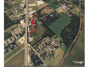
Highway 95, Athol, ID 83801
Property Detail
Highway 95
Sandpoint, ID
1-58N-2W WHITEFOOT TRACTS LOT 3 LESS PT TAX 6 LOT 4 LESS TAX 1 & PT TAX 6
RP54N-03W-341500A
BONNER
Ruralimprovednonresidential
Idaho
R-5
3-4
B and X Area of moderate flood hazard, usually the area between the limits of the 100-year and 500-year floods.
20 AC
0
Bonner
2025
Coeur D'Alene
950203
NEARBY LISTINGS FOR SALE OR LEASE
-
-
View all Athol listings for lease on LoopNet.com
DEMOGRAPHICS near Highway 95
1 mile
3 mile
5 mile
2025 Total Population
1,389
4,201
11,498
2030 Population
1,515
4,603
12,666
Pop Growth 2025-2030
+ 9.07%
+ 9.57%
+ 10.16%
Average Age
46
46
46
2025 Total Households
571
1,721
4,825
HH Growth 2025-2030
+ 8.76%
+ 9.12%
+ 9.82%
Median Household Inc
$75,278
$78,652
$75,424
Avg Household Size
2.40
2.40
2.30
2025 Avg HH Vehicles
2.00
2.00
2.00
Median Home Value
$601,635
$618,694
$617,704
Median Year Built
1988
1990
1989
Nearby Places
Map Layers
Map Styles
 Street
 Aerial
Layers
 Traffic
 Biking
Places
Listings with unknown addresses are not visible on the map
- Restaurants
- Banks
- Shops
- Fitness
- Groceries
SALE & LEASE HISTORY
LISTING DATE
SALE/LEASE

Sep 25, 2016
For Lease
Nearby Properties
Address
Land Use
TOTAL SIZE
Lot Size
Zoning
Address
Land Use
TOTAL SIZE
Lot Size
Zoning
57,394 SF
6.93 AC
COM
Address
Land Use
TOTAL SIZE
Lot Size
Zoning
43,707 SF
7.75 AC
Address
Land Use
TOTAL SIZE
Lot Size
Zoning
22,364 SF
3.70 AC
Address
Land Use
TOTAL SIZE
Lot Size
Zoning
10,640 SF
2.03 AC
Address
Land Use
TOTAL SIZE
Lot Size
Zoning
43,868 SF
4.41 AC
RUR
Address
Land Use
TOTAL SIZE
Lot Size
Zoning
8,770 SF
1.14 AC
Address
Land Use
TOTAL SIZE
Lot Size
Zoning
5,770 SF
1.19 AC
Address
Land Use
TOTAL SIZE
Lot Size
Zoning
1.25 AC
Address
Land Use
TOTAL SIZE
Lot Size
Zoning
4,542 SF
2 AC
Address
Land Use
TOTAL SIZE
Lot Size
Zoning
3,873 SF
1.17 AC
Address
Land Use
TOTAL SIZE
Lot Size
Zoning
Address
Land Use
TOTAL SIZE
Lot Size
Zoning
30,600 SF
4.44 AC
Address
Land Use
TOTAL SIZE
Lot Size
Zoning
3,239 SF
4.71 AC
Address
Land Use
TOTAL SIZE
Lot Size
Zoning
7,424 SF
0.92 AC
Address
Land Use
TOTAL SIZE
Lot Size
Zoning
2,988 SF
3.25 AC
Address
Land Use
TOTAL SIZE
Lot Size
Zoning
2,554 SF
4.50 AC
Address
Land Use
TOTAL SIZE
Lot Size
Zoning
4,628 SF
5 AC
Address
Land Use
TOTAL SIZE
Lot Size
Zoning
4,400 SF
0.47 AC
Address
Land Use
TOTAL SIZE
Lot Size
Zoning
Address
Land Use
TOTAL SIZE
Lot Size
Zoning
22,150 SF
3.55 AC
Address
Land Use
TOTAL SIZE
Lot Size
Zoning
2,413 SF
5 AC
Address
Land Use
TOTAL SIZE
Lot Size
Zoning
35.50 AC
R-5
Address
Land Use
TOTAL SIZE
Lot Size
Zoning
2,291 SF
5.03 AC
Address
Land Use
TOTAL SIZE
Lot Size
Zoning
2,400 SF
10 AC
RUR
Address
Land Use
TOTAL SIZE
Lot Size
Zoning
9,454 SF
3.55 AC
Address
Land Use
TOTAL SIZE
Lot Size
Zoning
240 SF
3.15 AC
Address
Land Use
TOTAL SIZE
Lot Size
Zoning
1,440 SF
2.82 AC
Address
Land Use
TOTAL SIZE
Lot Size
Zoning
3,112 SF
0.28 AC
Address
Land Use
TOTAL SIZE
Lot Size
Zoning
28.80 AC
RUR
Address
Land Use
TOTAL SIZE
Lot Size
Zoning
21.19 AC
RUR
The World's #1 Commercial Real Estate Marketplace
Connect with us
© 2026 CoStar Group
The information above has been obtained from sources believed reliable. While we do not doubt its accuracy we have not verified it and make no guarantee, warranty or representation about it. It is your responsibility to independently confirm its accuracy and completeness. Any projections, opinions, assumptions, or estimates used are for example only and do not represent the current or future performance of the property. The value of this transaction to you depends on tax and other factors which should be evaluated by your tax, financial, and legal advisors. You and your advisors should conduct a careful, independent investigation of the property to determine to your satisfaction the suitability of the property for your needs.