Property Record
Highway 95, Sagle, ID 83860
NEARBY LISTINGS FOR SALE OR LEASE
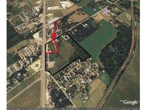
Property Detail
Highway 95
Sandpoint, ID
1-58N-2W WHITEFOOT TRACTS LOT 3 LESS PT TAX 6 LOT 4 LESS TAX 1 & PT TAX 6
RP56N-02W-101055A
Bonner
Residentialacreage
Idaho
X
3-4
16017C0950E
0.93 AC
0
Bonner
2025
Coeur D'Alene
950203
DEMOGRAPHICS near Highway 95
1 Mile
3 Mile
5 Mile
2024 Total Population
1,317
4,217
11,807
2029 Population
1,602
5,139
14,447
Pop Growth 2024-2029
+ 21.64%
+ 21.86%
+ 22.36%
Average Age
45
46
46
2024 Total Households
542
1,731
4,987
HH Growth 2024-2029
+ 21.40%
+ 21.55%
+ 22.14%
Median Household Inc
$71,886
$74,367
$70,940
Avg Household Size
2.40
2.40
2.30
2024 Avg HH Vehicles
2.00
2.00
2.00
Median Home Value
$497,252
$508,440
$486,241
Median Year Built
1990
1991
1991
Nearby Places
Map Layers
Map Styles
 Street
 Aerial
- Restaurants
- Banks
- Shops
- Fitness
- Groceries
PUBLIC TRANSPORTATION
COMMUTER RAIL
Sandpoint Amtrak (Empire Builder - Amtrak)
DRIVE
WALK
Distance
Sandpoint Amtrak (Empire Builder - Amtrak)
6 min
4.0 mi
Freight Ports
Port of Everett
DRIVE
WALK
Distance
Port of Everett
422 min
369.2 mi
SALE & LEASE HISTORY
LISTING DATE
SALE/LEASE

Sep 25, 2016
For Lease
Nearby Properties
Address
Land Use
TOTAL SIZE
Lot Size
Zoning
Address
Land Use
TOTAL SIZE
Lot Size
Zoning
1,306 SF
3.05 AC
Rec
Address
Land Use
TOTAL SIZE
Lot Size
Zoning
19,200 SF
13.36 AC
C
Address
Land Use
TOTAL SIZE
Lot Size
Zoning
2,349 SF
2.83 AC
C
Address
Land Use
TOTAL SIZE
Lot Size
Zoning
14.90 AC
C
Address
Land Use
TOTAL SIZE
Lot Size
Zoning
5,007 SF
2.16 AC
Rec
Address
Land Use
TOTAL SIZE
Lot Size
Zoning
14,400 SF
4.93 AC
C
Address
Land Use
TOTAL SIZE
Lot Size
Zoning
1,956 SF
13 AC
Rsc
Address
Land Use
TOTAL SIZE
Lot Size
Zoning
0.12 AC
Address
Land Use
TOTAL SIZE
Lot Size
Zoning
0.85 AC
Address
Land Use
TOTAL SIZE
Lot Size
Zoning
32,292 SF
3.50 AC
C
Address
Land Use
TOTAL SIZE
Lot Size
Zoning
4.13 AC
S
Address
Land Use
TOTAL SIZE
Lot Size
Zoning
236.44 AC
Address
Land Use
TOTAL SIZE
Lot Size
Zoning
0.79 AC
Address
Land Use
TOTAL SIZE
Lot Size
Zoning
0.77 AC
Address
Land Use
TOTAL SIZE
Lot Size
Zoning
0.96 AC
S
Address
Land Use
TOTAL SIZE
Lot Size
Zoning
3.13 AC
Address
Land Use
TOTAL SIZE
Lot Size
Zoning
7,601 SF
1.24 AC
C
Address
Land Use
TOTAL SIZE
Lot Size
Zoning
12,800 SF
2.20 AC
C
Address
Land Use
TOTAL SIZE
Lot Size
Zoning
0.54 AC
S
Address
Land Use
TOTAL SIZE
Lot Size
Zoning
2,048 SF
0.56 AC
S
Address
Land Use
TOTAL SIZE
Lot Size
Zoning
12,000 SF
5.45 AC
C
Address
Land Use
TOTAL SIZE
Lot Size
Zoning
0.64 AC
S
Address
Land Use
TOTAL SIZE
Lot Size
Zoning
0.19 AC
S
Address
Land Use
TOTAL SIZE
Lot Size
Zoning
1.09 AC
S
Address
Land Use
TOTAL SIZE
Lot Size
Zoning
Address
Land Use
TOTAL SIZE
Lot Size
Zoning
1 AC
Rec
Address
Land Use
TOTAL SIZE
Lot Size
Zoning
0.60 AC
Address
Land Use
TOTAL SIZE
Lot Size
Zoning
1,648 SF
8.90 AC
C
Address
Land Use
TOTAL SIZE
Lot Size
Zoning
0.36 AC
S
Address
Land Use
TOTAL SIZE
Lot Size
Zoning
0.34 AC
S
The World's #1 Commercial Real Estate Marketplace
Connect with us
© 2025 CoStar Group
The information above has been obtained from sources believed reliable. While we do not doubt its accuracy we have not verified it and make no guarantee, warranty or representation about it. It is your responsibility to independently confirm its accuracy and completeness. Any projections, opinions, assumptions, or estimates used are for example only and do not represent the current or future performance of the property. The value of this transaction to you depends on tax and other factors which should be evaluated by your tax, financial, and legal advisors. You and your advisors should conduct a careful, independent investigation of the property to determine to your satisfaction the suitability of the property for your needs.