Property Record
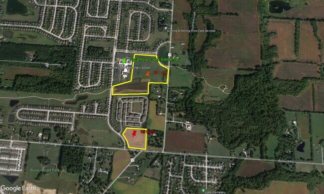
Hill Rd S, Pickerington, OH 43147

Property Detail
Hill Rd S
Columbus, OH
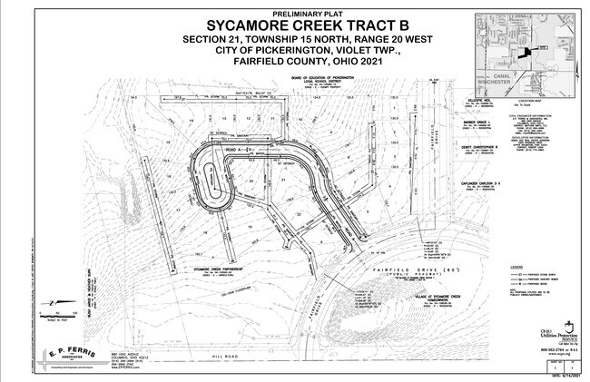
R 20 T 15 S 21 NE
04-10559-400
FAIRFIELD
Agriculturalland
Ohio
B and X Area of moderate flood hazard, usually the area between the limits of the 100-year and 500-year floods.
7.76 AC
2024
Fairfield County
2025
Columbus
033102
NEARBY LISTINGS FOR SALE OR LEASE
DEMOGRAPHICS near Hill Rd S
1 mile
3 mile
5 mile
2025 Total Population
5,485
33,408
90,258
2030 Population
5,783
35,108
94,380
Pop Growth 2025-2030
+ 5.43%
+ 5.09%
+ 4.57%
Average Age
37
38
38
2025 Total Households
1,804
11,478
32,287
HH Growth 2025-2030
+ 5.71%
+ 5.34%
+ 4.70%
Median Household Inc
$133,169
$110,432
$97,424
Avg Household Size
3.00
2.80
2.70
2025 Avg HH Vehicles
2.00
2.00
2.00
Median Home Value
$375,093
$347,787
$337,984
Median Year Built
2005
2000
1998
Nearby Places
Map Layers
Map Styles
 Street
 Aerial
Layers
 Traffic
 Biking
Places
Listings with unknown addresses are not visible on the map
- Restaurants
- Banks
- Shops
- Fitness
- Groceries
PUBLIC TRANSPORTATION
AIRPORT
John Glenn Columbus International
Drive
Walk
Distance
John Glenn Columbus International
25 min
14.8 mi
Rickenbacker International
Drive
Walk
Distance
Rickenbacker International
27 min
15.3 mi
Freight Ports
Port of Toledo
Drive
Walk
Distance
Port of Toledo
201 min
158.5 mi
SALE & LEASE HISTORY
LISTING DATE
SALE/LEASE

May 17, 2023
For Sale
Nearby Properties
Address
Land Use
TOTAL SIZE
Lot Size
Zoning
Address
Land Use
TOTAL SIZE
Lot Size
Zoning
496,169 SF
146.23 AC
Address
Land Use
TOTAL SIZE
Lot Size
Zoning
106,679 SF
35.60 AC
Address
Land Use
TOTAL SIZE
Lot Size
Zoning
61,542 SF
29.16 AC
Address
Land Use
TOTAL SIZE
Lot Size
Zoning
65,760 SF
25.37 AC
Address
Land Use
TOTAL SIZE
Lot Size
Zoning
243,891 SF
75.29 AC
Address
Land Use
TOTAL SIZE
Lot Size
Zoning
60,005 SF
0.35 AC
Address
Land Use
TOTAL SIZE
Lot Size
Zoning
1,200 SF
18.73 AC
Address
Land Use
TOTAL SIZE
Lot Size
Zoning
1,842 SF
24.99 AC
Address
Land Use
TOTAL SIZE
Lot Size
Zoning
25,138 SF
23.64 AC
Address
Land Use
TOTAL SIZE
Lot Size
Zoning
13,591 SF
20.83 AC
Address
Land Use
TOTAL SIZE
Lot Size
Zoning
183,545 SF
43.70 AC
Address
Land Use
TOTAL SIZE
Lot Size
Zoning
88,530 SF
4.73 AC
Address
Land Use
TOTAL SIZE
Lot Size
Zoning
41,263 SF
24.83 AC
Address
Land Use
TOTAL SIZE
Lot Size
Zoning
70,258 SF
23.32 AC
Address
Land Use
TOTAL SIZE
Lot Size
Zoning
136,440 SF
5.38 AC
Address
Land Use
TOTAL SIZE
Lot Size
Zoning
46,737 SF
26.70 AC
Address
Land Use
TOTAL SIZE
Lot Size
Zoning
29,569 SF
0.34 AC
Address
Land Use
TOTAL SIZE
Lot Size
Zoning
59,296 SF
7.91 AC
Address
Land Use
TOTAL SIZE
Lot Size
Zoning
96,069 SF
3.66 AC
Address
Land Use
TOTAL SIZE
Lot Size
Zoning
42,860 SF
13.32 AC
Address
Land Use
TOTAL SIZE
Lot Size
Zoning
89,303 SF
17.25 AC
Address
Land Use
TOTAL SIZE
Lot Size
Zoning
13.34 AC
Address
Land Use
TOTAL SIZE
Lot Size
Zoning
91,794 SF
20.07 AC
Address
Land Use
TOTAL SIZE
Lot Size
Zoning
74,202 SF
18.07 AC
Address
Land Use
TOTAL SIZE
Lot Size
Zoning
84,974 SF
16.52 AC
Address
Land Use
TOTAL SIZE
Lot Size
Zoning
35,520 SF
14.01 AC
Address
Land Use
TOTAL SIZE
Lot Size
Zoning
210,296 SF
21.28 AC
Address
Land Use
TOTAL SIZE
Lot Size
Zoning
54,284 SF
12.50 AC
Address
Land Use
TOTAL SIZE
Lot Size
Zoning
113,913 SF
16.29 AC
Address
Land Use
TOTAL SIZE
Lot Size
Zoning
54,932 SF
8.08 AC
The World's #1 Commercial Real Estate Marketplace
Connect with us
© 2026 CoStar Group
The information above has been obtained from sources believed reliable. While we do not doubt its accuracy we have not verified it and make no guarantee, warranty or representation about it. It is your responsibility to independently confirm its accuracy and completeness. Any projections, opinions, assumptions, or estimates used are for example only and do not represent the current or future performance of the property. The value of this transaction to you depends on tax and other factors which should be evaluated by your tax, financial, and legal advisors. You and your advisors should conduct a careful, independent investigation of the property to determine to your satisfaction the suitability of the property for your needs.