Property Record
Hilltop Rd, Temple, PA 19560

Save to a Folder
{{folder.Name}}
{{folder.ListingIds.length}} Properties
{{folder.ListingIds.length}} Property
Create a New Folder
Property Detail
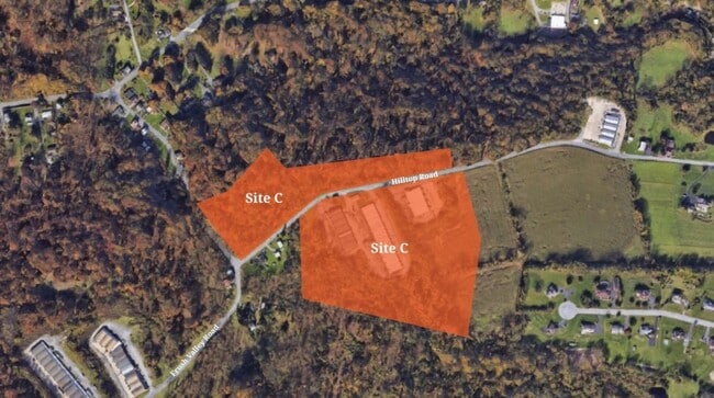
Hilltop Rd
66-5319-02-77-3407
BERKS
Horticulturegrowinghousesagricultural
Pennsylvania
B and X Area of moderate flood hazard, usually the area between the limits of the 100-year and 500-year floods.
14.05 AC
2026
Berks
2026
Philadelphia
012400
Reading, PA
704 SF
NEARBY LISTINGS FOR SALE OR LEASE
DEMOGRAPHICS near Hilltop Rd
1 mile
3 mile
5 mile
2025 Total Population
1,421
30,609
101,815
2030 Population
1,469
31,249
103,667
Pop Growth 2025-2030
+ 3.38%
+ 2.09%
+ 1.82%
Average Age
40
41
39
2025 Total Households
534
11,430
36,199
HH Growth 2025-2030
+ 3.37%
+ 2.08%
+ 1.87%
Median Household Inc
$90,602
$84,948
$69,463
Avg Household Size
2.60
2.60
2.70
2025 Avg HH Vehicles
2.00
2.00
2.00
Median Home Value
$246,581
$231,174
$214,386
Median Year Built
1976
1967
1956
Nearby Places
Map Layers
Map Styles
 Street
 Aerial
Layers
 Traffic
 Biking
Places
Listings with unknown addresses are not visible on the map
- Restaurants
- Banks
- Shops
- Fitness
- Groceries
PUBLIC TRANSPORTATION
AIRPORT
Lehigh Valley International
Drive
Walk
Distance
Lehigh Valley International
53 min
35.2 mi
Freight Ports
Port of Wilmington, RI
Drive
Walk
Distance
Port of Wilmington, RI
99 min
65.2 mi
Nearby Properties
Address
Land Use
TOTAL SIZE
Lot Size
Zoning
Address
Land Use
TOTAL SIZE
Lot Size
Zoning
652,080 SF
57.73 AC
Address
Land Use
TOTAL SIZE
Lot Size
Zoning
106,045 SF
19.16 AC
Address
Land Use
TOTAL SIZE
Lot Size
Zoning
386,194 SF
29.21 AC
Address
Land Use
TOTAL SIZE
Lot Size
Zoning
85,374 SF
5.10 AC
Address
Land Use
TOTAL SIZE
Lot Size
Zoning
203,665 SF
17.94 AC
Address
Land Use
TOTAL SIZE
Lot Size
Zoning
112,474 SF
10.38 AC
Address
Land Use
TOTAL SIZE
Lot Size
Zoning
402,006 SF
32.46 AC
Address
Land Use
TOTAL SIZE
Lot Size
Zoning
347,124 SF
19.93 AC
Address
Land Use
TOTAL SIZE
Lot Size
Zoning
167,440 SF
13.03 AC
Address
Land Use
TOTAL SIZE
Lot Size
Zoning
505,536 SF
31.80 AC
Address
Land Use
TOTAL SIZE
Lot Size
Zoning
177,834 SF
19.15 AC
Address
Land Use
TOTAL SIZE
Lot Size
Zoning
170,000 SF
17.73 AC
Address
Land Use
TOTAL SIZE
Lot Size
Zoning
177,756 SF
13.04 AC
Address
Land Use
TOTAL SIZE
Lot Size
Zoning
270,000 SF
18.44 AC
Address
Land Use
TOTAL SIZE
Lot Size
Zoning
164,648 SF
14.13 AC
Address
Land Use
TOTAL SIZE
Lot Size
Zoning
209,490 SF
10.95 AC
Address
Land Use
TOTAL SIZE
Lot Size
Zoning
160,160 SF
7.32 AC
Address
Land Use
TOTAL SIZE
Lot Size
Zoning
154,118 SF
86.20 AC
Address
Land Use
TOTAL SIZE
Lot Size
Zoning
11,648 SF
1.01 AC
Address
Land Use
TOTAL SIZE
Lot Size
Zoning
21,440 SF
7.99 AC
Address
Land Use
TOTAL SIZE
Lot Size
Zoning
139,843 SF
12.90 AC
Address
Land Use
TOTAL SIZE
Lot Size
Zoning
283,638 SF
19.46 AC
Address
Land Use
TOTAL SIZE
Lot Size
Zoning
253,648 SF
38.76 AC
Address
Land Use
TOTAL SIZE
Lot Size
Zoning
127,216 SF
8.87 AC
Address
Land Use
TOTAL SIZE
Lot Size
Zoning
25,644 SF
9.29 AC
Address
Land Use
TOTAL SIZE
Lot Size
Zoning
167,202 SF
16.08 AC
Address
Land Use
TOTAL SIZE
Lot Size
Zoning
156,495 SF
9.45 AC
Address
Land Use
TOTAL SIZE
Lot Size
Zoning
57,436 SF
7.86 AC
Address
Land Use
TOTAL SIZE
Lot Size
Zoning
141,325 SF
16.09 AC
Address
Land Use
TOTAL SIZE
Lot Size
Zoning
50,142 SF
10.29 AC
The World's #1 Commercial Real Estate Marketplace
Connect with us
© 2026 CoStar Group
The information above has been obtained from sources believed reliable. While we do not doubt its accuracy we have not verified it and make no guarantee, warranty or representation about it. It is your responsibility to independently confirm its accuracy and completeness. Any projections, opinions, assumptions, or estimates used are for example only and do not represent the current or future performance of the property. The value of this transaction to you depends on tax and other factors which should be evaluated by your tax, financial, and legal advisors. You and your advisors should conduct a careful, independent investigation of the property to determine to your satisfaction the suitability of the property for your needs.