Property Record
Hollars Pl, Middleburg, FL 32068

Save to a Folder
{{folder.Name}}
{{folder.ListingIds.length}} Properties
{{folder.ListingIds.length}} Property
Create a New Folder
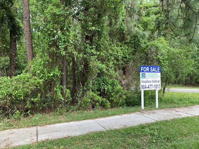
This Property Is For Sale
Property Detail
Hollars Pl
05-05-25-009016-003-71
TRACT B QUAILS HOLLAR AS REC OR 1519 PG 1761, 3157 PG 576,3885 PG 194, 4185 PG 973, 4871
Commercialacreage
CLAY
PUD
Florida
B and X Area of moderate flood hazard, usually the area between the limits of the 100-year and 500-year floods.
1.25 AC
2024
Orange Park/Clay County
2025
Jacksonville (Florida)
030204
Jacksonville, FL
NEARBY LISTINGS FOR SALE OR LEASE
DEMOGRAPHICS near Hollars Pl
1 mile
3 mile
5 mile
2025 Total Population
5,415
29,906
85,859
2030 Population
5,773
32,214
92,715
Pop Growth 2025-2030
+ 6.61%
+ 7.72%
+ 7.99%
Average Age
39
39
40
2025 Total Households
1,992
10,704
30,105
HH Growth 2025-2030
+ 6.83%
+ 7.89%
+ 8.18%
Median Household Inc
$84,652
$85,111
$89,140
Avg Household Size
2.70
2.80
2.80
2025 Avg HH Vehicles
2.00
2.00
2.00
Median Home Value
$311,970
$325,918
$338,623
Median Year Built
1997
1996
1999
Nearby Places
Map Layers
Map Styles
 Street
 Aerial
Layers
 Traffic
 Biking
Places
Listings with unknown addresses are not visible on the map
- Restaurants
- Banks
- Shops
- Fitness
- Groceries
PUBLIC TRANSPORTATION
AIRPORT
Jacksonville International
Drive
Walk
Distance
Jacksonville International
54 min
35.4 mi
Gainesville Regional
Drive
Walk
Distance
Gainesville Regional
73 min
46.8 mi
Freight Ports
Jacksonville Port
Drive
Walk
Distance
Jacksonville Port
46 min
29.2 mi
Nearby Properties
Address
Land Use
TOTAL SIZE
Lot Size
Zoning
Address
Land Use
TOTAL SIZE
Lot Size
Zoning
340,385 SF
28.98 AC
Address
Land Use
TOTAL SIZE
Lot Size
Zoning
241,396 SF
37.78 AC
Address
Land Use
TOTAL SIZE
Lot Size
Zoning
257,608 SF
27.17 AC
Address
Land Use
TOTAL SIZE
Lot Size
Zoning
233,551 SF
18.96 AC
PUD
Address
Land Use
TOTAL SIZE
Lot Size
Zoning
235,679 SF
53.26 AC
PO-1
Address
Land Use
TOTAL SIZE
Lot Size
Zoning
148,895 SF
35.72 AC
PO-1
Address
Land Use
TOTAL SIZE
Lot Size
Zoning
297,028 SF
16.78 AC
PUD
Address
Land Use
TOTAL SIZE
Lot Size
Zoning
1,716 SF
489.12 AC
Address
Land Use
TOTAL SIZE
Lot Size
Zoning
83,621 SF
26.35 AC
Address
Land Use
TOTAL SIZE
Lot Size
Zoning
141,441 SF
82.05 AC
Address
Land Use
TOTAL SIZE
Lot Size
Zoning
105,657 SF
28.86 AC
Address
Land Use
TOTAL SIZE
Lot Size
Zoning
174,016 SF
8.12 AC
Address
Land Use
TOTAL SIZE
Lot Size
Zoning
106,486 SF
24.23 AC
PS-1
Address
Land Use
TOTAL SIZE
Lot Size
Zoning
89,513 SF
19.76 AC
Address
Land Use
TOTAL SIZE
Lot Size
Zoning
221,247 SF
27.30 AC
Address
Land Use
TOTAL SIZE
Lot Size
Zoning
70,640 SF
7.15 AC
Address
Land Use
TOTAL SIZE
Lot Size
Zoning
113,473 SF
14.90 AC
Address
Land Use
TOTAL SIZE
Lot Size
Zoning
59,700 SF
0.58 AC
Address
Land Use
TOTAL SIZE
Lot Size
Zoning
109,200 SF
3.89 AC
BB-3
Address
Land Use
TOTAL SIZE
Lot Size
Zoning
140,280 SF
10.74 AC
Address
Land Use
TOTAL SIZE
Lot Size
Zoning
83,680 SF
7.86 AC
Address
Land Use
TOTAL SIZE
Lot Size
Zoning
60.13 AC
Address
Land Use
TOTAL SIZE
Lot Size
Zoning
110,457 SF
4.07 AC
BB
Address
Land Use
TOTAL SIZE
Lot Size
Zoning
101,582 SF
36.73 AC
Address
Land Use
TOTAL SIZE
Lot Size
Zoning
105,513 SF
3.55 AC
Address
Land Use
TOTAL SIZE
Lot Size
Zoning
29.98 AC
Address
Land Use
TOTAL SIZE
Lot Size
Zoning
125,604 SF
23.77 AC
Address
Land Use
TOTAL SIZE
Lot Size
Zoning
92,250 SF
3.14 AC
Address
Land Use
TOTAL SIZE
Lot Size
Zoning
94,293 SF
40 AC
PS-1
Address
Land Use
TOTAL SIZE
Lot Size
Zoning
47,920 SF
3.50 AC
The World's #1 Commercial Real Estate Marketplace
Connect with us
© 2026 CoStar Group
The information above has been obtained from sources believed reliable. While we do not doubt its accuracy we have not verified it and make no guarantee, warranty or representation about it. It is your responsibility to independently confirm its accuracy and completeness. Any projections, opinions, assumptions, or estimates used are for example only and do not represent the current or future performance of the property. The value of this transaction to you depends on tax and other factors which should be evaluated by your tax, financial, and legal advisors. You and your advisors should conduct a careful, independent investigation of the property to determine to your satisfaction the suitability of the property for your needs.