Property Record
Holloway Rd, Gilroy, CA 95020


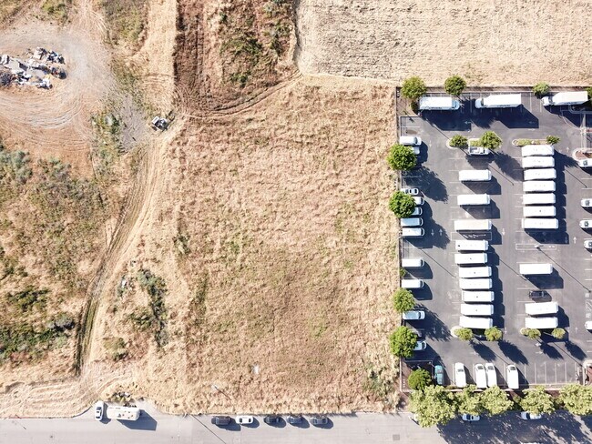

This Property Is For Sale
NEARBY LISTINGS FOR SALE OR LEASE
Property Detail
Holloway Rd
San Jose-Sunnyvale-Santa Clara, CA
Tract No 6997
841-70-005
TRACT 6997 BOOK 503 PAGE 33 PAGE 34 LOT 8
Residentialacreage
Santa Clara
AE
California
06085C0643H
8
2024
1.27 AC
2025
Gilroy
512513
South Bay/San Jose
DEMOGRAPHICS near Holloway Rd
1 Mile
3 Mile
5 Mile
2024 Total Population
3,289
42,784
61,671
2029 Population
3,194
41,083
59,051
Pop Growth 2024-2029
(2.89%)
(3.98%)
(4.25%)
Average Age
32
37
38
2024 Total Households
790
12,366
18,059
HH Growth 2024-2029
(3.04%)
(4.25%)
(4.54%)
Median Household Inc
$80,708
$94,695
$111,602
Avg Household Size
3.80
3.30
3.30
2024 Avg HH Vehicles
2.00
2.00
2.00
Median Home Value
$747,222
$771,817
$841,651
Median Year Built
1981
1982
1987
Nearby Places
Map Layers
Map Styles
 Street
 Aerial
- Restaurants
- Banks
- Shops
- Fitness
- Groceries
PUBLIC TRANSPORTATION
COMMUTER RAIL
Gilroy Caltrain Station Southbound (South Santa Clara County Connector - Caltrain (Caltrain))
DRIVE
WALK
Distance
Gilroy Caltrain Station Southbound (South Santa Clara County Connector - Caltrain (Caltrain))
3 min
1.5 mi
Gilroy (Caltrain - Caltrain (Caltrain))
DRIVE
WALK
Distance
Gilroy (Caltrain - Caltrain (Caltrain))
4 min
1.7 mi
Freight Ports
Port of Redwood City
DRIVE
WALK
Distance
Port of Redwood City
66 min
54.1 mi
Nearby Properties
Address
Land Use
TOTAL SIZE
Lot Size
Zoning
Address
Land Use
TOTAL SIZE
Lot Size
Zoning
270,205 SF
6.65 AC
M2
Address
Land Use
TOTAL SIZE
Lot Size
Zoning
921,750 SF
40.33 AC
M2
Address
Land Use
TOTAL SIZE
Lot Size
Zoning
171,339 SF
16.43 AC
C3
Address
Land Use
TOTAL SIZE
Lot Size
Zoning
133,498 SF
12.16 AC
C3
Address
Land Use
TOTAL SIZE
Lot Size
Zoning
156,290 SF
5.87 AC
APD
Address
Land Use
TOTAL SIZE
Lot Size
Zoning
189,303 SF
28.73 AC
CM
Address
Land Use
TOTAL SIZE
Lot Size
Zoning
55.03 AC
AW
Address
Land Use
TOTAL SIZE
Lot Size
Zoning
113,883 SF
9.63 AC
C1
Address
Land Use
TOTAL SIZE
Lot Size
Zoning
103,974 SF
3.90 AC
R4
Address
Land Use
TOTAL SIZE
Lot Size
Zoning
172,348 SF
9.58 AC
A140
Address
Land Use
TOTAL SIZE
Lot Size
Zoning
11.04 AC
M2
Address
Land Use
TOTAL SIZE
Lot Size
Zoning
9.90 AC
M2
Address
Land Use
TOTAL SIZE
Lot Size
Zoning
94,345 SF
10.68 AC
C1
Address
Land Use
TOTAL SIZE
Lot Size
Zoning
219,622 SF
19.80 AC
A1-25
Address
Land Use
TOTAL SIZE
Lot Size
Zoning
43,973 SF
3.38 AC
R3
Address
Land Use
TOTAL SIZE
Lot Size
Zoning
56.33 AC
M2
Address
Land Use
TOTAL SIZE
Lot Size
Zoning
59.87 AC
M2
Address
Land Use
TOTAL SIZE
Lot Size
Zoning
142,684 SF
4.94 AC
CD
Address
Land Use
TOTAL SIZE
Lot Size
Zoning
123,268 SF
7.62 AC
R3
Address
Land Use
TOTAL SIZE
Lot Size
Zoning
64,893 SF
4.32 AC
R3
Address
Land Use
TOTAL SIZE
Lot Size
Zoning
72,159 SF
4.16 AC
R3
Address
Land Use
TOTAL SIZE
Lot Size
Zoning
90,677 SF
11.26 AC
C1
Address
Land Use
TOTAL SIZE
Lot Size
Zoning
148,663 SF
14.79 AC
PUD
Address
Land Use
TOTAL SIZE
Lot Size
Zoning
4,853 SF
11.59 AC
HC
Address
Land Use
TOTAL SIZE
Lot Size
Zoning
32,727 SF
1.82 AC
M2
Address
Land Use
TOTAL SIZE
Lot Size
Zoning
129,000 SF
6.84 AC
MULIT
Address
Land Use
TOTAL SIZE
Lot Size
Zoning
2.94 AC
A140
Address
Land Use
TOTAL SIZE
Lot Size
Zoning
3.43 AC
APD
Address
Land Use
TOTAL SIZE
Lot Size
Zoning
63,560 SF
7.63 AC
A1-25
The World's #1 Commercial Real Estate Marketplace
Connect with us
© 2026 CoStar Group
The information above has been obtained from sources believed reliable. While we do not doubt its accuracy we have not verified it and make no guarantee, warranty or representation about it. It is your responsibility to independently confirm its accuracy and completeness. Any projections, opinions, assumptions, or estimates used are for example only and do not represent the current or future performance of the property. The value of this transaction to you depends on tax and other factors which should be evaluated by your tax, financial, and legal advisors. You and your advisors should conduct a careful, independent investigation of the property to determine to your satisfaction the suitability of the property for your needs.