Property Record
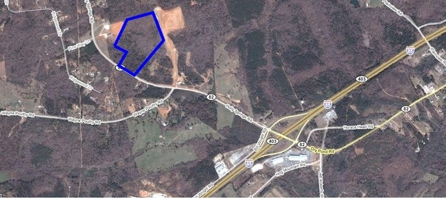
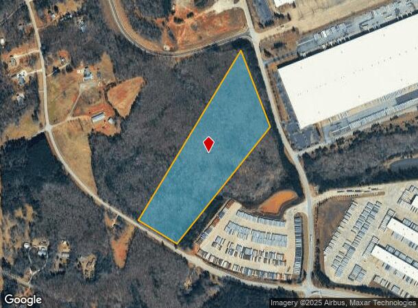
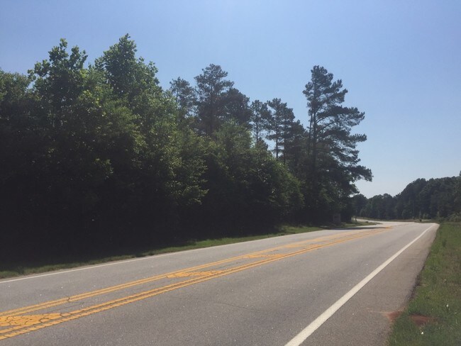
Holly Springs Rd, Pendergrass, GA 30567

NEARBY LISTINGS FOR SALE OR LEASE
Property Detail
Holly Springs Rd
078-003N
20 ACRES PLAT BK 34 PG 21
Residentialacreage
Jackson
X
Georgia
13157C0128C
20 AC
2025
Jackson County
2024
Atlanta
010104
Jefferson, GA
DEMOGRAPHICS near Holly Springs Rd
1 Mile
3 Mile
5 Mile
2024 Total Population
334
4,487
14,663
2029 Population
439
5,764
18,722
Pop Growth 2024-2029
+ 31.44%
+ 28.46%
+ 27.68%
Average Age
40
39
38
2024 Total Households
115
1,500
4,773
HH Growth 2024-2029
+ 30.43%
+ 27.07%
+ 26.25%
Median Household Inc
$69,999
$68,675
$70,033
Avg Household Size
2.80
2.80
2.90
2024 Avg HH Vehicles
3.00
3.00
2.00
Median Home Value
$511,111
$355,263
$327,862
Median Year Built
2002
1998
2000
Nearby Places
Map Layers
Map Styles
 Street
 Aerial
- Restaurants
- Banks
- Shops
- Fitness
- Groceries
SALE & LEASE HISTORY
LISTING DATE
SALE/LEASE

Sep 24, 2016
For Sale
Apr 26, 2019
For Sale
Nearby Properties
Address
Land Use
TOTAL SIZE
Lot Size
Zoning
Address
Land Use
TOTAL SIZE
Lot Size
Zoning
1,131,000 SF
94.67 AC
LI
Address
Land Use
TOTAL SIZE
Lot Size
Zoning
1,016,631 SF
65.03 AC
LI
Address
Land Use
TOTAL SIZE
Lot Size
Zoning
1,004,400 SF
61.31 AC
L1
Address
Land Use
TOTAL SIZE
Lot Size
Zoning
999,205 SF
74.81 AC
L-I
Address
Land Use
TOTAL SIZE
Lot Size
Zoning
78.68 AC
001
Address
Land Use
TOTAL SIZE
Lot Size
Zoning
458,640 SF
54.96 AC
MI
Address
Land Use
TOTAL SIZE
Lot Size
Zoning
801,420 SF
80.72 AC
L-I
Address
Land Use
TOTAL SIZE
Lot Size
Zoning
850,500 SF
57.87 AC
I
Address
Land Use
TOTAL SIZE
Lot Size
Zoning
1,040,000 SF
105.41 AC
LI
Address
Land Use
TOTAL SIZE
Lot Size
Zoning
916,560 SF
82.80 AC
004
Address
Land Use
TOTAL SIZE
Lot Size
Zoning
1,053,360 SF
101.96 AC
001
Address
Land Use
TOTAL SIZE
Lot Size
Zoning
772,000 SF
86.10 AC
LI
Address
Land Use
TOTAL SIZE
Lot Size
Zoning
820,800 SF
46.50 AC
LI
Address
Land Use
TOTAL SIZE
Lot Size
Zoning
815,112 SF
104.67 AC
LI
Address
Land Use
TOTAL SIZE
Lot Size
Zoning
339,207 SF
65.25 AC
MI
Address
Land Use
TOTAL SIZE
Lot Size
Zoning
404,608 SF
52.95 AC
M1
Address
Land Use
TOTAL SIZE
Lot Size
Zoning
719,200 SF
113.14 AC
M1
Address
Land Use
TOTAL SIZE
Lot Size
Zoning
749,700 SF
44.96 AC
LI
Address
Land Use
TOTAL SIZE
Lot Size
Zoning
366,300 SF
123.06 AC
I2
Address
Land Use
TOTAL SIZE
Lot Size
Zoning
147.44 AC
MI
Address
Land Use
TOTAL SIZE
Lot Size
Zoning
848,000 SF
60.86 AC
I2
Address
Land Use
TOTAL SIZE
Lot Size
Zoning
518,500 SF
35.05 AC
LI
Address
Land Use
TOTAL SIZE
Lot Size
Zoning
242,306 SF
32.76 AC
I2
Address
Land Use
TOTAL SIZE
Lot Size
Zoning
518,125 SF
28.51 AC
I2
Address
Land Use
TOTAL SIZE
Lot Size
Zoning
502,156 SF
85.32 AC
LI-C2
Address
Land Use
TOTAL SIZE
Lot Size
Zoning
151.22 AC
MI
Address
Land Use
TOTAL SIZE
Lot Size
Zoning
195,200 SF
14.37 AC
003
Address
Land Use
TOTAL SIZE
Lot Size
Zoning
140,996 SF
29.69 AC
LI
Address
Land Use
TOTAL SIZE
Lot Size
Zoning
202.89 AC
GI
Address
Land Use
TOTAL SIZE
Lot Size
Zoning
498,160 SF
45.63 AC
LI
The World's #1 Commercial Real Estate Marketplace
Connect with us
© 2025 CoStar Group
The information above has been obtained from sources believed reliable. While we do not doubt its accuracy we have not verified it and make no guarantee, warranty or representation about it. It is your responsibility to independently confirm its accuracy and completeness. Any projections, opinions, assumptions, or estimates used are for example only and do not represent the current or future performance of the property. The value of this transaction to you depends on tax and other factors which should be evaluated by your tax, financial, and legal advisors. You and your advisors should conduct a careful, independent investigation of the property to determine to your satisfaction the suitability of the property for your needs.