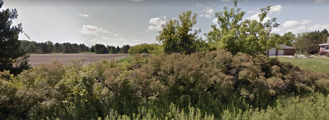
Property Record
Hough Rd, Allenton, MI 48002


Property Detail
Hough Rd
09-033-2003-520
BEG S 89D 11M W 220' FROM NE SEC COR, TH S 0D 0M W 666.83', TH S 89D 11M W 220' TH N 0D 0M E 666.83', TH N 89D 11M E 220' TO BEG SECTION 33 T6N R13E 3.37 A SPLIT ON 03/29/2006 FROM 09-033-2003-501;
Residentialacreage
ST. CLAIR
AG
Michigan
B and X Area of moderate flood hazard, usually the area between the limits of the 100-year and 500-year floods.
3.37 AC
2024
St Clair & Lapeer Counties
2025
Detroit
657200
Detroit-Warren-Dearborn, MI
NEARBY LISTINGS FOR SALE OR LEASE
-
-
View all Allenton listings for sale on LoopNet.com
DEMOGRAPHICS near Hough Rd
1 mile
3 mile
5 mile
2025 Total Population
513
2,814
8,476
2030 Population
514
2,808
8,487
Pop Growth 2025-2030
+ 0.19%
(0.21%)
+ 0.13%
Average Age
44
44
43
2025 Total Households
188
1,025
3,089
HH Growth 2025-2030
+ 0.53%
(0.29%)
+ 0.06%
Median Household Inc
$74,999
$89,670
$91,874
Avg Household Size
2.60
2.70
2.70
2025 Avg HH Vehicles
2.00
3.00
3.00
Median Home Value
$289,999
$318,182
$316,686
Median Year Built
1974
1978
1983
Nearby Places
Map Layers
Map Styles
 Street
 Aerial
Layers
 Traffic
 Biking
Places
Listings with unknown addresses are not visible on the map
- Restaurants
- Banks
- Shops
- Fitness
- Groceries
SALE & LEASE HISTORY
LISTING DATE
SALE/LEASE

Sep 04, 2017
For Sale
Feb 28, 2018
For Sale
Nearby Properties
Address
Land Use
TOTAL SIZE
Lot Size
Zoning
Address
Land Use
TOTAL SIZE
Lot Size
Zoning
1,932 SF
108 AC
AG 1.75
Address
Land Use
TOTAL SIZE
Lot Size
Zoning
251.54 AC
AG
Address
Land Use
TOTAL SIZE
Lot Size
Zoning
1,404 SF
181.35 AC
AG 1.75
Address
Land Use
TOTAL SIZE
Lot Size
Zoning
2,668 SF
153.18 AC
AG
Address
Land Use
TOTAL SIZE
Lot Size
Zoning
1,350 SF
158 AC
AG
Address
Land Use
TOTAL SIZE
Lot Size
Zoning
1,600 SF
160 AC
AG
Address
Land Use
TOTAL SIZE
Lot Size
Zoning
173.60 AC
AG
Address
Land Use
TOTAL SIZE
Lot Size
Zoning
1,713 SF
43.62 AC
AG 1.75
Address
Land Use
TOTAL SIZE
Lot Size
Zoning
4,919 SF
119.16 AC
AG
Address
Land Use
TOTAL SIZE
Lot Size
Zoning
240 AC
AG 1.75
Address
Land Use
TOTAL SIZE
Lot Size
Zoning
2,284 SF
116.92 AC
AG 1.75
Address
Land Use
TOTAL SIZE
Lot Size
Zoning
2,016 SF
90.76 AC
AG 1.75
Address
Land Use
TOTAL SIZE
Lot Size
Zoning
Address
Land Use
TOTAL SIZE
Lot Size
Zoning
156.16 AC
AG
Address
Land Use
TOTAL SIZE
Lot Size
Zoning
2,451 SF
40 AC
AR
Address
Land Use
TOTAL SIZE
Lot Size
Zoning
Address
Land Use
TOTAL SIZE
Lot Size
Zoning
1,864 SF
118.32 AC
AG 1.75
Address
Land Use
TOTAL SIZE
Lot Size
Zoning
134.14 AC
AG
Address
Land Use
TOTAL SIZE
Lot Size
Zoning
2,648 SF
86.81 AC
RES
Address
Land Use
TOTAL SIZE
Lot Size
Zoning
10.38 AC
AG
Address
Land Use
TOTAL SIZE
Lot Size
Zoning
125.54 AC
AG
Address
Land Use
TOTAL SIZE
Lot Size
Zoning
1,796 SF
98.32 AC
AG
Address
Land Use
TOTAL SIZE
Lot Size
Zoning
1,338 SF
50.70 AC
AG 1.75
Address
Land Use
TOTAL SIZE
Lot Size
Zoning
1,680 SF
97 AC
AG
Address
Land Use
TOTAL SIZE
Lot Size
Zoning
960 SF
110.78 AC
AG
Address
Land Use
TOTAL SIZE
Lot Size
Zoning
2,424 SF
141.74 AC
AG
Address
Land Use
TOTAL SIZE
Lot Size
Zoning
1,830 SF
116.33 AC
AG
Address
Land Use
TOTAL SIZE
Lot Size
Zoning
2,608 SF
20.81 AC
AG 1.75
Address
Land Use
TOTAL SIZE
Lot Size
Zoning
1,066 SF
103 AC
AG
Address
Land Use
TOTAL SIZE
Lot Size
Zoning
97 AC
AG
The World's #1 Commercial Real Estate Marketplace
Connect with us
© 2026 CoStar Group
The information above has been obtained from sources believed reliable. While we do not doubt its accuracy we have not verified it and make no guarantee, warranty or representation about it. It is your responsibility to independently confirm its accuracy and completeness. Any projections, opinions, assumptions, or estimates used are for example only and do not represent the current or future performance of the property. The value of this transaction to you depends on tax and other factors which should be evaluated by your tax, financial, and legal advisors. You and your advisors should conduct a careful, independent investigation of the property to determine to your satisfaction the suitability of the property for your needs.