Property Record
Houston St, Maybrook, NY 12543
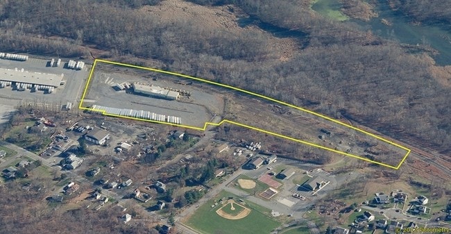

Property Detail
Houston St
334201-105-000-0002-028.000-0000
ORANGE
Truckterminal
New York
I3
28.00
B and X Area of moderate flood hazard, usually the area between the limits of the 100-year and 500-year floods.
12.30 AC
2024
Orange County
2025
Northern New Jersey
010801
Kiryas Joel-Poughkeepsie-Newburgh, NY
10,215 SF
NEARBY LISTINGS FOR SALE OR LEASE
DEMOGRAPHICS near Houston St
1 mile
3 mile
5 mile
2025 Total Population
3,203
10,180
29,083
2030 Population
3,252
10,362
29,663
Pop Growth 2025-2030
+ 1.53%
+ 1.79%
+ 1.99%
Average Age
40
41
41
2025 Total Households
1,268
3,770
10,502
HH Growth 2025-2030
+ 1.66%
+ 1.86%
+ 2.07%
Median Household Inc
$93,296
$100,842
$100,637
Avg Household Size
2.50
2.60
2.70
2025 Avg HH Vehicles
2.00
2.00
2.00
Median Home Value
$250,452
$372,046
$394,369
Median Year Built
1975
1979
1979
Nearby Places
Map Layers
Map Styles
 Street
 Aerial
Layers
 Traffic
 Biking
Places
Listings with unknown addresses are not visible on the map
- Restaurants
- Banks
- Shops
- Fitness
- Groceries
PUBLIC TRANSPORTATION
AIRPORT
New York Stewart International
Drive
Walk
Distance
New York Stewart International
16 min
8.9 mi
Nearby Properties
Address
Land Use
TOTAL SIZE
Lot Size
Zoning
Address
Land Use
TOTAL SIZE
Lot Size
Zoning
1,332,075 SF
118 AC
I1
Address
Land Use
TOTAL SIZE
Lot Size
Zoning
1,040,580 SF
70.80 AC
ID
Address
Land Use
TOTAL SIZE
Lot Size
Zoning
513,951 SF
112.80 AC
ID
Address
Land Use
TOTAL SIZE
Lot Size
Zoning
249,128 SF
43.72 AC
ID
Address
Land Use
TOTAL SIZE
Lot Size
Zoning
340,782 SF
37 AC
LUI
Address
Land Use
TOTAL SIZE
Lot Size
Zoning
762,500 SF
80 AC
I1
Address
Land Use
TOTAL SIZE
Lot Size
Zoning
374,356 SF
35.90 AC
LUI
Address
Land Use
TOTAL SIZE
Lot Size
Zoning
760,927 SF
51.60 AC
ID
Address
Land Use
TOTAL SIZE
Lot Size
Zoning
176,246 SF
80.20 AC
LUI
Address
Land Use
TOTAL SIZE
Lot Size
Zoning
312,980 SF
42.30 AC
ID
Address
Land Use
TOTAL SIZE
Lot Size
Zoning
108.50 AC
Address
Land Use
TOTAL SIZE
Lot Size
Zoning
366,680 SF
32.10 AC
Address
Land Use
TOTAL SIZE
Lot Size
Zoning
121,460 SF
42.70 AC
ID
Address
Land Use
TOTAL SIZE
Lot Size
Zoning
Address
Land Use
TOTAL SIZE
Lot Size
Zoning
103,857 SF
14.30 AC
B4
Address
Land Use
TOTAL SIZE
Lot Size
Zoning
26,500 SF
27.50 AC
B4
Address
Land Use
TOTAL SIZE
Lot Size
Zoning
109,481 SF
24.90 AC
ID
Address
Land Use
TOTAL SIZE
Lot Size
Zoning
41.40 AC
R4A
Address
Land Use
TOTAL SIZE
Lot Size
Zoning
100,300 SF
22.50 AC
I1
Address
Land Use
TOTAL SIZE
Lot Size
Zoning
221,958 SF
12.10 AC
ID
Address
Land Use
TOTAL SIZE
Lot Size
Zoning
146,617 SF
41.60 AC
I3
Address
Land Use
TOTAL SIZE
Lot Size
Zoning
90,200 SF
7.50 AC
B4
Address
Land Use
TOTAL SIZE
Lot Size
Zoning
89,960 SF
10.90 AC
I1
Address
Land Use
TOTAL SIZE
Lot Size
Zoning
103,079 SF
30.60 AC
ID
Address
Land Use
TOTAL SIZE
Lot Size
Zoning
82,464 SF
3.80 AC
B4
Address
Land Use
TOTAL SIZE
Lot Size
Zoning
49,056 SF
20 AC
RM1
Address
Land Use
TOTAL SIZE
Lot Size
Zoning
4,022 SF
360.50 AC
R4A*
Address
Land Use
TOTAL SIZE
Lot Size
Zoning
48,131 SF
2.80 AC
B4
Address
Land Use
TOTAL SIZE
Lot Size
Zoning
38,624 SF
11.50 AC
I1
Address
Land Use
TOTAL SIZE
Lot Size
Zoning
The World's #1 Commercial Real Estate Marketplace
Connect with us
© 2026 CoStar Group
The information above has been obtained from sources believed reliable. While we do not doubt its accuracy we have not verified it and make no guarantee, warranty or representation about it. It is your responsibility to independently confirm its accuracy and completeness. Any projections, opinions, assumptions, or estimates used are for example only and do not represent the current or future performance of the property. The value of this transaction to you depends on tax and other factors which should be evaluated by your tax, financial, and legal advisors. You and your advisors should conduct a careful, independent investigation of the property to determine to your satisfaction the suitability of the property for your needs.