No Photo
Property Record
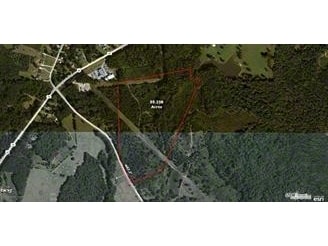
Hudson Rd, Lagrange, GA 30240

Property Detail
Hudson Rd
LaGrange, GA-AL
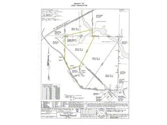
HUDSON RD/ LL133 & 134 LD-5TH
079-1-000-037
TROUP
Agriculturalland
Georgia
01-SU-R
2
A Areas with a 1% annual chance of flooding and a 26% chance of flooding over the life of a 30-year mortgage.
50.30 AC
2025
Troup County
2025
Columbus GA
960300
NEARBY LISTINGS FOR SALE OR LEASE
DEMOGRAPHICS near Hudson Rd
1 mile
3 mile
5 mile
2024 Total Population
933
6,417
17,466
2029 Population
954
6,539
17,962
Pop Growth 2024-2029
+ 2.25%
+ 1.90%
+ 2.84%
Average Age
41
41
40
2024 Total Households
359
2,470
6,646
HH Growth 2024-2029
+ 2.23%
+ 2.06%
+ 3.07%
Median Household Inc
$116,071
$94,755
$71,148
Avg Household Size
2.60
2.60
2.50
2024 Avg HH Vehicles
3.00
2.00
2.00
Median Home Value
$369,736
$265,409
$241,320
Median Year Built
1998
1992
1985
Nearby Places
Map Layers
Map Styles
 Street
 Aerial
Transit
 Traffic
 Biking
Places
Listings with unknown addresses are not visible on the map
- Restaurants
- Banks
- Shops
- Fitness
- Groceries
Nearby Properties
Address
Land Use
TOTAL SIZE
Lot Size
Zoning
Address
Land Use
TOTAL SIZE
Lot Size
Zoning
35,964 SF
72.39 AC
16- CP-GI
Address
Land Use
TOTAL SIZE
Lot Size
Zoning
525,250 SF
45.33 AC
16- CP-GI
Address
Land Use
TOTAL SIZE
Lot Size
Zoning
4,909 SF
715.68 AC
16- CP-GI
Address
Land Use
TOTAL SIZE
Lot Size
Zoning
323,137 SF
34.65 AC
16- CP-GI
Address
Land Use
TOTAL SIZE
Lot Size
Zoning
Address
Land Use
TOTAL SIZE
Lot Size
Zoning
20,129 SF
357.53 AC
01-LR
Address
Land Use
TOTAL SIZE
Lot Size
Zoning
154,930 SF
73.75 AC
01-SU-R
Address
Land Use
TOTAL SIZE
Lot Size
Zoning
79,956 SF
16.23 AC
16- CP-GI
Address
Land Use
TOTAL SIZE
Lot Size
Zoning
14,810 SF
3.70 AC
16- CR-MX
Address
Land Use
TOTAL SIZE
Lot Size
Zoning
1,269.04 AC
16- CP-GI
Address
Land Use
TOTAL SIZE
Lot Size
Zoning
106,248 SF
23.21 AC
16- CP-GI
Address
Land Use
TOTAL SIZE
Lot Size
Zoning
62,262 SF
25 AC
01-SU-R
Address
Land Use
TOTAL SIZE
Lot Size
Zoning
8,400 SF
7.50 AC
16- CR-MX
Address
Land Use
TOTAL SIZE
Lot Size
Zoning
Address
Land Use
TOTAL SIZE
Lot Size
Zoning
Address
Land Use
TOTAL SIZE
Lot Size
Zoning
Address
Land Use
TOTAL SIZE
Lot Size
Zoning
16,570 SF
11.94 AC
01-SU-R
Address
Land Use
TOTAL SIZE
Lot Size
Zoning
52,580 SF
6.09 AC
16- CP-GI
Address
Land Use
TOTAL SIZE
Lot Size
Zoning
12,612 SF
3.36 AC
16- CR-MX
Address
Land Use
TOTAL SIZE
Lot Size
Zoning
4,060 SF
0.51 AC
01-LC
Address
Land Use
TOTAL SIZE
Lot Size
Zoning
14,216 SF
4.93 AC
01-SU-R
Address
Land Use
TOTAL SIZE
Lot Size
Zoning
12,000 SF
16- CP-GI
Address
Land Use
TOTAL SIZE
Lot Size
Zoning
39,469 SF
9.28 AC
16- CP-GB
Address
Land Use
TOTAL SIZE
Lot Size
Zoning
20,046 SF
4.42 AC
16- CP-GB
Address
Land Use
TOTAL SIZE
Lot Size
Zoning
9,520 SF
1 AC
16- CR-MX
Address
Land Use
TOTAL SIZE
Lot Size
Zoning
4,180 SF
45.14 AC
16- CP-GI
Address
Land Use
TOTAL SIZE
Lot Size
Zoning
9,580 SF
6.50 AC
01-SU-R
Address
Land Use
TOTAL SIZE
Lot Size
Zoning
10,729 SF
2.27 AC
01-LC
Address
Land Use
TOTAL SIZE
Lot Size
Zoning
15,540 SF
5.45 AC
01-LC
Address
Land Use
TOTAL SIZE
Lot Size
Zoning
8,662 SF
8.19 AC
01-SU-R
The World's #1 Commercial Real Estate Marketplace
Connect with us
© 2026 CoStar Group
The information above has been obtained from sources believed reliable. While we do not doubt its accuracy we have not verified it and make no guarantee, warranty or representation about it. It is your responsibility to independently confirm its accuracy and completeness. Any projections, opinions, assumptions, or estimates used are for example only and do not represent the current or future performance of the property. The value of this transaction to you depends on tax and other factors which should be evaluated by your tax, financial, and legal advisors. You and your advisors should conduct a careful, independent investigation of the property to determine to your satisfaction the suitability of the property for your needs.