Property Record
Highway 101, Encinitas, CA 92024
Save to a Folder
{{folder.Name}}
{{folder.ListingIds.length}} Properties
{{folder.ListingIds.length}} Property
Create a New Folder
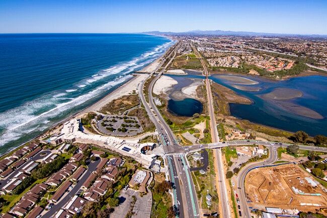
Property Detail
Highway 101
San Diego-Chula Vista-Carlsbad, CA
SEC 33-12-4W N PAR AS PER ROS 1691 /EXC HWY OP/ IN
216-042-01
SAN DIEGO
Commercialacreage
California
N-VSC
10
AE The base floodplain where base flood elevations are provided. AE Zones are now used on new format FIRMs instead of A1-A30 Zones.
0.93 AC
0
North Beach Cities
2026
San Diego
017606
NEARBY LISTINGS FOR SALE OR LEASE
DEMOGRAPHICS near Highway 101
1 mile
3 mile
5 mile
2025 Total Population
6,518
51,899
137,418
2030 Population
6,652
52,464
138,301
Pop Growth 2025-2030
+ 2.06%
+ 1.09%
+ 0.64%
Average Age
44
44
43
2025 Total Households
2,853
21,048
53,529
HH Growth 2025-2030
+ 2.03%
+ 1.07%
+ 0.61%
Median Household Inc
$158,011
$161,460
$160,942
Avg Household Size
2.20
2.40
2.50
2025 Avg HH Vehicles
2.00
2.00
2.00
Median Home Value
$1,112,921
$1,106,340
$1,103,904
Median Year Built
1984
1989
1985
Nearby Places
Map Layers
Map Styles
 Street
 Aerial
Layers
 Traffic
 Biking
Places
Listings with unknown addresses are not visible on the map
- Restaurants
- Banks
- Shops
- Fitness
- Groceries
PUBLIC TRANSPORTATION
COMMUTER RAIL
Carlsbad Poinsettia (Coaster - San Diego North County Transit District (Coaster/Sprinter/Breeze))
Drive
Walk
Distance
Carlsbad Poinsettia (Coaster - San Diego North County Transit District (Coaster/Sprinter/Breeze))
6 min
2.4 mi
Encinitas (Coaster - San Diego North County Transit District (Coaster/Sprinter/Breeze))
Drive
Walk
Distance
Encinitas (Coaster - San Diego North County Transit District (Coaster/Sprinter/Breeze))
9 min
4.4 mi
AIRPORT
San Diego International
Drive
Walk
Distance
San Diego International
38 min
28.7 mi
Freight Ports
Port of San Diego
Drive
Walk
Distance
Port of San Diego
43 min
33.0 mi
SALE & LEASE HISTORY
LISTING DATE
SALE/LEASE

Apr 03, 2023
For Sale
Nearby Properties
Address
Land Use
TOTAL SIZE
Lot Size
Zoning
Address
Land Use
TOTAL SIZE
Lot Size
Zoning
132.11 AC
C-T-Q
Address
Land Use
TOTAL SIZE
Lot Size
Zoning
55.06 AC
P-C
Address
Land Use
TOTAL SIZE
Lot Size
Zoning
9,999 SF
18.19 AC
P-C
Address
Land Use
TOTAL SIZE
Lot Size
Zoning
9,999 SF
30.88 AC
P-C
Address
Land Use
TOTAL SIZE
Lot Size
Zoning
12.62 AC
P-C
Address
Land Use
TOTAL SIZE
Lot Size
Zoning
9,999 SF
21.15 AC
P-C
Address
Land Use
TOTAL SIZE
Lot Size
Zoning
9,999 SF
4.32 AC
N-LVSC
Address
Land Use
TOTAL SIZE
Lot Size
Zoning
18.34 AC
P-C
Address
Land Use
TOTAL SIZE
Lot Size
Zoning
9,999 SF
12.44 AC
P/SP
Address
Land Use
TOTAL SIZE
Lot Size
Zoning
9,999 SF
4.77 AC
ER-MU1
Address
Land Use
TOTAL SIZE
Lot Size
Zoning
9,999 SF
5.91 AC
RD-M
Address
Land Use
TOTAL SIZE
Lot Size
Zoning
9,999 SF
5.45 AC
C-T
Address
Land Use
TOTAL SIZE
Lot Size
Zoning
9,999 SF
14.73 AC
C-L
Address
Land Use
TOTAL SIZE
Lot Size
Zoning
1,431 SF
8.69 AC
C-2
Address
Land Use
TOTAL SIZE
Lot Size
Zoning
9,999 SF
11.10 AC
RD-M-Q
Address
Land Use
TOTAL SIZE
Lot Size
Zoning
9,999 SF
3.17 AC
C-T
Address
Land Use
TOTAL SIZE
Lot Size
Zoning
9,999 SF
6.61 AC
P-C
Address
Land Use
TOTAL SIZE
Lot Size
Zoning
2.95 AC
OP
Address
Land Use
TOTAL SIZE
Lot Size
Zoning
5,656 SF
13.04 AC
R-1-Q
Address
Land Use
TOTAL SIZE
Lot Size
Zoning
9,999 SF
9.76 AC
M
Address
Land Use
TOTAL SIZE
Lot Size
Zoning
6.25 AC
P-C
Address
Land Use
TOTAL SIZE
Lot Size
Zoning
8,188 SF
1.95 AC
N-R3
Address
Land Use
TOTAL SIZE
Lot Size
Zoning
9,999 SF
9.15 AC
RD-M-Q
Address
Land Use
TOTAL SIZE
Lot Size
Zoning
2.42 AC
R-4
Address
Land Use
TOTAL SIZE
Lot Size
Zoning
9,000 SF
8.61 AC
O
Address
Land Use
TOTAL SIZE
Lot Size
Zoning
9,999 SF
12.67 AC
P-C
Address
Land Use
TOTAL SIZE
Lot Size
Zoning
1,962 SF
5.33 AC
P/SP
Address
Land Use
TOTAL SIZE
Lot Size
Zoning
6,444 SF
4.59 AC
P-C
Address
Land Use
TOTAL SIZE
Lot Size
Zoning
5,000 SF
3.79 AC
P-M-Q
Address
Land Use
TOTAL SIZE
Lot Size
Zoning
6,940 SF
3.85 AC
P-M
The World's #1 Commercial Real Estate Marketplace
Connect with us
© 2026 CoStar Group
The information above has been obtained from sources believed reliable. While we do not doubt its accuracy we have not verified it and make no guarantee, warranty or representation about it. It is your responsibility to independently confirm its accuracy and completeness. Any projections, opinions, assumptions, or estimates used are for example only and do not represent the current or future performance of the property. The value of this transaction to you depends on tax and other factors which should be evaluated by your tax, financial, and legal advisors. You and your advisors should conduct a careful, independent investigation of the property to determine to your satisfaction the suitability of the property for your needs.