Property Record
Us 158 Byp, Henderson, NC 27537

NEARBY LISTINGS FOR SALE OR LEASE
Property Detail
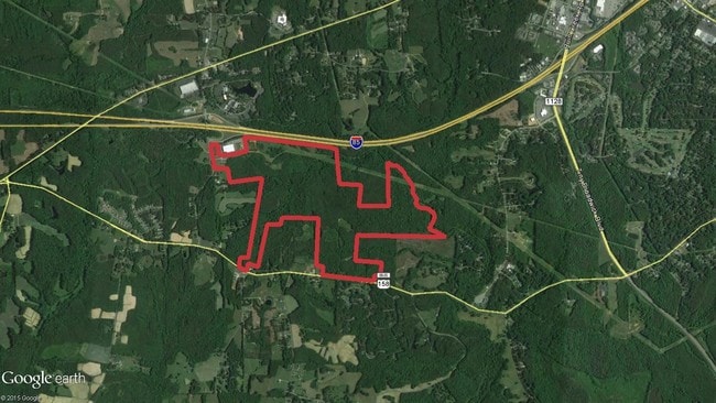
Us 158 Byp
Henderson, NC
Kerr Tar Regional Economic
0412-01008
US 158 BYPASS 52.080
Agriculturalland
Vance
X
North Carolina
3720194200K
52.08 AC
2025
North Carolina Northeast Area
2025
Other Market Areas
960600
DEMOGRAPHICS near Us 158 Byp
1 Mile
3 Mile
5 Mile
2024 Total Population
793
5,247
21,327
2029 Population
790
5,145
21,340
Pop Growth 2024-2029
(0.38%)
(1.94%)
+ 0.06%
Average Age
44
45
42
2024 Total Households
340
2,236
8,634
HH Growth 2024-2029
(0.29%)
(1.97%)
+ 0.02%
Median Household Inc
$44,317
$49,317
$45,994
Avg Household Size
2.30
2.30
2.40
2024 Avg HH Vehicles
2.00
2.00
2.00
Median Home Value
$236,400
$207,249
$154,578
Median Year Built
1986
1979
1974
Nearby Places
Map Layers
Map Styles
 Street
 Aerial
- Restaurants
- Banks
- Shops
- Fitness
- Groceries
SALE & LEASE HISTORY
LISTING DATE
SALE/LEASE

Sep 24, 2016
For Sale
Nearby Properties
Address
Land Use
TOTAL SIZE
Lot Size
Zoning
Address
Land Use
TOTAL SIZE
Lot Size
Zoning
82,663 SF
33 AC
HOI
Address
Land Use
TOTAL SIZE
Lot Size
Zoning
201,508 SF
19.91 AC
HB2
Address
Land Use
TOTAL SIZE
Lot Size
Zoning
50,245 SF
80 AC
OI
Address
Land Use
TOTAL SIZE
Lot Size
Zoning
164,283 SF
20.33 AC
HB2
Address
Land Use
TOTAL SIZE
Lot Size
Zoning
95,568 SF
22.65 AC
LI
Address
Land Use
TOTAL SIZE
Lot Size
Zoning
1,504 SF
432.29 AC
I2
Address
Land Use
TOTAL SIZE
Lot Size
Zoning
70,011 SF
54.94 AC
OI
Address
Land Use
TOTAL SIZE
Lot Size
Zoning
38,331 SF
13.62 AC
HB2A
Address
Land Use
TOTAL SIZE
Lot Size
Zoning
36,173 SF
1.56 AC
HOI
Address
Land Use
TOTAL SIZE
Lot Size
Zoning
19,596 SF
7.60 AC
HR15M
Address
Land Use
TOTAL SIZE
Lot Size
Zoning
21,548 SF
13.77 AC
Address
Land Use
TOTAL SIZE
Lot Size
Zoning
28,326 SF
7.63 AC
HB2
Address
Land Use
TOTAL SIZE
Lot Size
Zoning
43,590 SF
2.27 AC
HB2A
Address
Land Use
TOTAL SIZE
Lot Size
Zoning
27,344 SF
23.26 AC
HR15M
Address
Land Use
TOTAL SIZE
Lot Size
Zoning
82,660 SF
9.88 AC
EIA
Address
Land Use
TOTAL SIZE
Lot Size
Zoning
21,576 SF
5.50 AC
HOI
Address
Land Use
TOTAL SIZE
Lot Size
Zoning
43,538 SF
6.67 AC
HB2A
Address
Land Use
TOTAL SIZE
Lot Size
Zoning
6,416 SF
6.99 AC
HR8
Address
Land Use
TOTAL SIZE
Lot Size
Zoning
29,806 SF
1.50 AC
HB2
Address
Land Use
TOTAL SIZE
Lot Size
Zoning
15,344 SF
3.38 AC
R30
Address
Land Use
TOTAL SIZE
Lot Size
Zoning
55,552 SF
6.72 AC
HB2A
Address
Land Use
TOTAL SIZE
Lot Size
Zoning
40,575 SF
7 AC
HOI
Address
Land Use
TOTAL SIZE
Lot Size
Zoning
14,605 SF
1.91 AC
HB2A
Address
Land Use
TOTAL SIZE
Lot Size
Zoning
29,188 SF
1.05 AC
HB2
Address
Land Use
TOTAL SIZE
Lot Size
Zoning
24,100 SF
2.94 AC
HB2A
Address
Land Use
TOTAL SIZE
Lot Size
Zoning
4,799 SF
1.20 AC
HB2A
Address
Land Use
TOTAL SIZE
Lot Size
Zoning
15,411 SF
96.46 AC
HR15
Address
Land Use
TOTAL SIZE
Lot Size
Zoning
23,603 SF
1.70 AC
HB2A
Address
Land Use
TOTAL SIZE
Lot Size
Zoning
19,666 SF
3 AC
HR15M
Address
Land Use
TOTAL SIZE
Lot Size
Zoning
11,016 SF
2.20 AC
HB2
The World's #1 Commercial Real Estate Marketplace
Connect with us
© 2025 CoStar Group
The information above has been obtained from sources believed reliable. While we do not doubt its accuracy we have not verified it and make no guarantee, warranty or representation about it. It is your responsibility to independently confirm its accuracy and completeness. Any projections, opinions, assumptions, or estimates used are for example only and do not represent the current or future performance of the property. The value of this transaction to you depends on tax and other factors which should be evaluated by your tax, financial, and legal advisors. You and your advisors should conduct a careful, independent investigation of the property to determine to your satisfaction the suitability of the property for your needs.