Property Record
191 Interstate Dr S, Jasper, GA 30143
NEARBY LISTINGS FOR SALE OR LEASE
Property Detail
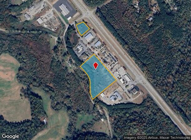
191 Interstate Dr S
Atlanta-Sandy Springs-Roswell, GA
Highway
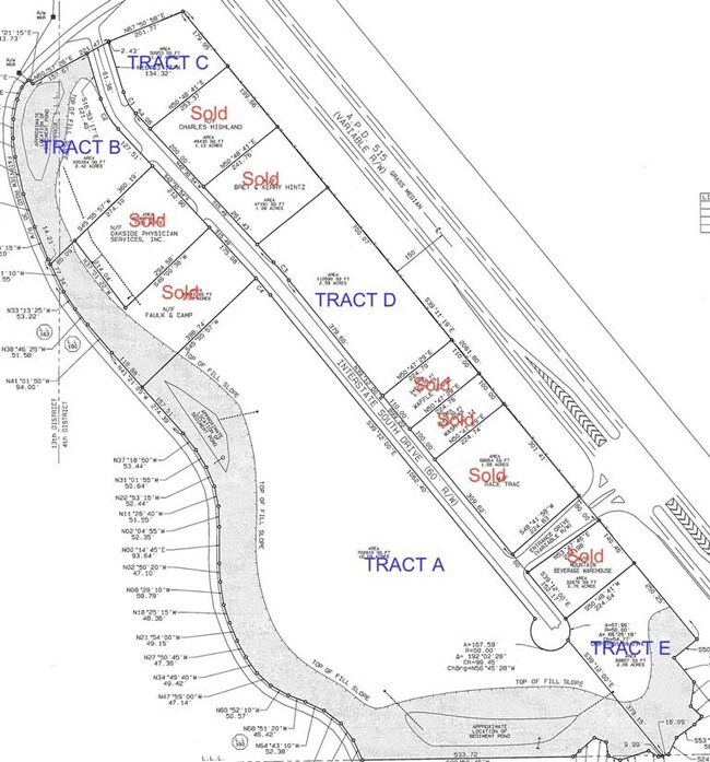
065B-000-050-000
DIST4 LL190 8.48AC
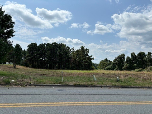
Commercialacreage
Pickens
X
Georgia
13057C0075E
8.48 AC
2024
Pickens County
2024
Atlanta
050202
DEMOGRAPHICS near 191 Interstate Dr S
1 Mile
3 Mile
5 Mile
2024 Total Population
923
6,678
17,423
2029 Population
1,037
7,564
19,698
Pop Growth 2024-2029
+ 12.35%
+ 13.27%
+ 13.06%
Average Age
42
43
42
2024 Total Households
338
2,530
6,554
HH Growth 2024-2029
+ 12.13%
+ 13.60%
+ 13.09%
Median Household Inc
$79,545
$83,649
$75,068
Avg Household Size
2.60
2.60
2.60
2024 Avg HH Vehicles
2.00
2.00
2.00
Median Home Value
$256,521
$283,027
$292,235
Median Year Built
1989
1992
1994
Nearby Places
Map Layers
Map Styles
 Street
 Aerial
- Restaurants
- Banks
- Shops
- Fitness
- Groceries
SALE & LEASE HISTORY
LISTING DATE
SALE/LEASE

Jan 05, 2024
For Sale
Nearby Properties
Address
Land Use
TOTAL SIZE
Lot Size
Zoning
Address
Land Use
TOTAL SIZE
Lot Size
Zoning
10,000 SF
38.60 AC
HB
Address
Land Use
TOTAL SIZE
Lot Size
Zoning
60,684 SF
5.42 AC
C-2
Address
Land Use
TOTAL SIZE
Lot Size
Zoning
29,236 SF
3.44 AC
HB
Address
Land Use
TOTAL SIZE
Lot Size
Zoning
213,868 SF
170.62 AC
HB
Address
Land Use
TOTAL SIZE
Lot Size
Zoning
13,532 SF
21.37 AC
HB
Address
Land Use
TOTAL SIZE
Lot Size
Zoning
22,560 SF
10.29 AC
C-2
Address
Land Use
TOTAL SIZE
Lot Size
Zoning
18,300 SF
4.46 AC
C-2
Address
Land Use
TOTAL SIZE
Lot Size
Zoning
6,655 SF
18 AC
HB
Address
Land Use
TOTAL SIZE
Lot Size
Zoning
1,456 SF
308.12 AC
AG
Address
Land Use
TOTAL SIZE
Lot Size
Zoning
15,678 SF
6 AC
HB
Address
Land Use
TOTAL SIZE
Lot Size
Zoning
6,000 SF
20.30 AC
C-2
Address
Land Use
TOTAL SIZE
Lot Size
Zoning
14,772 SF
2.08 AC
C-2
Address
Land Use
TOTAL SIZE
Lot Size
Zoning
4,000 SF
0.40 AC
I
Address
Land Use
TOTAL SIZE
Lot Size
Zoning
15,142 SF
9.84 AC
HB
Address
Land Use
TOTAL SIZE
Lot Size
Zoning
5,130 SF
3.95 AC
HB
Address
Land Use
TOTAL SIZE
Lot Size
Zoning
9,960 SF
7.25 AC
HB
Address
Land Use
TOTAL SIZE
Lot Size
Zoning
158.94 AC
AG
Address
Land Use
TOTAL SIZE
Lot Size
Zoning
8,510 SF
8.50 AC
PUD
Address
Land Use
TOTAL SIZE
Lot Size
Zoning
15,200 SF
1.13 AC
C-2
Address
Land Use
TOTAL SIZE
Lot Size
Zoning
8,319 SF
3.33 AC
C-2
Address
Land Use
TOTAL SIZE
Lot Size
Zoning
162.99 AC
HB
Address
Land Use
TOTAL SIZE
Lot Size
Zoning
12,000 SF
2.01 AC
HB
Address
Land Use
TOTAL SIZE
Lot Size
Zoning
10,260 SF
4.29 AC
C-2
Address
Land Use
TOTAL SIZE
Lot Size
Zoning
4,692 SF
6.80 AC
HB
Address
Land Use
TOTAL SIZE
Lot Size
Zoning
17,610 SF
3.46 AC
C-2
Address
Land Use
TOTAL SIZE
Lot Size
Zoning
3,358 SF
10.11 AC
HB
Address
Land Use
TOTAL SIZE
Lot Size
Zoning
6,264 SF
1.58 AC
C-2
Address
Land Use
TOTAL SIZE
Lot Size
Zoning
10,500 SF
1.82 AC
C-2
Address
Land Use
TOTAL SIZE
Lot Size
Zoning
10,857 SF
2.09 AC
HB
Address
Land Use
TOTAL SIZE
Lot Size
Zoning
250.76 AC
AG
The World's #1 Commercial Real Estate Marketplace
Connect with us
© 2025 CoStar Group
The information above has been obtained from sources believed reliable. While we do not doubt its accuracy we have not verified it and make no guarantee, warranty or representation about it. It is your responsibility to independently confirm its accuracy and completeness. Any projections, opinions, assumptions, or estimates used are for example only and do not represent the current or future performance of the property. The value of this transaction to you depends on tax and other factors which should be evaluated by your tax, financial, and legal advisors. You and your advisors should conduct a careful, independent investigation of the property to determine to your satisfaction the suitability of the property for your needs.