Property Record
Charlotte Hwy, Lancaster, SC 29720
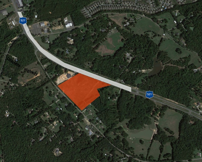
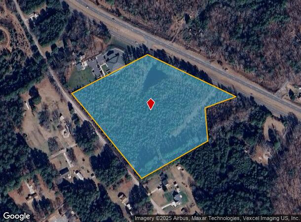
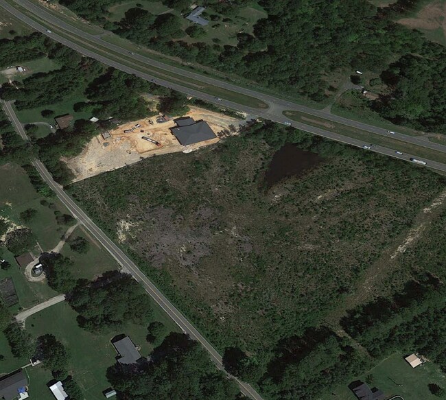
This Property Is For Sale
NEARBY LISTINGS FOR SALE OR LEASE
Property Detail
Charlotte Hwy
0016-00-047.00
Lancaster
Agriculturalland
South Carolina
X
9.61 AC
45057C0087E
Lancaster County
2024
Charlotte
2024
Charlotte-Concord-Gastonia, NC-SC
011002
DEMOGRAPHICS near Charlotte Hwy
1 Mile
3 Mile
5 Mile
2024 Total Population
3,856
26,978
61,994
2029 Population
4,676
32,518
72,673
Pop Growth 2024-2029
+ 21.27%
+ 20.54%
+ 17.23%
Average Age
48
47
42
2024 Total Households
1,702
10,954
22,439
HH Growth 2024-2029
+ 21.21%
+ 20.59%
+ 17.85%
Median Household Inc
$95,246
$102,449
$106,335
Avg Household Size
2.30
2.50
2.70
2024 Avg HH Vehicles
2.00
2.00
2.00
Median Home Value
$375,200
$368,093
$384,208
Median Year Built
2010
2010
2009
Nearby Places
- Restaurants
- Banks
- Shops
- Fitness
- Groceries
PUBLIC TRANSPORTATION
AIRPORT
Charlotte/Douglas International
DRIVE
WALK
Distance
Charlotte/Douglas International
40 min
24.3 mi
Freight Ports
North Charleston Terminal
DRIVE
WALK
Distance
North Charleston Terminal
212 min
180.6 mi
Nearby Properties
Address
Land Use
TOTAL SIZE
Lot Size
Zoning
Address
Land Use
TOTAL SIZE
Lot Size
Zoning
149,109 SF
21.87 AC
INS
Address
Land Use
TOTAL SIZE
Lot Size
Zoning
50,462 SF
15.68 AC
Address
Land Use
TOTAL SIZE
Lot Size
Zoning
95,726 SF
49.65 AC
INS
Address
Land Use
TOTAL SIZE
Lot Size
Zoning
40,516 SF
55.66 AC
INS
Address
Land Use
TOTAL SIZE
Lot Size
Zoning
1,200 SF
113.16 AC
R-40 UNION
Address
Land Use
TOTAL SIZE
Lot Size
Zoning
1,724 SF
43.33 AC
INS
Address
Land Use
TOTAL SIZE
Lot Size
Zoning
1,184 SF
38.39 AC
Address
Land Use
TOTAL SIZE
Lot Size
Zoning
15,440 SF
2.62 AC
INS
Address
Land Use
TOTAL SIZE
Lot Size
Zoning
61.22 AC
R-40 UNION
Address
Land Use
TOTAL SIZE
Lot Size
Zoning
467.55 AC
RUD
Address
Land Use
TOTAL SIZE
Lot Size
Zoning
7,258 SF
19 AC
PDD
Address
Land Use
TOTAL SIZE
Lot Size
Zoning
10,620 SF
2.68 AC
INS
Address
Land Use
TOTAL SIZE
Lot Size
Zoning
630 AC
RUD
Address
Land Use
TOTAL SIZE
Lot Size
Zoning
10,846 SF
10.07 AC
CU R-4 PRD
Address
Land Use
TOTAL SIZE
Lot Size
Zoning
2,244 SF
6.90 AC
INS
Address
Land Use
TOTAL SIZE
Lot Size
Zoning
2,726 SF
12.25 AC
INS
Address
Land Use
TOTAL SIZE
Lot Size
Zoning
146.15 AC
RN
Address
Land Use
TOTAL SIZE
Lot Size
Zoning
65 AC
INS
Address
Land Use
TOTAL SIZE
Lot Size
Zoning
3.51 AC
R-40 UNION
Address
Land Use
TOTAL SIZE
Lot Size
Zoning
8,895 SF
13.02 AC
LDR
Address
Land Use
TOTAL SIZE
Lot Size
Zoning
10,275 SF
2 AC
INS
Address
Land Use
TOTAL SIZE
Lot Size
Zoning
2,148 SF
21.60 AC
PDD
Address
Land Use
TOTAL SIZE
Lot Size
Zoning
38.57 AC
INS
Address
Land Use
TOTAL SIZE
Lot Size
Zoning
7 AC
INS
Address
Land Use
TOTAL SIZE
Lot Size
Zoning
2,878 SF
66.70 AC
PDD
Address
Land Use
TOTAL SIZE
Lot Size
Zoning
8,270 SF
5 AC
INS
Address
Land Use
TOTAL SIZE
Lot Size
Zoning
80,606 SF
5.08 AC
Address
Land Use
TOTAL SIZE
Lot Size
Zoning
7,900 SF
8.70 AC
INS
Address
Land Use
TOTAL SIZE
Lot Size
Zoning
2.50 AC
R-40 UNION
Address
Land Use
TOTAL SIZE
Lot Size
Zoning
0.25 AC
CU R-4 PRD
The World's #1 Commercial Real Estate Marketplace
Connect with us
© 2025 CoStar Group
The information above has been obtained from sources believed reliable. While we do not doubt its accuracy we have not verified it and make no guarantee, warranty or representation about it. It is your responsibility to independently confirm its accuracy and completeness. Any projections, opinions, assumptions, or estimates used are for example only and do not represent the current or future performance of the property. The value of this transaction to you depends on tax and other factors which should be evaluated by your tax, financial, and legal advisors. You and your advisors should conduct a careful, independent investigation of the property to determine to your satisfaction the suitability of the property for your needs.