Property Record
Charlotte Hwy, Fort Mill, SC 29707
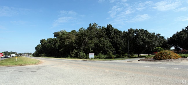
This Property Is For Sale
NEARBY LISTINGS FOR SALE OR LEASE
-
-
-
-
-
No Photo
-
-
-
View all Fort Mill listings for sale on LoopNet.com
Property Detail
Charlotte Hwy
Charlotte-Concord-Gastonia, NC-SC
Black
0008G-0A-003.00
Lancaster
Vacantlandnec
South Carolina
X
3
45057C0076E
0.71 AC
2024
Lancaster County
2024
Charlotte
011205
DEMOGRAPHICS near Charlotte Hwy
1 Mile
3 Mile
5 Mile
2024 Total Population
5,119
47,978
130,785
2029 Population
5,929
52,873
141,931
Pop Growth 2024-2029
+ 15.82%
+ 10.20%
+ 8.52%
Average Age
39
38
40
2024 Total Households
1,927
17,088
47,868
HH Growth 2024-2029
+ 16.19%
+ 10.56%
+ 8.78%
Median Household Inc
$141,863
$147,172
$137,440
Avg Household Size
2.60
2.80
2.70
2024 Avg HH Vehicles
2.00
2.00
2.00
Median Home Value
$565,898
$603,582
$585,692
Median Year Built
2010
2008
2005
Nearby Places
- Restaurants
- Banks
- Shops
- Fitness
- Groceries
PUBLIC TRANSPORTATION
AIRPORT
Charlotte/Douglas International
DRIVE
WALK
Distance
Charlotte/Douglas International
31 min
18.7 mi
Concord-Padgett Regional
DRIVE
WALK
Distance
Concord-Padgett Regional
50 min
40.0 mi
Freight Ports
North Charleston Terminal
DRIVE
WALK
Distance
North Charleston Terminal
215 min
188.6 mi
Nearby Properties
Address
Land Use
TOTAL SIZE
Lot Size
Zoning
Address
Land Use
TOTAL SIZE
Lot Size
Zoning
348,409 SF
26.08 AC
R17MFCD
Address
Land Use
TOTAL SIZE
Lot Size
Zoning
287,004 SF
14.52 AC
R3
Address
Land Use
TOTAL SIZE
Lot Size
Zoning
353,996 SF
58.49 AC
R3
Address
Land Use
TOTAL SIZE
Lot Size
Zoning
195,262 SF
4.56 AC
Address
Land Use
TOTAL SIZE
Lot Size
Zoning
211,609 SF
6.91 AC
UR2CD
Address
Land Use
TOTAL SIZE
Lot Size
Zoning
182,180 SF
7.31 AC
MX2
Address
Land Use
TOTAL SIZE
Lot Size
Zoning
137,210 SF
4.52 AC
Address
Land Use
TOTAL SIZE
Lot Size
Zoning
90,466 SF
105.72 AC
INST
Address
Land Use
TOTAL SIZE
Lot Size
Zoning
120,698 SF
5.18 AC
Address
Land Use
TOTAL SIZE
Lot Size
Zoning
74,000 SF
20.51 AC
O-1(CD)
Address
Land Use
TOTAL SIZE
Lot Size
Zoning
86,368 SF
11.28 AC
NS
Address
Land Use
TOTAL SIZE
Lot Size
Zoning
133,155 SF
5.57 AC
I-1(CD)
Address
Land Use
TOTAL SIZE
Lot Size
Zoning
3,948 SF
14.70 AC
MUDD-O
Address
Land Use
TOTAL SIZE
Lot Size
Zoning
74,604 SF
2.26 AC
Address
Land Use
TOTAL SIZE
Lot Size
Zoning
77,646 SF
13.89 AC
Address
Land Use
TOTAL SIZE
Lot Size
Zoning
53,352 SF
17.65 AC
INST
Address
Land Use
TOTAL SIZE
Lot Size
Zoning
228.10 AC
MX-1(INNOV
Address
Land Use
TOTAL SIZE
Lot Size
Zoning
80,614 SF
6.83 AC
MX-2
Address
Land Use
TOTAL SIZE
Lot Size
Zoning
93,956 SF
21.28 AC
R-40 MARVI
Address
Land Use
TOTAL SIZE
Lot Size
Zoning
108,195 SF
28.29 AC
INS
Address
Land Use
TOTAL SIZE
Lot Size
Zoning
3,187 SF
182.31 AC
R-3
Address
Land Use
TOTAL SIZE
Lot Size
Zoning
68,300 SF
10.11 AC
B1CD
Address
Land Use
TOTAL SIZE
Lot Size
Zoning
50,462 SF
15.68 AC
Address
Land Use
TOTAL SIZE
Lot Size
Zoning
29,816 SF
2.94 AC
MX-2
Address
Land Use
TOTAL SIZE
Lot Size
Zoning
95,726 SF
49.65 AC
INS
Address
Land Use
TOTAL SIZE
Lot Size
Zoning
3,150 SF
161.39 AC
MX-1(INNOV
Address
Land Use
TOTAL SIZE
Lot Size
Zoning
61,867 SF
3.98 AC
UR2CD
Address
Land Use
TOTAL SIZE
Lot Size
Zoning
51,633 SF
1.44 AC
UR2CD
Address
Land Use
TOTAL SIZE
Lot Size
Zoning
71,872 SF
2.37 AC
NS
Address
Land Use
TOTAL SIZE
Lot Size
Zoning
86,620 SF
1.55 AC
The World's #1 Commercial Real Estate Marketplace
Connect with us
© 2025 CoStar Group
The information above has been obtained from sources believed reliable. While we do not doubt its accuracy we have not verified it and make no guarantee, warranty or representation about it. It is your responsibility to independently confirm its accuracy and completeness. Any projections, opinions, assumptions, or estimates used are for example only and do not represent the current or future performance of the property. The value of this transaction to you depends on tax and other factors which should be evaluated by your tax, financial, and legal advisors. You and your advisors should conduct a careful, independent investigation of the property to determine to your satisfaction the suitability of the property for your needs.