Property Record
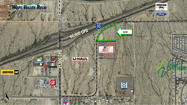
I-10 Freeway & Miller Rd, Buckeye, AZ 85326

NEARBY LISTINGS FOR SALE OR LEASE
Property Detail
I-10 Freeway & Miller Rd
504-25-013C
NW4 NE4 NW4 EX TH PT LY NLY OF TH FOL DESC LN BEG AT A PT ON N LN SD SEC 2813.08F E FR NW COR TH S 50F TH W 485F TH S 78D 45M W 419.27F TH S 67D 47 M W 900F TO PT OF ENDING SD LN EX P/F 11-0600936 DAF BEG SW COR P/F 08-0752206 TH N 284.59F TH N 67D 4
Residentialacreage
Maricopa
X
Arizona
04013C2115L
5.81 AC
2025
Southwest Outlying
2025
Phoenix
050615
Phoenix-Mesa-Scottsdale, AZ
DEMOGRAPHICS near I-10 Freeway & Miller Rd
1 Mile
3 Mile
5 Mile
2024 Total Population
2,582
30,753
61,864
2029 Population
2,865
33,694
67,865
Pop Growth 2024-2029
+ 10.96%
+ 9.56%
+ 9.70%
Average Age
34
35
34
2024 Total Households
796
9,286
18,533
HH Growth 2024-2029
+ 11.06%
+ 9.69%
+ 9.79%
Median Household Inc
$71,795
$79,073
$76,293
Avg Household Size
3.20
3.30
3.30
2024 Avg HH Vehicles
2.00
2.00
2.00
Median Home Value
$250,821
$274,054
$282,433
Median Year Built
2010
2007
2006
Nearby Places
Map Layers
Map Styles
 Street
 Aerial
- Restaurants
- Banks
- Shops
- Fitness
- Groceries
SALE & LEASE HISTORY
LISTING DATE
SALE/LEASE

Dec 29, 2016
For Sale
Nearby Properties
Address
Land Use
TOTAL SIZE
Lot Size
Zoning
Address
Land Use
TOTAL SIZE
Lot Size
Zoning
862,622 SF
75.39 AC
GC
Address
Land Use
TOTAL SIZE
Lot Size
Zoning
18.64 AC
Address
Land Use
TOTAL SIZE
Lot Size
Zoning
269,665 SF
54.66 AC
PC
Address
Land Use
TOTAL SIZE
Lot Size
Zoning
13.06 AC
Address
Land Use
TOTAL SIZE
Lot Size
Zoning
326,103 SF
21.54 AC
Address
Land Use
TOTAL SIZE
Lot Size
Zoning
217,965 SF
23.03 AC
PAD
Address
Land Use
TOTAL SIZE
Lot Size
Zoning
93,337 SF
15.37 AC
PC
Address
Land Use
TOTAL SIZE
Lot Size
Zoning
78,774 SF
7.57 AC
PUD
Address
Land Use
TOTAL SIZE
Lot Size
Zoning
108,818 SF
10.65 AC
C-C
Address
Land Use
TOTAL SIZE
Lot Size
Zoning
78,165 SF
15.81 AC
PUD
Address
Land Use
TOTAL SIZE
Lot Size
Zoning
858,000 SF
69.08 AC
GC
Address
Land Use
TOTAL SIZE
Lot Size
Zoning
138,134 SF
13.14 AC
PAD
Address
Land Use
TOTAL SIZE
Lot Size
Zoning
72,254 SF
13.66 AC
PAD
Address
Land Use
TOTAL SIZE
Lot Size
Zoning
3.34 AC
Address
Land Use
TOTAL SIZE
Lot Size
Zoning
75,026 SF
14.07 AC
PAD
Address
Land Use
TOTAL SIZE
Lot Size
Zoning
57,950 SF
9.89 AC
PAD
Address
Land Use
TOTAL SIZE
Lot Size
Zoning
85,712 SF
15.18 AC
PR
Address
Land Use
TOTAL SIZE
Lot Size
Zoning
102,640 SF
3.73 AC
PC
Address
Land Use
TOTAL SIZE
Lot Size
Zoning
40,104 SF
4.75 AC
PAD
Address
Land Use
TOTAL SIZE
Lot Size
Zoning
55,485 SF
2.10 AC
PC
Address
Land Use
TOTAL SIZE
Lot Size
Zoning
188,937 SF
20.87 AC
Address
Land Use
TOTAL SIZE
Lot Size
Zoning
50,445 SF
2.05 AC
PAD
Address
Land Use
TOTAL SIZE
Lot Size
Zoning
38,620 SF
20.87 AC
C-G
Address
Land Use
TOTAL SIZE
Lot Size
Zoning
48,556 SF
7.68 AC
Address
Land Use
TOTAL SIZE
Lot Size
Zoning
26,239 SF
6.26 AC
RR
Address
Land Use
TOTAL SIZE
Lot Size
Zoning
30,320 SF
13.81 AC
PAD
Address
Land Use
TOTAL SIZE
Lot Size
Zoning
106,305 SF
9.11 AC
C-G
Address
Land Use
TOTAL SIZE
Lot Size
Zoning
31,400 SF
8.42 AC
R-43
Address
Land Use
TOTAL SIZE
Lot Size
Zoning
58,500 SF
10.58 AC
C2
Address
Land Use
TOTAL SIZE
Lot Size
Zoning
29,836 SF
1.66 AC
PC
The World's #1 Commercial Real Estate Marketplace
Connect with us
© 2025 CoStar Group
The information above has been obtained from sources believed reliable. While we do not doubt its accuracy we have not verified it and make no guarantee, warranty or representation about it. It is your responsibility to independently confirm its accuracy and completeness. Any projections, opinions, assumptions, or estimates used are for example only and do not represent the current or future performance of the property. The value of this transaction to you depends on tax and other factors which should be evaluated by your tax, financial, and legal advisors. You and your advisors should conduct a careful, independent investigation of the property to determine to your satisfaction the suitability of the property for your needs.