Property Record
I-30 S South Opas S, Bryant, AR 72022
This Property Is For Sale
NEARBY LISTINGS FOR SALE OR LEASE
Property Detail
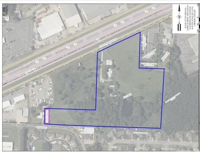
I-30 S South Opas S
Little Rock-North Little Rock-Conway, AR
PT SWSE 2018-022110
805-05005-002
Saline
Residentialacreage
Arkansas
2025
2.35 AC
2025
Saline County
010601
Little Rock/N Little Rock
DEMOGRAPHICS near I-30 S South Opas S
1 Mile
3 Mile
5 Mile
2024 Total Population
6,463
36,783
66,730
2029 Population
6,914
39,626
72,175
Pop Growth 2024-2029
+ 6.98%
+ 7.73%
+ 8.16%
Average Age
39
38
39
2024 Total Households
2,711
14,667
26,318
HH Growth 2024-2029
+ 7.05%
+ 7.81%
+ 8.27%
Median Household Inc
$61,534
$69,905
$69,973
Avg Household Size
2.30
2.50
2.50
2024 Avg HH Vehicles
2.00
2.00
2.00
Median Home Value
$249,852
$208,406
$196,032
Median Year Built
2005
1997
1994
Nearby Places
- Restaurants
- Banks
- Shops
- Fitness
- Groceries
PUBLIC TRANSPORTATION
AIRPORT
Bill and Hillary Clinton Ntl/Adams Field
DRIVE
WALK
Distance
Bill and Hillary Clinton Ntl/Adams Field
28 min
22.2 mi
Freight Ports
Port of Shreveport
DRIVE
WALK
Distance
Port of Shreveport
231 min
215.3 mi
Nearby Properties
Address
Land Use
TOTAL SIZE
Lot Size
Zoning
Address
Land Use
TOTAL SIZE
Lot Size
Zoning
32,067 SF
26.67 AC
Address
Land Use
TOTAL SIZE
Lot Size
Zoning
80,480 SF
33.40 AC
Address
Land Use
TOTAL SIZE
Lot Size
Zoning
91,459 SF
6.03 AC
Address
Land Use
TOTAL SIZE
Lot Size
Zoning
297,680 SF
16.96 AC
Address
Land Use
TOTAL SIZE
Lot Size
Zoning
28,150 SF
17.11 AC
Address
Land Use
TOTAL SIZE
Lot Size
Zoning
262,431 SF
23.01 AC
Address
Land Use
TOTAL SIZE
Lot Size
Zoning
175,840 SF
21.93 AC
Address
Land Use
TOTAL SIZE
Lot Size
Zoning
89,854 SF
37 AC
Address
Land Use
TOTAL SIZE
Lot Size
Zoning
121,010 SF
13.33 AC
Address
Land Use
TOTAL SIZE
Lot Size
Zoning
22,000 SF
20.76 AC
Address
Land Use
TOTAL SIZE
Lot Size
Zoning
138,752 SF
12.60 AC
Address
Land Use
TOTAL SIZE
Lot Size
Zoning
106,096 SF
9.46 AC
Address
Land Use
TOTAL SIZE
Lot Size
Zoning
36,979 SF
7.85 AC
Address
Land Use
TOTAL SIZE
Lot Size
Zoning
137,445 SF
28.75 AC
Address
Land Use
TOTAL SIZE
Lot Size
Zoning
98,702 SF
0.67 AC
Address
Land Use
TOTAL SIZE
Lot Size
Zoning
75,795 SF
9.39 AC
Address
Land Use
TOTAL SIZE
Lot Size
Zoning
128,225 SF
8.41 AC
Address
Land Use
TOTAL SIZE
Lot Size
Zoning
72,506 SF
4.44 AC
Address
Land Use
TOTAL SIZE
Lot Size
Zoning
19,208 SF
12 AC
Address
Land Use
TOTAL SIZE
Lot Size
Zoning
36,356 SF
5.45 AC
Address
Land Use
TOTAL SIZE
Lot Size
Zoning
90,200 SF
17.30 AC
Address
Land Use
TOTAL SIZE
Lot Size
Zoning
60,030 SF
6.51 AC
Address
Land Use
TOTAL SIZE
Lot Size
Zoning
43,055 SF
3.94 AC
Address
Land Use
TOTAL SIZE
Lot Size
Zoning
54,681 SF
1.88 AC
Address
Land Use
TOTAL SIZE
Lot Size
Zoning
44,776 SF
7 AC
Address
Land Use
TOTAL SIZE
Lot Size
Zoning
78,845 SF
15.44 AC
Address
Land Use
TOTAL SIZE
Lot Size
Zoning
27,288 SF
4.02 AC
Address
Land Use
TOTAL SIZE
Lot Size
Zoning
63,870 SF
7.97 AC
Address
Land Use
TOTAL SIZE
Lot Size
Zoning
44,100 SF
3.52 AC
Address
Land Use
TOTAL SIZE
Lot Size
Zoning
12,354 SF
6.35 AC
The World's #1 Commercial Real Estate Marketplace
Connect with us
© 2025 CoStar Group
The information above has been obtained from sources believed reliable. While we do not doubt its accuracy we have not verified it and make no guarantee, warranty or representation about it. It is your responsibility to independently confirm its accuracy and completeness. Any projections, opinions, assumptions, or estimates used are for example only and do not represent the current or future performance of the property. The value of this transaction to you depends on tax and other factors which should be evaluated by your tax, financial, and legal advisors. You and your advisors should conduct a careful, independent investigation of the property to determine to your satisfaction the suitability of the property for your needs.