Property Record
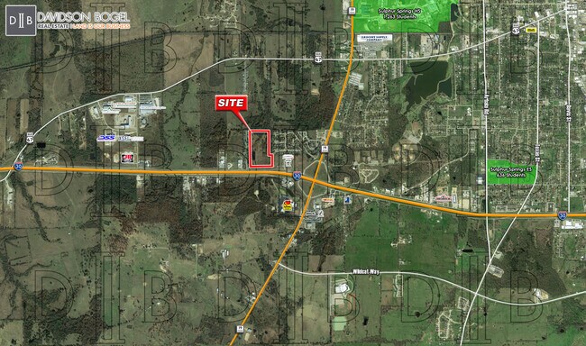
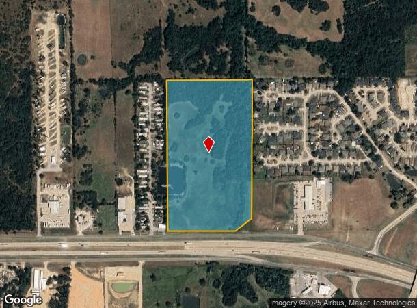
W Interstate 30, Sulphur Springs, TX 75482

Property Detail
W Interstate 30
Sulphur Springs, TX
ACRES: 27.574 LOT: 5 BLK: 216 TOWN: SULPHUR SPRINGS
R000007355
Hopkins
Ruralagriculturalresidence
Texas
A
5
48223C0325E
27.57 AC
2025
Texas East Area
2025
Other Market Areas
950500
NEARBY LISTINGS FOR SALE OR LEASE
DEMOGRAPHICS near W Interstate 30
1 mile
3 mile
5 mile
2024 Total Population
1,555
12,617
19,979
2029 Population
1,663
13,501
21,387
Pop Growth 2024-2029
+ 6.95%
+ 7.01%
+ 7.05%
Average Age
40
39
40
2024 Total Households
624
4,985
7,738
HH Growth 2024-2029
+ 7.05%
+ 7.02%
+ 7.11%
Median Household Inc
$57,410
$53,642
$54,294
Avg Household Size
2.50
2.50
2.50
2024 Avg HH Vehicles
2.00
2.00
2.00
Median Home Value
$166,139
$141,588
$155,984
Median Year Built
1992
1978
1979
Nearby Places
Map Layers
Map Styles
 Street
 Aerial
Transit
 Traffic
 Biking
Places
Listings with unknown addresses are not visible on the map
- Restaurants
- Banks
- Shops
- Fitness
- Groceries
SALE & LEASE HISTORY
LISTING DATE
SALE/LEASE

Mar 09, 2021
For Sale
Nearby Properties
Address
Land Use
TOTAL SIZE
Lot Size
Zoning
Address
Land Use
TOTAL SIZE
Lot Size
Zoning
224,723 SF
119.32 AC
Address
Land Use
TOTAL SIZE
Lot Size
Zoning
155,527 SF
52.41 AC
Address
Land Use
TOTAL SIZE
Lot Size
Zoning
81,323 SF
7.03 AC
Address
Land Use
TOTAL SIZE
Lot Size
Zoning
78,800 SF
12.24 AC
Address
Land Use
TOTAL SIZE
Lot Size
Zoning
177,678 SF
29.43 AC
Address
Land Use
TOTAL SIZE
Lot Size
Zoning
14,564 SF
66.18 AC
Address
Land Use
TOTAL SIZE
Lot Size
Zoning
9,639 SF
19.90 AC
Address
Land Use
TOTAL SIZE
Lot Size
Zoning
30,811 SF
31.66 AC
Address
Land Use
TOTAL SIZE
Lot Size
Zoning
10,816 SF
13.63 AC
Address
Land Use
TOTAL SIZE
Lot Size
Zoning
62,050 SF
7.13 AC
Address
Land Use
TOTAL SIZE
Lot Size
Zoning
40,200 SF
2.58 AC
Address
Land Use
TOTAL SIZE
Lot Size
Zoning
109,918 SF
11.55 AC
Address
Land Use
TOTAL SIZE
Lot Size
Zoning
101,085 SF
32.59 AC
Address
Land Use
TOTAL SIZE
Lot Size
Zoning
159,269 SF
48.78 AC
Address
Land Use
TOTAL SIZE
Lot Size
Zoning
35,585 SF
6.07 AC
Address
Land Use
TOTAL SIZE
Lot Size
Zoning
12.01 AC
Address
Land Use
TOTAL SIZE
Lot Size
Zoning
40,746 SF
3.24 AC
Address
Land Use
TOTAL SIZE
Lot Size
Zoning
49,038 SF
5.21 AC
Address
Land Use
TOTAL SIZE
Lot Size
Zoning
200 SF
887.32 AC
Address
Land Use
TOTAL SIZE
Lot Size
Zoning
36,580 SF
1.94 AC
Address
Land Use
TOTAL SIZE
Lot Size
Zoning
110,975 SF
11.40 AC
Address
Land Use
TOTAL SIZE
Lot Size
Zoning
18,920 SF
24.21 AC
Address
Land Use
TOTAL SIZE
Lot Size
Zoning
11,226 SF
9.68 AC
Address
Land Use
TOTAL SIZE
Lot Size
Zoning
12,106 SF
19.85 AC
Address
Land Use
TOTAL SIZE
Lot Size
Zoning
43,221 SF
2.50 AC
Address
Land Use
TOTAL SIZE
Lot Size
Zoning
49,289 SF
2.20 AC
Address
Land Use
TOTAL SIZE
Lot Size
Zoning
10.13 AC
Address
Land Use
TOTAL SIZE
Lot Size
Zoning
24,098 SF
Address
Land Use
TOTAL SIZE
Lot Size
Zoning
42,312 SF
2.28 AC
Address
Land Use
TOTAL SIZE
Lot Size
Zoning
48,909 SF
4.13 AC
The World's #1 Commercial Real Estate Marketplace
Connect with us
© 2026 CoStar Group
The information above has been obtained from sources believed reliable. While we do not doubt its accuracy we have not verified it and make no guarantee, warranty or representation about it. It is your responsibility to independently confirm its accuracy and completeness. Any projections, opinions, assumptions, or estimates used are for example only and do not represent the current or future performance of the property. The value of this transaction to you depends on tax and other factors which should be evaluated by your tax, financial, and legal advisors. You and your advisors should conduct a careful, independent investigation of the property to determine to your satisfaction the suitability of the property for your needs.