Property Record
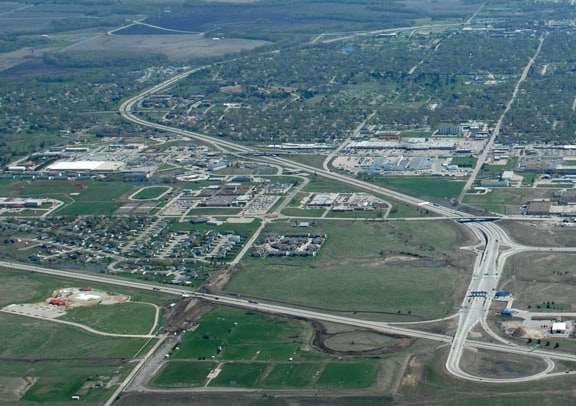
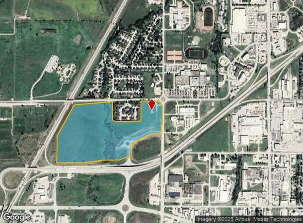
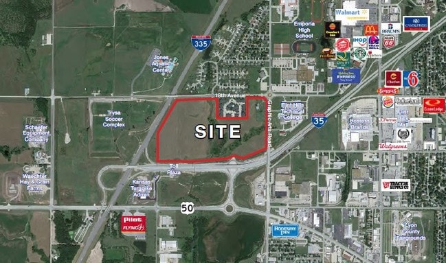
Graphic Arts Rd, Emporia, KS 66801
This Property Is For Sale
NEARBY LISTINGS FOR SALE OR LEASE
Property Detail
Graphic Arts Rd
Emporia, KS
Emporia Tract
193-07-0-00-00-001.00-0
S07, T19S, R11E, ACRES 64.2, NE1/4 EXC BEG 1480.35S & 1515.98W NE COR NE1/4 E421.95 NE104.41 SLY147.58 WLY470(S) N183.27(S)
Ranch
Lyon
AE
Kansas
20111C0236E
64.20 AC
2024
Kansas Area
2025
Other Market Areas
000300
DEMOGRAPHICS near Graphic Arts Rd
1 mile
3 mile
5 mile
2024 Total Population
2,030
17,571
25,516
2029 Population
1,988
17,377
25,251
Pop Growth 2024-2029
(2.07%)
(1.10%)
(1.04%)
Average Age
42
38
37
2024 Total Households
787
7,168
10,421
HH Growth 2024-2029
(2.29%)
(1.14%)
(1.07%)
Median Household Inc
$67,983
$50,069
$48,821
Avg Household Size
2.40
2.30
2.30
2024 Avg HH Vehicles
2.00
2.00
2.00
Median Home Value
$195,923
$136,147
$122,227
Median Year Built
1983
1968
1968
Nearby Places
Map Layers
Map Styles
 Street
 Aerial
Transit
 Traffic
 Biking
Places
Listings with unknown addresses are not visible on the map
- Restaurants
- Banks
- Shops
- Fitness
- Groceries
Nearby Properties
Address
Land Use
TOTAL SIZE
Lot Size
Zoning
Address
Land Use
TOTAL SIZE
Lot Size
Zoning
97,645 SF
116.32 AC
P
Address
Land Use
TOTAL SIZE
Lot Size
Zoning
174,562 SF
38 AC
P
Address
Land Use
TOTAL SIZE
Lot Size
Zoning
289,666 SF
38.08 AC
P
Address
Land Use
TOTAL SIZE
Lot Size
Zoning
91,154 SF
2.28 AC
R3
Address
Land Use
TOTAL SIZE
Lot Size
Zoning
60,239 SF
23.20 AC
P
Address
Land Use
TOTAL SIZE
Lot Size
Zoning
102,522 SF
1.12 AC
P
Address
Land Use
TOTAL SIZE
Lot Size
Zoning
224,765 SF
10.51 AC
Address
Land Use
TOTAL SIZE
Lot Size
Zoning
62,075 SF
17.32 AC
Address
Land Use
TOTAL SIZE
Lot Size
Zoning
60,239 SF
11.80 AC
P
Address
Land Use
TOTAL SIZE
Lot Size
Zoning
36,648 SF
79.21 AC
P
Address
Land Use
TOTAL SIZE
Lot Size
Zoning
5,237 SF
41.81 AC
P
Address
Land Use
TOTAL SIZE
Lot Size
Zoning
10,811 SF
39.60 AC
P
Address
Land Use
TOTAL SIZE
Lot Size
Zoning
98,648 SF
16.35 AC
R3
Address
Land Use
TOTAL SIZE
Lot Size
Zoning
11,743 SF
4.63 AC
P
Address
Land Use
TOTAL SIZE
Lot Size
Zoning
58,193 SF
7.90 AC
P
Address
Land Use
TOTAL SIZE
Lot Size
Zoning
34,403 SF
1.12 AC
P
Address
Land Use
TOTAL SIZE
Lot Size
Zoning
28,336 SF
0.37 AC
C4
Address
Land Use
TOTAL SIZE
Lot Size
Zoning
44,449 SF
3.90 AC
P
Address
Land Use
TOTAL SIZE
Lot Size
Zoning
23,316 SF
0.45 AC
R3
Address
Land Use
TOTAL SIZE
Lot Size
Zoning
63,004 SF
2.25 AC
P
Address
Land Use
TOTAL SIZE
Lot Size
Zoning
393,475 SF
46.76 AC
I2
Address
Land Use
TOTAL SIZE
Lot Size
Zoning
13,600 SF
6.86 AC
R1
Address
Land Use
TOTAL SIZE
Lot Size
Zoning
186,987 SF
14.10 AC
C2
Address
Land Use
TOTAL SIZE
Lot Size
Zoning
11,641 SF
2.59 AC
R1
Address
Land Use
TOTAL SIZE
Lot Size
Zoning
2,776 SF
77.91 AC
P
Address
Land Use
TOTAL SIZE
Lot Size
Zoning
35,710 SF
2.57 AC
P
Address
Land Use
TOTAL SIZE
Lot Size
Zoning
32,799 SF
0.90 AC
C4
Address
Land Use
TOTAL SIZE
Lot Size
Zoning
9,764 SF
1.08 AC
R3
Address
Land Use
TOTAL SIZE
Lot Size
Zoning
304,382 SF
36.26 AC
I1
Address
Land Use
TOTAL SIZE
Lot Size
Zoning
19,568 SF
0.42 AC
C4
The World's #1 Commercial Real Estate Marketplace
Connect with us
© 2026 CoStar Group
The information above has been obtained from sources believed reliable. While we do not doubt its accuracy we have not verified it and make no guarantee, warranty or representation about it. It is your responsibility to independently confirm its accuracy and completeness. Any projections, opinions, assumptions, or estimates used are for example only and do not represent the current or future performance of the property. The value of this transaction to you depends on tax and other factors which should be evaluated by your tax, financial, and legal advisors. You and your advisors should conduct a careful, independent investigation of the property to determine to your satisfaction the suitability of the property for your needs.