Property Record
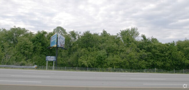
I-64 Rte, Hampton, VA 23669

Property Detail
I-64 Rte
Virginia Beach-Chesapeake-Norfolk, VA-NC
Roseland
13004181
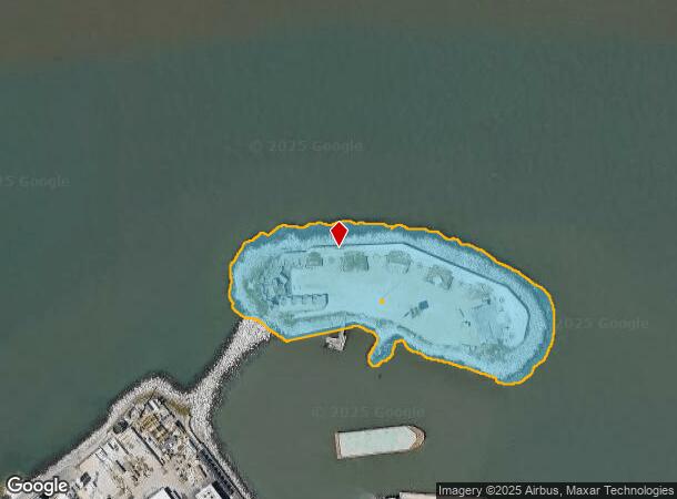
FORT WOOL
Stateproperty
Hampton City
AE
Virginia
5101040006H
15 AC
0
Fox Hill
2025
Hampton Roads
010602
NEARBY LISTINGS FOR SALE OR LEASE
-
-
View all Hampton listings for sale on LoopNet.com
DEMOGRAPHICS near I-64 Rte
1 mile
3 mile
5 mile
2024 Total Population
6,475
53,410
115,911
2029 Population
6,675
54,630
118,153
Pop Growth 2024-2029
+ 3.09%
+ 2.28%
+ 1.93%
Average Age
33
39
39
2024 Total Households
2,006
21,864
48,392
HH Growth 2024-2029
+ 3.94%
+ 2.35%
+ 2.02%
Median Household Inc
$44,885
$53,947
$56,111
Avg Household Size
2.20
2.30
2.30
2024 Avg HH Vehicles
1.00
2.00
2.00
Median Home Value
$158,389
$197,525
$211,318
Median Year Built
1972
1966
1970
Nearby Places
Map Layers
Map Styles
 Street
 Aerial
Transit
 Traffic
 Biking
Places
Listings with unknown addresses are not visible on the map
- Restaurants
- Banks
- Shops
- Fitness
- Groceries
PUBLIC TRANSPORTATION
AIRPORT
Norfolk International
Drive
Walk
Distance
Norfolk International
26 min
16.5 mi
Newport News/Williamsburg International
Drive
Walk
Distance
Newport News/Williamsburg International
25 min
17.2 mi
Freight Ports
Virginia Port Authority - Norfolk
Drive
Walk
Distance
Virginia Port Authority - Norfolk
27 min
15.3 mi
Nearby Properties
Address
Land Use
TOTAL SIZE
Lot Size
Zoning
Address
Land Use
TOTAL SIZE
Lot Size
Zoning
1 SF
92.67 AC
5 R-13 ONE
Address
Land Use
TOTAL SIZE
Lot Size
Zoning
83.50 AC
5 R-13 ONE
Address
Land Use
TOTAL SIZE
Lot Size
Zoning
7,644 SF
322.21 AC
19 PO-1 GE
Address
Land Use
TOTAL SIZE
Lot Size
Zoning
4.99 AC
47 PH-2 PH
Address
Land Use
TOTAL SIZE
Lot Size
Zoning
68.02 AC
Address
Land Use
TOTAL SIZE
Lot Size
Zoning
2,106 SF
191.59 AC
42 FM-1 FO
Address
Land Use
TOTAL SIZE
Lot Size
Zoning
204,803 SF
4.97 AC
43 FM-2 FO
Address
Land Use
TOTAL SIZE
Lot Size
Zoning
122,256 SF
4.80 AC
11 MD-4 MU
Address
Land Use
TOTAL SIZE
Lot Size
Zoning
808 SF
112.03 AC
19 PO-1 GE
Address
Land Use
TOTAL SIZE
Lot Size
Zoning
2,204 SF
90.11 AC
19 PO-1 GE
Address
Land Use
TOTAL SIZE
Lot Size
Zoning
52,420 SF
14.68 AC
6 R-11 ONE
Address
Land Use
TOTAL SIZE
Lot Size
Zoning
109,326 SF
5.84 AC
7 R-9 ONE
Address
Land Use
TOTAL SIZE
Lot Size
Zoning
53,229 SF
6.81 AC
IN1
Address
Land Use
TOTAL SIZE
Lot Size
Zoning
6,000 SF
19 PO-1 GE
Address
Land Use
TOTAL SIZE
Lot Size
Zoning
3,060 SF
1.50 AC
5 R-13 ONE
Address
Land Use
TOTAL SIZE
Lot Size
Zoning
33,594 SF
4.39 AC
6 R-11 ONE
Address
Land Use
TOTAL SIZE
Lot Size
Zoning
6,150 SF
8.07 AC
PDRSPECTR
Address
Land Use
TOTAL SIZE
Lot Size
Zoning
13,265 SF
2.44 AC
14 C-2 LIM
Address
Land Use
TOTAL SIZE
Lot Size
Zoning
11,280 SF
4.30 AC
14 C-2 LIM
Address
Land Use
TOTAL SIZE
Lot Size
Zoning
41,050 SF
4.78 AC
48 PH-3 PH
Address
Land Use
TOTAL SIZE
Lot Size
Zoning
4,704 SF
0.86 AC
R12
Address
Land Use
TOTAL SIZE
Lot Size
Zoning
49,764 SF
2.87 AC
9 R-M MULT
Address
Land Use
TOTAL SIZE
Lot Size
Zoning
3,496 SF
0.99 AC
C2
Address
Land Use
TOTAL SIZE
Lot Size
Zoning
5.80 AC
14 C-2 LIM
Address
Land Use
TOTAL SIZE
Lot Size
Zoning
21,118 SF
1.43 AC
46 PH-1 PH
Address
Land Use
TOTAL SIZE
Lot Size
Zoning
454 SF
1.02 AC
43 FM-2 FO
Address
Land Use
TOTAL SIZE
Lot Size
Zoning
48,269 SF
2.66 AC
R12
Address
Land Use
TOTAL SIZE
Lot Size
Zoning
Address
Land Use
TOTAL SIZE
Lot Size
Zoning
7,065 SF
8.68 AC
19 PO-1 GE
Address
Land Use
TOTAL SIZE
Lot Size
Zoning
25,478 SF
0.98 AC
C2
The World's #1 Commercial Real Estate Marketplace
Connect with us
© 2026 CoStar Group
The information above has been obtained from sources believed reliable. While we do not doubt its accuracy we have not verified it and make no guarantee, warranty or representation about it. It is your responsibility to independently confirm its accuracy and completeness. Any projections, opinions, assumptions, or estimates used are for example only and do not represent the current or future performance of the property. The value of this transaction to you depends on tax and other factors which should be evaluated by your tax, financial, and legal advisors. You and your advisors should conduct a careful, independent investigation of the property to determine to your satisfaction the suitability of the property for your needs.