Property Record
I-65 Service Rd N, Creola, AL 36525

NEARBY LISTINGS FOR SALE OR LEASE
Property Detail
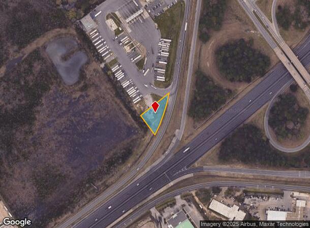
I-65 Service Rd N
Mobile, AL
Owens Div
22-10-44-0-014-009
THAT PORT OF LOT 17 R1W OWENS DIV OF ST LOUIS TRT DESC AS FOLL: BEG AT NW COR OF LOT 17 R1W OWENS DIV OF ST LOUIS TRT SD PT
Vacantlandnec
Mobile
X
Alabama
01097C0551L
17
2025
0.44 AC
2025
Prichard/Saraland
005702
Mobile
DEMOGRAPHICS near I-65 Service Rd N
1 Mile
3 Mile
5 Mile
2024 Total Population
6,385
47,898
105,366
2029 Population
6,507
48,612
105,895
Pop Growth 2024-2029
+ 1.91%
+ 1.49%
+ 0.50%
Average Age
40
41
40
2024 Total Households
2,542
18,972
42,909
HH Growth 2024-2029
+ 1.97%
+ 1.60%
+ 0.54%
Median Household Inc
$33,134
$34,162
$41,385
Avg Household Size
2.40
2.40
2.30
2024 Avg HH Vehicles
2.00
2.00
2.00
Median Home Value
$62,009
$74,697
$122,624
Median Year Built
1971
1967
1966
Nearby Places
Map Layers
Map Styles
 Street
 Aerial
- Restaurants
- Banks
- Shops
- Fitness
- Groceries
PUBLIC TRANSPORTATION
AIRPORT
Mobile International
DRIVE
WALK
Distance
Mobile International
17 min
12.3 mi
Mobile Regional
DRIVE
WALK
Distance
Mobile Regional
25 min
13.4 mi
Freight Ports
Port of Mobile
DRIVE
WALK
Distance
Port of Mobile
9 min
7.0 mi
SALE & LEASE HISTORY
LISTING DATE
SALE/LEASE

Sep 26, 2016
For Lease
Nearby Properties
Address
Land Use
TOTAL SIZE
Lot Size
Zoning
Address
Land Use
TOTAL SIZE
Lot Size
Zoning
141,209 SF
10.20 AC
Address
Land Use
TOTAL SIZE
Lot Size
Zoning
91,391 SF
14.93 AC
Address
Land Use
TOTAL SIZE
Lot Size
Zoning
103,308 SF
34 AC
Address
Land Use
TOTAL SIZE
Lot Size
Zoning
15,960 SF
11.06 AC
Address
Land Use
TOTAL SIZE
Lot Size
Zoning
5,553 SF
40.77 AC
Address
Land Use
TOTAL SIZE
Lot Size
Zoning
97,443 SF
98.83 AC
Address
Land Use
TOTAL SIZE
Lot Size
Zoning
37,209 SF
8.75 AC
Address
Land Use
TOTAL SIZE
Lot Size
Zoning
131,516 SF
15 AC
Address
Land Use
TOTAL SIZE
Lot Size
Zoning
53,850 SF
12 AC
Address
Land Use
TOTAL SIZE
Lot Size
Zoning
87,532 SF
17 AC
Address
Land Use
TOTAL SIZE
Lot Size
Zoning
66,025 SF
9.70 AC
Address
Land Use
TOTAL SIZE
Lot Size
Zoning
94,787 SF
18 AC
Address
Land Use
TOTAL SIZE
Lot Size
Zoning
12,520 SF
5.92 AC
Address
Land Use
TOTAL SIZE
Lot Size
Zoning
69,338 SF
8.23 AC
Address
Land Use
TOTAL SIZE
Lot Size
Zoning
41,928 SF
29.40 AC
Address
Land Use
TOTAL SIZE
Lot Size
Zoning
143,623 SF
11.94 AC
Address
Land Use
TOTAL SIZE
Lot Size
Zoning
101,578 SF
32 AC
Address
Land Use
TOTAL SIZE
Lot Size
Zoning
89,556 SF
18 AC
Address
Land Use
TOTAL SIZE
Lot Size
Zoning
58,789 SF
17 AC
Address
Land Use
TOTAL SIZE
Lot Size
Zoning
47,388 SF
9.75 AC
Address
Land Use
TOTAL SIZE
Lot Size
Zoning
49,528 SF
8.70 AC
Address
Land Use
TOTAL SIZE
Lot Size
Zoning
64,452 SF
18.79 AC
Address
Land Use
TOTAL SIZE
Lot Size
Zoning
12,848 SF
8.20 AC
Address
Land Use
TOTAL SIZE
Lot Size
Zoning
58,828 SF
15.08 AC
Address
Land Use
TOTAL SIZE
Lot Size
Zoning
107,965 SF
8.14 AC
Address
Land Use
TOTAL SIZE
Lot Size
Zoning
58,624 SF
8.30 AC
Address
Land Use
TOTAL SIZE
Lot Size
Zoning
74,538 SF
4.48 AC
Address
Land Use
TOTAL SIZE
Lot Size
Zoning
83,404 SF
10 AC
Address
Land Use
TOTAL SIZE
Lot Size
Zoning
17,300 SF
7.17 AC
Address
Land Use
TOTAL SIZE
Lot Size
Zoning
84,844 SF
3.66 AC
The World's #1 Commercial Real Estate Marketplace
Connect with us
© 2026 CoStar Group
The information above has been obtained from sources believed reliable. While we do not doubt its accuracy we have not verified it and make no guarantee, warranty or representation about it. It is your responsibility to independently confirm its accuracy and completeness. Any projections, opinions, assumptions, or estimates used are for example only and do not represent the current or future performance of the property. The value of this transaction to you depends on tax and other factors which should be evaluated by your tax, financial, and legal advisors. You and your advisors should conduct a careful, independent investigation of the property to determine to your satisfaction the suitability of the property for your needs.