Property Record
850 E Chapelgate Dr, Fairborn, OH 45324
NEARBY LISTINGS FOR SALE OR LEASE
Property Detail
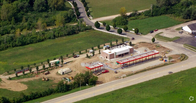
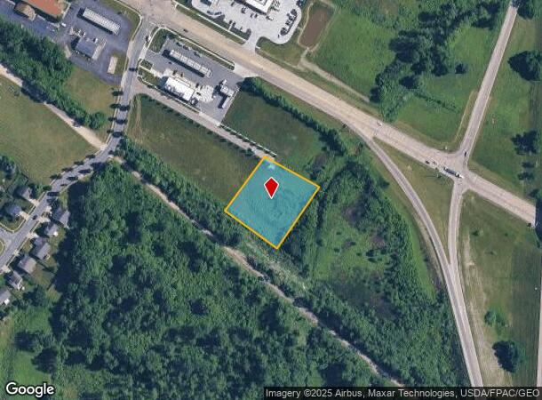
850 E Chapelgate Dr
Dayton, OH
Xenia
A02-0001-0039-0-0007-00
SR 235 & CHAPELGATE DR REPLAT LOT 9720 1.1802AC CHAPELGATE DR
Commercialacreage
Greene
X
Ohio
39057C0010D
9720
2024
1.18 AC
2024
East Dayton
200600
Cincinnati/Dayton
12,600 SF
DEMOGRAPHICS near 850 E Chapelgate Dr
1 Mile
3 Mile
5 Mile
2024 Total Population
7,207
33,005
65,791
2029 Population
7,388
33,943
67,525
Pop Growth 2024-2029
+ 2.51%
+ 2.84%
+ 2.64%
Average Age
39
40
39
2024 Total Households
3,030
14,698
28,384
HH Growth 2024-2029
+ 2.48%
+ 2.88%
+ 2.78%
Median Household Inc
$60,692
$61,678
$66,441
Avg Household Size
2.30
2.20
2.20
2024 Avg HH Vehicles
2.00
2.00
2.00
Median Home Value
$121,101
$147,900
$173,275
Median Year Built
1955
1966
1977
Nearby Places
- Restaurants
- Banks
- Shops
- Fitness
- Groceries
PUBLIC TRANSPORTATION
AIRPORT
James M Cox Dayton International
DRIVE
WALK
Distance
James M Cox Dayton International
27 min
19.9 mi
Freight Ports
Port of Toledo
DRIVE
WALK
Distance
Port of Toledo
186 min
160.1 mi
Nearby Properties
Address
Land Use
TOTAL SIZE
Lot Size
Zoning
Address
Land Use
TOTAL SIZE
Lot Size
Zoning
101,768 SF
22.02 AC
B1
Address
Land Use
TOTAL SIZE
Lot Size
Zoning
57,816 SF
9.15 AC
PD1
Address
Land Use
TOTAL SIZE
Lot Size
Zoning
594,070 SF
43.95 AC
AG
Address
Land Use
TOTAL SIZE
Lot Size
Zoning
45,204 SF
14.92 AC
PD1
Address
Land Use
TOTAL SIZE
Lot Size
Zoning
46,802 SF
25.30 AC
R3
Address
Land Use
TOTAL SIZE
Lot Size
Zoning
4,494 SF
23.15 AC
R1
Address
Land Use
TOTAL SIZE
Lot Size
Zoning
163,780 SF
36.93 AC
PARK
Address
Land Use
TOTAL SIZE
Lot Size
Zoning
278,290 SF
18.87 AC
AG
Address
Land Use
TOTAL SIZE
Lot Size
Zoning
7,772 SF
8.52 AC
R3
Address
Land Use
TOTAL SIZE
Lot Size
Zoning
14,496 SF
0.64 AC
2
Address
Land Use
TOTAL SIZE
Lot Size
Zoning
46,656 SF
10.35 AC
PD1
Address
Land Use
TOTAL SIZE
Lot Size
Zoning
261,152 SF
15.63 AC
B3
Address
Land Use
TOTAL SIZE
Lot Size
Zoning
51,279 SF
2.58 AC
PD1
Address
Land Use
TOTAL SIZE
Lot Size
Zoning
24,512 SF
6.73 AC
PD1
Address
Land Use
TOTAL SIZE
Lot Size
Zoning
24,522 SF
8.46 AC
R3
Address
Land Use
TOTAL SIZE
Lot Size
Zoning
46,005 SF
9.33 AC
PD4
Address
Land Use
TOTAL SIZE
Lot Size
Zoning
17,600 SF
16.43 AC
Address
Land Use
TOTAL SIZE
Lot Size
Zoning
24,512 SF
5.75 AC
PD1
Address
Land Use
TOTAL SIZE
Lot Size
Zoning
38,324 SF
2.77 AC
R4
Address
Land Use
TOTAL SIZE
Lot Size
Zoning
3,456 SF
5.66 AC
PD1
Address
Land Use
TOTAL SIZE
Lot Size
Zoning
31,338 SF
0.25 AC
B2
Address
Land Use
TOTAL SIZE
Lot Size
Zoning
76,636 SF
7.40 AC
R4
Address
Land Use
TOTAL SIZE
Lot Size
Zoning
101,824 SF
6.13 AC
R4
Address
Land Use
TOTAL SIZE
Lot Size
Zoning
11,176 SF
9.03 AC
Address
Land Use
TOTAL SIZE
Lot Size
Zoning
11,631 SF
2.44 AC
B3
Address
Land Use
TOTAL SIZE
Lot Size
Zoning
23,759 SF
25.60 AC
PARK
Address
Land Use
TOTAL SIZE
Lot Size
Zoning
740 SF
6.90 AC
Address
Land Use
TOTAL SIZE
Lot Size
Zoning
53.70 AC
PD2
Address
Land Use
TOTAL SIZE
Lot Size
Zoning
121,316 SF
20.43 AC
AG
Address
Land Use
TOTAL SIZE
Lot Size
Zoning
93,733 SF
7.83 AC
I-R
The World's #1 Commercial Real Estate Marketplace
Connect with us
© 2025 CoStar Group
The information above has been obtained from sources believed reliable. While we do not doubt its accuracy we have not verified it and make no guarantee, warranty or representation about it. It is your responsibility to independently confirm its accuracy and completeness. Any projections, opinions, assumptions, or estimates used are for example only and do not represent the current or future performance of the property. The value of this transaction to you depends on tax and other factors which should be evaluated by your tax, financial, and legal advisors. You and your advisors should conduct a careful, independent investigation of the property to determine to your satisfaction the suitability of the property for your needs.