Property Record
720 N 118Th St, Bonner Springs, KS 66012
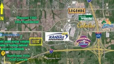
NEARBY LISTINGS FOR SALE OR LEASE
Property Detail
720 N 118Th St
953000
SEC-09 TWP-11 RNG-23, S9, T11, R23, ACRES 82.950000, 227B S1/2 NE1/4 LS E 20FT LS: BEG 20FT W OF NE COR S1/2 NE1/4; S 115.68FT, NLY CUR RT-117.77FT, E 21.45FT TO POB CONTG 79.4AC M/L
Sfr
Wyandotte
X
Kansas
20209C0130D
79.76 AC
2024
Kansas City KS
2024
Kansas City
044807
Kansas City, MO-KS
1,312 SF
DEMOGRAPHICS near 720 N 118Th St
1 Mile
3 Mile
5 Mile
2024 Total Population
81
10,527
43,983
2029 Population
79
10,175
43,230
Pop Growth 2024-2029
(2.47%)
(3.34%)
(1.71%)
Average Age
42
40
40
2024 Total Households
33
4,243
16,226
HH Growth 2024-2029
(3.03%)
(3.42%)
(1.89%)
Median Household Inc
$101,562
$98,506
$94,531
Avg Household Size
2.40
2.40
2.60
2024 Avg HH Vehicles
3.00
2.00
2.00
Median Home Value
$285,713
$264,761
$250,546
Median Year Built
1987
2001
1990
Nearby Places
Map Layers
Map Styles
 Street
 Aerial
- Restaurants
- Banks
- Shops
- Fitness
- Groceries
PUBLIC TRANSPORTATION
AIRPORT
Kansas City International
DRIVE
WALK
Distance
Kansas City International
32 min
25.0 mi
Freight Ports
Tulsa Port Of Catoosa
DRIVE
WALK
Distance
Tulsa Port Of Catoosa
270 min
240.5 mi
Nearby Properties
Address
Land Use
TOTAL SIZE
Lot Size
Zoning
Address
Land Use
TOTAL SIZE
Lot Size
Zoning
466.24 AC
Address
Land Use
TOTAL SIZE
Lot Size
Zoning
103,299 SF
13.41 AC
Address
Land Use
TOTAL SIZE
Lot Size
Zoning
122,784 SF
13.05 AC
Address
Land Use
TOTAL SIZE
Lot Size
Zoning
700,029 SF
50.11 AC
Address
Land Use
TOTAL SIZE
Lot Size
Zoning
176.36 AC
Address
Land Use
TOTAL SIZE
Lot Size
Zoning
134,870 SF
73.61 AC
Address
Land Use
TOTAL SIZE
Lot Size
Zoning
75,027 SF
13.51 AC
Address
Land Use
TOTAL SIZE
Lot Size
Zoning
268,951 SF
63.35 AC
Address
Land Use
TOTAL SIZE
Lot Size
Zoning
1,099,964 SF
115.80 AC
Address
Land Use
TOTAL SIZE
Lot Size
Zoning
16,603 SF
133.44 AC
Address
Land Use
TOTAL SIZE
Lot Size
Zoning
66.54 AC
Address
Land Use
TOTAL SIZE
Lot Size
Zoning
186,293 SF
63.45 AC
Address
Land Use
TOTAL SIZE
Lot Size
Zoning
96,144 SF
38.53 AC
Address
Land Use
TOTAL SIZE
Lot Size
Zoning
95,844 SF
3.91 AC
Address
Land Use
TOTAL SIZE
Lot Size
Zoning
28,210 SF
317.17 AC
Address
Land Use
TOTAL SIZE
Lot Size
Zoning
40,016 SF
5.20 AC
Address
Land Use
TOTAL SIZE
Lot Size
Zoning
116,455 SF
16.49 AC
Address
Land Use
TOTAL SIZE
Lot Size
Zoning
58,897 SF
140.44 AC
BA1
Address
Land Use
TOTAL SIZE
Lot Size
Zoning
118,146 SF
19.85 AC
WR1B
Address
Land Use
TOTAL SIZE
Lot Size
Zoning
146,336 SF
115.81 AC
A1
Address
Land Use
TOTAL SIZE
Lot Size
Zoning
1,036,732 SF
25.08 AC
KC1
Address
Land Use
TOTAL SIZE
Lot Size
Zoning
69,406 SF
29.75 AC
Address
Land Use
TOTAL SIZE
Lot Size
Zoning
26,738 SF
82.01 AC
Address
Land Use
TOTAL SIZE
Lot Size
Zoning
13,024 SF
140.94 AC
Address
Land Use
TOTAL SIZE
Lot Size
Zoning
1,036,732 SF
45.64 AC
KC1
Address
Land Use
TOTAL SIZE
Lot Size
Zoning
24,933 SF
17.16 AC
KAG
Address
Land Use
TOTAL SIZE
Lot Size
Zoning
86,176 SF
49.23 AC
KAG
Address
Land Use
TOTAL SIZE
Lot Size
Zoning
Address
Land Use
TOTAL SIZE
Lot Size
Zoning
197,528 SF
23.71 AC
Address
Land Use
TOTAL SIZE
Lot Size
Zoning
6,380 SF
296.16 AC
BA1
The World's #1 Commercial Real Estate Marketplace
Connect with us
© 2025 CoStar Group
The information above has been obtained from sources believed reliable. While we do not doubt its accuracy we have not verified it and make no guarantee, warranty or representation about it. It is your responsibility to independently confirm its accuracy and completeness. Any projections, opinions, assumptions, or estimates used are for example only and do not represent the current or future performance of the property. The value of this transaction to you depends on tax and other factors which should be evaluated by your tax, financial, and legal advisors. You and your advisors should conduct a careful, independent investigation of the property to determine to your satisfaction the suitability of the property for your needs.