Property Record
I35, Corinth, TX 76210


Property Detail
I35
Dallas-Fort Worth-Arlington, TX
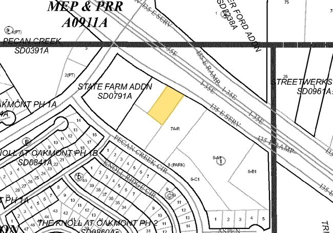
PECAN CREEK BLK 1 LOT 7A (NE MID PT)(PT)
R116932
DENTON
Commercialacreage
Texas
B and X Area of moderate flood hazard, usually the area between the limits of the 100-year and 500-year floods.
7a
2024
0.59 AC
2025
Denton
021417
Dallas/Ft Worth
NEARBY LISTINGS FOR SALE OR LEASE
DEMOGRAPHICS near I35
1 mile
3 mile
5 mile
2024 Total Population
10,158
73,333
147,129
2029 Population
11,236
81,968
164,865
Pop Growth 2024-2029
+ 10.61%
+ 11.78%
+ 12.05%
Average Age
39
39
38
2024 Total Households
3,575
25,938
53,867
HH Growth 2024-2029
+ 10.85%
+ 12.14%
+ 12.40%
Median Household Inc
$121,428
$106,072
$89,831
Avg Household Size
2.80
2.80
2.70
2024 Avg HH Vehicles
2.00
2.00
2.00
Median Home Value
$409,297
$398,089
$410,180
Median Year Built
2003
2003
2001
Nearby Places
Map Layers
Map Styles
 Street
 Aerial
Transit
 Traffic
 Biking
Places
Listings with unknown addresses are not visible on the map
- Restaurants
- Banks
- Shops
- Fitness
- Groceries
PUBLIC TRANSPORTATION
COMMUTER RAIL
Drive
Walk
Distance
7 min
2.7 mi
Drive
Walk
Distance
11 min
5.9 mi
AIRPORT
Dallas-Fort Worth International
Drive
Walk
Distance
Dallas-Fort Worth International
28 min
21.3 mi
Dallas Love Field
Drive
Walk
Distance
Dallas Love Field
40 min
30.3 mi
SALE & LEASE HISTORY
LISTING DATE
SALE/LEASE

Sep 24, 2016
For Sale
Nearby Properties
Address
Land Use
TOTAL SIZE
Lot Size
Zoning
Address
Land Use
TOTAL SIZE
Lot Size
Zoning
394,618 SF
12.29 AC
Address
Land Use
TOTAL SIZE
Lot Size
Zoning
387,383 SF
27.58 AC
Address
Land Use
TOTAL SIZE
Lot Size
Zoning
386,056 SF
81.56 AC
Address
Land Use
TOTAL SIZE
Lot Size
Zoning
310,952 SF
56.11 AC
Address
Land Use
TOTAL SIZE
Lot Size
Zoning
184,710 SF
16.82 AC
Address
Land Use
TOTAL SIZE
Lot Size
Zoning
310,772 SF
11.77 AC
Address
Land Use
TOTAL SIZE
Lot Size
Zoning
278,316 SF
17.81 AC
30G
Address
Land Use
TOTAL SIZE
Lot Size
Zoning
360,000 SF
24.34 AC
Address
Land Use
TOTAL SIZE
Lot Size
Zoning
294,021 SF
30.81 AC
Address
Land Use
TOTAL SIZE
Lot Size
Zoning
246,535 SF
53.67 AC
Address
Land Use
TOTAL SIZE
Lot Size
Zoning
208,582 SF
8.58 AC
Address
Land Use
TOTAL SIZE
Lot Size
Zoning
191,512 SF
8.04 AC
Address
Land Use
TOTAL SIZE
Lot Size
Zoning
337,537 SF
8.83 AC
Address
Land Use
TOTAL SIZE
Lot Size
Zoning
243,397 SF
14.43 AC
Address
Land Use
TOTAL SIZE
Lot Size
Zoning
226,040 SF
19.51 AC
Address
Land Use
TOTAL SIZE
Lot Size
Zoning
229,968 SF
6.93 AC
Address
Land Use
TOTAL SIZE
Lot Size
Zoning
232,942 SF
12.58 AC
30G
Address
Land Use
TOTAL SIZE
Lot Size
Zoning
282,217 SF
18.64 AC
8G
Address
Land Use
TOTAL SIZE
Lot Size
Zoning
210,801 SF
6.14 AC
Address
Land Use
TOTAL SIZE
Lot Size
Zoning
176,838 SF
15.64 AC
Address
Land Use
TOTAL SIZE
Lot Size
Zoning
221,051 SF
19.24 AC
Address
Land Use
TOTAL SIZE
Lot Size
Zoning
178,272 SF
10.25 AC
Address
Land Use
TOTAL SIZE
Lot Size
Zoning
276,244 SF
7.53 AC
Address
Land Use
TOTAL SIZE
Lot Size
Zoning
203,193 SF
23.34 AC
Address
Land Use
TOTAL SIZE
Lot Size
Zoning
264,138 SF
38.41 AC
Address
Land Use
TOTAL SIZE
Lot Size
Zoning
185,592 SF
14.38 AC
Address
Land Use
TOTAL SIZE
Lot Size
Zoning
77,887 SF
20.59 AC
Address
Land Use
TOTAL SIZE
Lot Size
Zoning
324,705 SF
47.74 AC
Address
Land Use
TOTAL SIZE
Lot Size
Zoning
150,104 SF
11.58 AC
Address
Land Use
TOTAL SIZE
Lot Size
Zoning
339,588 SF
5.84 AC
30G
The World's #1 Commercial Real Estate Marketplace
Connect with us
© 2026 CoStar Group
The information above has been obtained from sources believed reliable. While we do not doubt its accuracy we have not verified it and make no guarantee, warranty or representation about it. It is your responsibility to independently confirm its accuracy and completeness. Any projections, opinions, assumptions, or estimates used are for example only and do not represent the current or future performance of the property. The value of this transaction to you depends on tax and other factors which should be evaluated by your tax, financial, and legal advisors. You and your advisors should conduct a careful, independent investigation of the property to determine to your satisfaction the suitability of the property for your needs.