Property Record
Iger Way, Berkeley, NJ 08721
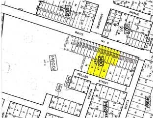

Property Detail
Iger Way
06-00858-17-00018
6.86 AC. BAY WEST 96 UNITS
Apartment
OCEAN
RMF
New Jersey
B and X Area of moderate flood hazard, usually the area between the limits of the 100-year and 500-year floods.
18
2025
6.86 AC
2025
Ocean County
731102
Northern New Jersey
2,524 SF
Lakewood-New Brunswick, NJ
NEARBY LISTINGS FOR SALE OR LEASE
DEMOGRAPHICS near Iger Way
1 mile
3 mile
5 mile
2025 Total Population
8,214
45,908
114,235
2030 Population
8,404
47,100
118,084
Pop Growth 2025-2030
+ 2.31%
+ 2.60%
+ 3.37%
Average Age
40
40
41
2025 Total Households
3,105
16,584
42,489
HH Growth 2025-2030
+ 1.64%
+ 2.13%
+ 3.22%
Median Household Inc
$91,771
$99,297
$97,338
Avg Household Size
2.50
2.70
2.60
2025 Avg HH Vehicles
2.00
2.00
2.00
Median Home Value
$365,005
$375,597
$392,372
Median Year Built
1983
1977
1976
Nearby Places
Map Layers
Map Styles
 Street
 Aerial
Transit
 Traffic
 Biking
Places
Listings with unknown addresses are not visible on the map
- Restaurants
- Banks
- Shops
- Fitness
- Groceries
Nearby Properties
Address
Land Use
TOTAL SIZE
Lot Size
Zoning
Address
Land Use
TOTAL SIZE
Lot Size
Zoning
35,102 SF
139.33 AC
LI
Address
Land Use
TOTAL SIZE
Lot Size
Zoning
2,000 SF
94 AC
CR
Address
Land Use
TOTAL SIZE
Lot Size
Zoning
15.67 AC
RC
Address
Land Use
TOTAL SIZE
Lot Size
Zoning
8,968 SF
26.36 AC
RMF
Address
Land Use
TOTAL SIZE
Lot Size
Zoning
2,549 SF
16.02 AC
RC
Address
Land Use
TOTAL SIZE
Lot Size
Zoning
1,494 SF
17.30 AC
R200
Address
Land Use
TOTAL SIZE
Lot Size
Zoning
1,680 SF
14.33 AC
HB
Address
Land Use
TOTAL SIZE
Lot Size
Zoning
23.28 AC
R75
Address
Land Use
TOTAL SIZE
Lot Size
Zoning
22.29 AC
HB
Address
Land Use
TOTAL SIZE
Lot Size
Zoning
4,102 SF
8 AC
HB
Address
Land Use
TOTAL SIZE
Lot Size
Zoning
3,588 SF
6.81 AC
EM10
Address
Land Use
TOTAL SIZE
Lot Size
Zoning
17.86 AC
RM
Address
Land Use
TOTAL SIZE
Lot Size
Zoning
3,000 SF
10.77 AC
HB
Address
Land Use
TOTAL SIZE
Lot Size
Zoning
2,792 SF
13.72 AC
R100
Address
Land Use
TOTAL SIZE
Lot Size
Zoning
59,100 SF
11.56 AC
HB
Address
Land Use
TOTAL SIZE
Lot Size
Zoning
5,364 SF
16.30 AC
R125
Address
Land Use
TOTAL SIZE
Lot Size
Zoning
1,740 SF
38.81 AC
HB
Address
Land Use
TOTAL SIZE
Lot Size
Zoning
69,798 SF
6.92 AC
R200
Address
Land Use
TOTAL SIZE
Lot Size
Zoning
559.95 AC
GI
Address
Land Use
TOTAL SIZE
Lot Size
Zoning
79,200 SF
8.93 AC
RMF
Address
Land Use
TOTAL SIZE
Lot Size
Zoning
47,440 SF
6.09 AC
R150
Address
Land Use
TOTAL SIZE
Lot Size
Zoning
1.24 AC
R
Address
Land Use
TOTAL SIZE
Lot Size
Zoning
2,631 SF
9.90 AC
M-R
Address
Land Use
TOTAL SIZE
Lot Size
Zoning
38,100 SF
2.30 AC
SPLT
Address
Land Use
TOTAL SIZE
Lot Size
Zoning
2,896 SF
25 AC
R200
Address
Land Use
TOTAL SIZE
Lot Size
Zoning
8.71 AC
HB
Address
Land Use
TOTAL SIZE
Lot Size
Zoning
6.26 AC
RMF
Address
Land Use
TOTAL SIZE
Lot Size
Zoning
11,597 SF
2.76 AC
C
Address
Land Use
TOTAL SIZE
Lot Size
Zoning
102.71 AC
HB
Address
Land Use
TOTAL SIZE
Lot Size
Zoning
80,700 SF
4.12 AC
HB
The World's #1 Commercial Real Estate Marketplace
Connect with us
© 2026 CoStar Group
The information above has been obtained from sources believed reliable. While we do not doubt its accuracy we have not verified it and make no guarantee, warranty or representation about it. It is your responsibility to independently confirm its accuracy and completeness. Any projections, opinions, assumptions, or estimates used are for example only and do not represent the current or future performance of the property. The value of this transaction to you depends on tax and other factors which should be evaluated by your tax, financial, and legal advisors. You and your advisors should conduct a careful, independent investigation of the property to determine to your satisfaction the suitability of the property for your needs.